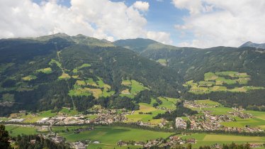
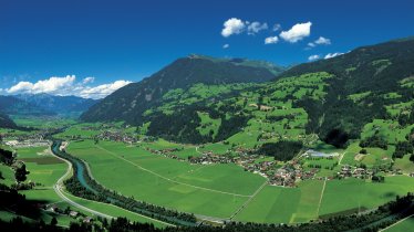
Three peaks with fantastic views of the Zillertal Valley all the way across to the Hohe Tauern Mountains are the reward for hikers who take on this circular walk. The highlights (in the literal sense of the word) are the Marchkopf (2,499 metres) and Wetterkreuz peak (2,254 metres), two mountain which are relatively easy to climb but require a good head for heights and surefootedness near the summit. En route, hikers occasionally cross meadows which in winter serve as ski pistes of the bustling Hochfügen-Hochzillertal ski resort.

Circular Hike
Starting point
Kaltenbacher Skihütte
Hike to
Wetterkreuzspitze (2,254 metres), Marchkopf (2,499 metres)
Finishing point
Kaltenbacher Skihütte
Mountain chain
Tux Alps
Length
14.3 km
Total hiking time
6 h 30 min
Features
- Wheelchair-accessible Hiking Route
- Circular hike
Difficulty rating
intermediate (red mountain trails)
Altitude
Elevation uphill 955m
Vertical metres downhill 955m
Fitness level
Technique
Best time of year
* These are approximate values and recommendations. Please take your personal fitness level, technical ability and the current weather conditions into account. Tirol Werbung cannot guarantee that the information provided is correct and accepts no liability.
Parking
Parking available next to the Kaltenbacher Skihütte
Places serving food & drink
- Wedelhütte (open Thursday to Sunday between June and September)
- Kaltenbacher Skihütte (open daily from June)
Downloads
Trail description
The starting point of the hike, the Kaltenbacher ski hut at 1,760 metres above sea level, can be reached by car from Ried or Kaltenbach via the Zillertal Valley High Road (toll road). From there, walk a few hundred metres downhill on the asphalt road and turn left at the first fork towards Hubertuskapelle. Now take hiking trail number 31 - a wide farm track - to the Hochalm. From there, the path is now much steeper and winds its way across the east-facing grassy slope and with a short, easy scrambling section up to the Wetterkreuzspitze (2,254 metres). On the way back from the summit, the hiking trail branches off to the right and leads on a gently ascending mountain ridge to the top of the Marchkopf (2,499 metres). From the summit, take the same route back to the top station of the Zillertal Shuttle cable car. From there, turn right onto trail number 25, leave the Wedelhütte (food & drink served) on the right and descend on trail number 35 towards Gedrechter. Shortly before the viewpoint, take trail number 34, which then leads back to the Kaltenbacher Skihütte.


