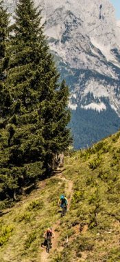
Hikes in Fulpmes
Map

Show
on mapSchlickeralm - Schlicker Scheibenweg
on mapSchlickeralm - Schlicker Scheibenweg
Themed hikes
Starting point: Top station, Kreuzjochbahn cable car
Length: 6km
Elevation uphill: 10m
Total hiking time: 2 h 30 min
Difficulty rating: intermediate (red mountain trails)

Show
on mapStubai High Trail
on mapStubai High Trail
Long Distance Path
Starting point: Top of Kreuzjoch cable car / Starkenburger Hütte
Length: 78km
Elevation uphill: 5,081m
Duration: 7 day(s)
Difficulty rating: difficult (black trails)

Show
on mapTwo-Day Trek: Fulpmes - Starkenburger Hütte
on mapTwo-Day Trek: Fulpmes - Starkenburger Hütte
Multi-day hikes
Starting point: Top of Kreuzjochbahn cable car
Length: 23km
Elevation uphill: 990m
Duration: 2 day(s)
Difficulty rating: difficult (black trails)
Fulpmes: Hikes in the region

Telfes
The Telfeser Wiesen are a series of lush green meadows at the start of the…

Neustift im Stubaital
The Elferspitze mountain in the Stubai Valley takes its name, which…

Neustift im Stubaital
The Falbesoner Ochsenalm hut nestles in a cirque in the Upper Stubai Valley…