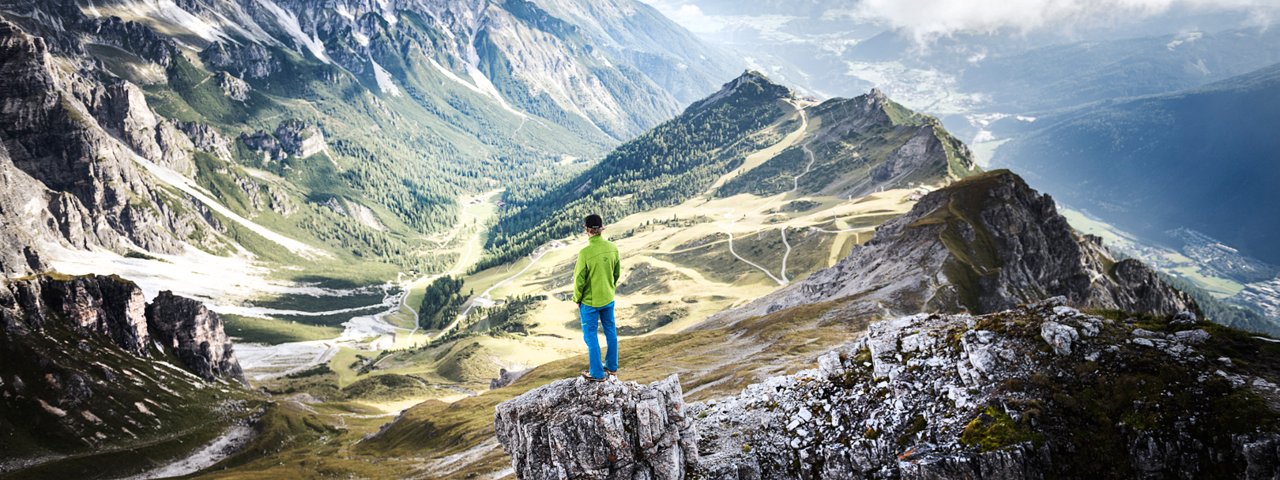
This challenging two-day trek at the foot of the Kalkkögel Mountains in the Stubai Alps begins with a cable car ride from Fulpmes up to the Kreuzjoch ridge at 2,089 metres above sea level. It is here that the first stage begins, leading up over the 2,611-metre-high Burgstall and ending in Milders (1,027 metres) in the Stubai Valley. Hikers can look forward to fabulous views of the Kalkkögel Mountains and into the Inn Valley and the Zillertal Valley as well as of the glistening glaciers of the Stubai Alps in the distance. After staying the night in the Starkenburger Hütte (2.237 Meter) day two leads past several more huts. Good general fitness and sure footedness are needed for this hike (some sections have steel ropes anchored into the rock for safety).

Starting point
Top of Kreuzjochbahn cable car
Hike to
Starkenberger Hütte
Finishing point
Milders
Mountain chain
Stubai Alps
Length
23 km
Duration
2 day(s)
Features
- Wheelchair-accessible Hiking Route
- Circular hike
Difficulty rating
difficult (black trails)
Altitude
Elevation uphill 990m
Vertical metres downhill 2,080m
Fitness level
Technique
Best time of year
* These are approximate values and recommendations. Please take your personal fitness level, technical ability and the current weather conditions into account. Tirol Werbung cannot guarantee that the information provided is correct and accepts no liability.
Public transport
- Accessible using public transport
Parking
Fulpmes: car park 300 metres from the bottom of the Kreuzjochbahn cable car
Places serving food & drink
- Stage 1: Sennjochhütte (opening times coordinated with those of the cable car), Starkenburger Hütte (June until October)
- Stage 2: Seducker Hochalm (June until September), Gasthof Alpenfrieden in Seduck, Alpengasthof Bärenbad in Neustift, Restaurant Huisler Stube, Gasthof Dorfkrug and other locations in Fulpmes
Downloads
Trail description
Stage 1: Fulpmes – Kreuzjoch (cable car ascent) – Hoher Burgstall – Starkenburger Hütte
Uphill/downhill: 501/377 vertical metres, walking time: 3 hours, distance: 4.7 kilometres, highest point: 2,611 metres, difficulty: intermediate (red)
From Fulpmes, (930 metres), take the Kreuzjochbahn cable car up onto the Kreuzjoch ridge. From the top of the cable car, follow the signs for “Burgstall”. The well-maintained walking trail gently ascends to the Sennjoch ridge (2,190 metres) and to the Sennjochhütte hut. The route continues along the southern flank of the Niederer Burgstall mountain (2,436 metres) and climbs onto the 2,410-metre-high Burgstalljoch ridge. The 2,611-metre Burgstall peak is easy to scale via the Burgstalljoch ridge across rugged and rock-laden terrain. Some sections are assisted by a fixed anchoring system of steel cables. On the other side of the peak, follow the signs for “Starkenburger Hütte”. The path zigzags down to Starkenburger Hütte hut, where you will spend the night.
Stage 2: Starkenburger Hütte – Seejöchl – Seducker Hochalm – Milders – Fulpmes
Uphill/downhill: 489/1,703 vertical metres, walking time: 7 hours, distance: 18.3 kilometres, highest point: 2,569 metres, difficulty: difficult (black)
From the hut, retrace your steps and walk back where you have come from the day before. Follow the signage for “Seejöchl” on a trail that gently climbs alpine pastures. Some distance beyond, traverse the scree slopes below the Kalkkögel Mountains and take the well-graded climb atop the Seejöchl ridge (2,518 metres). On the other side of the ridge, follow signs for “Franz-Senn-Hütte”. High above Oberbergtal Valley, you’ll walk into the valley traversing moderately steep tussock slopes that are interspersed with rocks, scree and talus. Proceed in the same direction on this trail that has many easy ups and downs. After a six-kilometre walk you will reach Seducker Hochalm at an elevation of 2,256 metres. From there, the route meanders down to Seduck and Neustift/Milders. It is a gentle downhill stroll over wide open alpine pastures in the beginning. After reaching a grove, the signed path plunges into the trees to descend to the hamlet of Seduck (1,472 metres). The walking time to this point is around five and a half hours.
From Seduck you can take a taxi across the Oberbergtal Valley to get back to the Stubai Valley. Those wanting to burn up some extra energy can walk out of the valley through the gorgeous meadows, following signage for “Bärenbad, Milders” and/or “Neustift”. Passing by remote farmsteads, you will eventually get to the Gasthaus Bärenbad inn, where the trail merges onto the valley road. Walk down along this road for about two kilometres to the hamlet of Milders (1,027 metres). The bus stop is located at the junction of Oberbergtalstraße road in Milders.


