“Grenzland” Border Area XC Ski Track

XC skiing trail closed

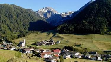
The Border Area XC Ski Track passes wide open fields and woodlands on its way atop Kartitsch Saddle. The varied trail mainly follows Gail River and takes avid cross country skiers to Frohnbrücke Bridge in the Carinthian resort of St. Lorenzen in Lesach Valley.

Open interactive map

Length

51 km

Vertical ascent

800m

Status

XC skiing trail closed

Difficulty rating

medium

Altitude

1,520m1,100m

Styles

Downloads

Trail description

  • The “Grenzland” Border Area XC Ski Track has its trailhead in Hollbruck near Kartitsch and gently ascends into Hollbruckertal Valley in the beginning. The track continues on the shady side of the valley and on the edge of the forest, taking you to Kartitsch through fields and meadows. Having crossed Kleine Gail River, you will pass sunny and wide open fields and reach the most challenging section of the route, which is Kartitsch Saddle. The almost flat terrain atop the mountain saddleback is a perfect place to catch your breath again.
  • The track follows the river banks of Gail and continues to Leiten and through relatively flat terrain to the Biathlon Center, passing meadows and fields.
  • Winding across sun-kissed foothills, the track will take you to Obertilliach and on to Bergen.
  • Shortly before reaching the sawmill, cross the bridge and follow the river to the end of the cross country ski track at Frohnbrücke Bridge in the Carinthian resort of St. Lorenzen in Lesach Valley.

Place along the route

Arrival date

How to get here by plane, train, bus or car.

Ihr Ziel: “Grenzland” Border Area XC Ski Track (46.73363,12.46202)

powered by Rome2Rio

Search accommodation

Number of travelers

How did you like this article?

Want to receive an answer? If so, please get in touch using the contact form.

Go up

Is your inbox in need of a holiday?

Then subscribe to our weekly newsletter full of exclusive holiday tips from Tirol!