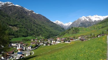
Hinterbichl - Toinig XC Ski Track

XC skiing trail closed

This picturesque track takes you from Hinterbichl to the valley end at Toinig, situated on foot of mighty Venediger Mountain Range. The trail follows the banks of Isel River and is a peaceful way to explore the snowy woods in winter while getting a great, low-impact workout. Gentle ascents and rolling terrain take you through the scenic Valley, leaving the picture-postcard villages behind.

Open interactive map

Length

6.9 km

Vertical ascent

60m

Status

XC skiing trail closed

Check trail status

Difficulty rating

medium

Altitude

1,360m1,300m

Styles

Downloads

Place along the route

Arrival date

How to get here by plane, train, bus or car.

Ihr Ziel: Hinterbichl - Toinig XC Ski Track (47.01507255435,12.366931764409)

powered by Rome2Rio

Search accommodation

Number of travelers

How did you like this article?

Want to receive an answer? If so, please get in touch using the contact form.

Go up

Is your inbox in need of a holiday?

Then subscribe to our weekly newsletter full of exclusive holiday tips from Tirol!