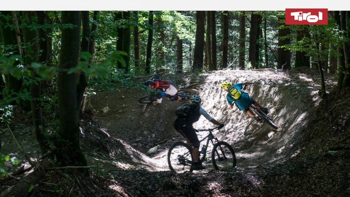
"A singletrack trail for all mountainbikers in the city of Innsbruck." That was the goal at the start of the planning process for the new Arzler Alm Trail (AAT) at the foot of the Nordkette mountains. The result is a 3km natural trail that is very flowy and great fun to ride with its banked corners, jumps and root sections. The AAT has been designed for riders of all abilities and is rated S2 on the difficulty scale.


Singletrack

"Very flowing trail which winds its way down through some steep terrain without becoming too technically challenging."
Starting point
Forest road next to Arzler Alm hut
Finishing point
Hungerburg
Mountain chain
Karwendel Mountains
Length
2.8 km
Riding time
0 h 15 min
Features
- Circular route
- Handicap-accessible
- Route with e-bike charging station
Difficulty rating
Singletrack intermediate
Altitude
1,070m 710m
Vertical metres downhill 510m
Fitness level
Technique
Best time of year
Jan
Feb
Mar
Apr
May
Jun
Jul
Aug
Sep
Oct
Nov
Dec
* These are approximate values and recommendations. Please take your personal fitness level, technical ability and the current weather conditions into account. Tirol Werbung cannot guarantee that the information provided is correct and accepts no liability.
Trail description
The start of this trail lies at the point where two forest roads cross, one leading to the Alzler Alm hut and the other to the Rumer Alm hut, and is just 30-45 minutes from the centre of Innsbruck. The bus ride (route J) from the city to the Hungerburg cable car station takes just 20 minutes. There is also the option of taking the funicular railway directly from the Congress Centre to the Hungerburg station (10 minutes). From the cable car, riders should take mountainbike route 5017 towards the Arzler Alm hut. Take a left at the first fork in the trail and continue to the start of the singletrack, which is clearly marked at 1,080 metres above sea level.
Riders who like a challenge can ride up to the Hungerburg cable car station via the settlement of Mühlau in the east of Innsbruck. From the centre of the city, ride downstream along the Inn Cycle Path past the Löwenhaus inn as far as the footbridge with a wooden roof. Cross the bridge and climb up to the Alpenzoo. Then take the forest trail to the first crossroads and turn left. Follow the signs all the way to the Hungerburg and then on to the start of the trail.
The start of the trail is around 300 metres east of the Arzler Alm hut. Though the 3km trail descends only 400 vertical metres, its first section has plenty to offer: changing gradient, banked corners and a few jumps (which can be avoided by beginners). The trail then crosses the forest road and the second section begins. This is characterised by long banked corners, tight switchbacks and some flowy passages with small jumps. Experts can take on the Jumpline, while those with less experience may want to take the easier Chicken Line. After around 15 minutes of riding time the trail meets the new mountainbike route connecting Mühlau to the Hungerburg cable car station. From here riders can descend back into the city.
Tip! Don't forget to stop off for a drink and a snack at the Arzler Alm hut, which gives the trail its name. The food is great and the views of the city spectacular.

