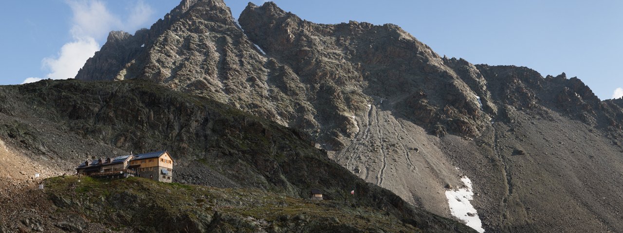
The Pitztal Valley Meadow Hike leads along the Kaunergrat ridge above the Pitztal Valley and connects five idyllically situated alpine huts at an altitude of almost 2,000 metres: the Söllberg, Mauchele, Neuberg, Tiefental and Arzler Alm huts - as well as the Kaunergrathütte at 2,817 metres. This high-altitude trail offers truly spectacular views of the Pitztal Valley's many three-thousand-metre-high peaks and itself reaches an impressive altitude of 2,928 metres at the Steinbockjoch. Hikers can also look forward to largely intact alpine pastures and the species-rich flora and fauna. The entire walk can be completed in two and a half days. Sure-footedness and a head for heights are essential on this high alpine adventure, which should be classified as difficult due to the extremely demanding 1,859 vertical metres of uphill walking on the second day.

Starting point
Wiese, St. Leonhard
Hike to
Scheibe in St. Leonhard, Kaunergrathütte
Finishing point
Plangeross
Mountain chain
Ötztal Alps
Length
39.6 km
Duration
3 day(s)
Features
- Wheelchair-accessible Hiking Route
- Circular hike
Difficulty rating
difficult (black trails)
Altitude
Elevation uphill 3,340m
Vertical metres downhill 2,906m
Fitness level
Technique
Best time of year
* These are approximate values and recommendations. Please take your personal fitness level, technical ability and the current weather conditions into account. Tirol Werbung cannot guarantee that the information provided is correct and accepts no liability.
Public transport
- Accessible using public transport
Bus route 4204, get off at stop St. Leonhard i. P. Gemeindeamt
Parking
Various parking options available in Wiese
Places serving food & drink
- Stage 1: Hotel Wiese, Hotel Gasthof Wiese, Söllbergalm (mid-June until mid-September), Mauchele-Alm (mid-June until mid-September), Neubergalm (mid-June until mid-September), Tiefentalalm (mid-June until mid-September), Arzler Alm, Haus Alpenruh, Gasthof Zur Einkehr (Scheibe)
- Stage 2: Kaunergrathütte (mid-June until mid-September)
- Stage 3: Hotel Pitztal Kirchenwirt, Gasthof Pension Santeler (Plangeross)
Downloads
Trail description
Stage 1: Wiese – Söllbergalm - Mauchele-Alm - Neubergalm - Tiefentalalm - Arzler Alm - Scheibe in St. Leonhard
Vertical metres uphill/downhill: 1,474/1,263 vertical metres, walking time: 10 hours, distance: 19.3 kilometres, highest point: 2,301 metres, difficulty rating: intermediate (red trails)
About 100 metres before Wiese, turn right along the farm track to the Söllbergalm. From there, the trail continues through larch and stone pine forests on a moderately steep climb up towards Brechsee. After about 30 minutes on foot, turn off in the direction of Stallkogel - Mauchele Alm. A moderately steep path leads off from here. After about 500 metres, turn left and follow the red markings until you cross the stream. Continue through slightly stony terrain in the direction of Neubergalm. A shady path leads to the Tiefentalalm and a footpath continues to the Arzler Alm. The descent from here is either along the farm track in the alpine pasture or via the forest path to Scheibe, a district of St. Leonhard. Accommodation in the Gasthof Alpenruh or Gasthof Zur Einkehr in Scheibe.
Stage 2: Scheibe in St. Leonhard - Arzler Alm - Kaunergrathütte
Vertical metres uphill/downhill: 1,859/427 vertical metres, walking time: 9 hours, distance: 14.3 kilometres, highest point: 2,928 metres, difficulty rating: difficult (black trails)
The second stage leads from Scheibe on a forest path back to the Arzler Alm, which is the only refreshment stop on this hike until the Kaunergrathütte. Behind the hut, follow a wide forest road to below the Rappenkopf, where a hiking trail branches off to the south. After about 500 metres, the high-level trail begins, again heading south, winding its way between 2,000 and 2,400 metres below the Seirlöcherkogel. The Neururer Berg is reached after around 4 hours of walking. There, follow the trail to Mittelberglsee lake at 2,446 metres. From there, the hiking trail climbs steadily up to 2,783 metres. Trail no. 927 then leads over the highest point of the tour - the Steinbockjoch at 2,928 metres - to the Kaunergrathütte, which lies at 2,817 metres.
Stage 3: Kaunergrathütte - Plangeross
Vertical metres uphill/downhill: 7/1,216 metres, walking time: 3.5 hours, distance: 6 kilometres, highest point: 2,817 metres, difficulty rating: intermediate (red trails)
After a three-and-a-half hour descent via trail no. 926, you reach Plangeross. The return journey to Wiese is by bus.


