Eagle Walk Stage 2: Gaudeamushütte - Hintersteinersee, © Tirol Werbung/Jens Schwarz
© Stefan Leitner
© Stefan Leitner

Eagle Walk Stage 02: Gaudeamushütte - Hintersteinersee

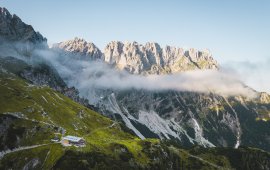
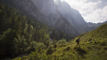
Is it about the journey or the destination? You decide. There is nothing quite like a pristine mountain lake for relief from the summer heat. Hikers can cool off in the lovely Hintersteinersee lake at the end of the hiking day. With that in mind, and surrounded by the mesmerising peaks of the Kaiser Mountains, this stage takes you through mountain meadows, dwarf pine scrubland, beech forests and craggy rocks, passing the Gruttenhütte hut on the way to the picture-postcard Hintersteinersee, one of the cleanest and most beautiful mountain lakes in Tirol. The pristine lake covers 56 hectares of spring-fed waters and measures 36 metres at its deepest point. Hintersteinersee lake is private property, but swimming is allowed on its north-western shore. Before taking the plunge, why not dip your finger in holy water? The Baroque ceiling frescos by local artist Matthias Kirchner at the Bärnstatt chapel opposite the Gasthof Bärnstatt inn are well worth a visit.

Interesting Facts

Eagle View ·The rugged and lofty Kaiser Mountains are named after the “Kaiserkopf” peak (“Kaiser” meaning "Emperor" in German). Legend has it that the rock shows the noble profile of a peacefully sleeping Charlemagne. The large imperial crown, formed by the spikes of Ellmauer Halt, slips from his head. The profile of the sleeping emperor can best be admired from the village of Going. However, you will still need to use your imagination a bit!

Eagle Kick ·Take a dip in the crystal-clear and ice cold water of the spring-fed Hintersteinersee lake. There’s nothing more refreshing on a hot day spent hiking in the high-altitude sun. With temperatures ranging from 18 to 20 degrees Celsius, it’s the perfect place to cool off. If cold refreshment is not exactly your idea of fun, the exceptionally beautiful lakeside scenery provides a wonderful opportunity to simply stand and stare. Or, take a walk along the five-kilometre-long trail that circles the pristine mountain lake and offers stunning views of the Wilder Kaiser Mountains.

Tip! There is a Black Diamond Service Station at the Gaudeamushütte, where hikers who have broken a walking pole or lost a glove can get a free replacement.

Interesting Facts Eagle View ·The rugged and lofty Kaiser Mountains are named after the “Kaiserkopf” peak (“Kaiser”…

Read moreShow less
Open interactive map

Starting point  

Gaudeamushütte

Finishing point

Hintersteinersee

Mountain chain

Kaiser Mountains

Length

14.5 km

Total hiking time

6h

Features

  • Wheelchair-accessible Hiking Route
  • Circular hike

Difficulty rating

intermediate (red mountain trails)

Altitude

1,630m 880m

Elevation uphill 800m
Vertical metres downhill 1,130m

Fitness level

Technique

Best time of year

Jan
Feb
Mar
Apr
May
Jun

Jul
Aug
Sep
Oct
Nov
Dec

* These are approximate values and recommendations. Please take your personal fitness level, technical ability and the current weather conditions into account. Tirol Werbung cannot guarantee that the information provided is correct and accepts no liability.

Eagle Walk

This is a stage of the Eagle Walk, Tirol's most famous long-distance hiking trail.

Downloads

Trail description

Starting point: Gaudeamushütte

From the Gaudeamushütte hut, a steep path winds its way up 400 vertical metres to the highest-lying mountain hut in the Wilder Kaiser Mountains, the Gruttenhütte. From there, first head towards the Ellmauer Tor and then turn onto trail number 824, 813 that winds westward through scree and talus slopes and dwarf pine scrubland. Cross a dry creek bed until you reach a signed trail (“Gruttenhütte über Klamml”) that branches off. Walkers must be sure-footed and have a good head for heights to negotiate this section. The trail becomes increasingly rock-laden, slowing your pace as you clamber up and around large boulders, offering occasional views of the Gaudeamushütte hut below. Make your way around and up the rocks assisted by a fixed anchoring system of cables and a two-metre iron ladder. Follow the narrow, rocky trail bordered by towering rock faces to the right and a talus slope to the left. Traverse a debris-filled chute on your way to the entrance to the Klamml gorge. This is where your vertical adventure begins. The via ferrata with bolted handholds and footholds heads off to the right from the Gruttenkopf mountain. It is steep and requires use of hands in one short section going over a headwall. The trail is not dangerous, but hikers afraid of exposedledges may want to opt for another trail. Bear left at the end of the via ferrata. From there it is a short walk to the Gruttenhütte hut.

Food & drink: Gruttenhütte 

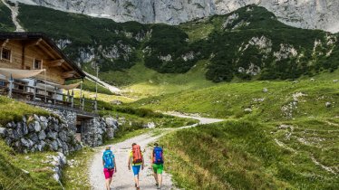
From the Gruttenhütte hut (1,620m), follow the "Gruttenweg" trail (number 14) and head southwest. At Krummbachegg, at an elevation of 1,400 metres, “Höhenweg” (literally, ‘high-altitude trail’) number 823 branches off from the Gruttenweg trail and runs westward (“Hintersteiner See”). Keep walking along the high-altitude trail, which is also called called “Wilder-Kaiser-Weg“, taking you through thin mixed woods and dwarf pines south of the Treffauer mountain and right around it. Continue hiking towards “Kaiser Hochalm”. From Kaiser Hochalm (1,417m), surrounded by wide open alpine meadows, head downhill on the marked trail. Follow the signs to “Steiner Hochalm” and hike down across mixed forest along trail number 823. At the end of the forest you will reach a fork – bear right and follow the signposted trail that skirts the slope on the left-hand side and takes you up to the Steiner Hochalm. This quaint alpine hut is a great place to gather new strength over a hearty snack. On occasions there is even live harp music!

Food & drink: Steiner Hochalm

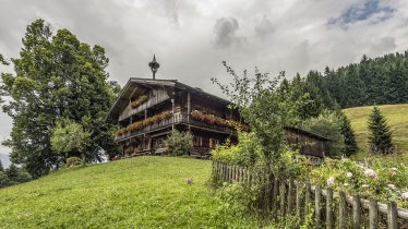
Southeast of the hut, take the dirt road that runs down to Hintersteinersee lake. You will soon get a glimpse of this scenic, spring-fed aquatic jewel. Continue walking along a forest road that descends quickly (keep walking downhill). The route merges with the road that leads to the Hintersteinersee lake at the Gasthof Bärnstatt inn/Bärnstatt chapel. Walking along this road, hikers pass flower-filled meadows and houses on the right-hand side before reaching the eastern shore of the Hintersteinersee lake. Apart from the first and last section of this walk (Gaudeamushütte hut & Gruttenhütte hut in the beginning; Gasthof Bärnstatt and Steiner Hochalm at the end) there are no huts en route serving food, so be sure to pack plenty of food and water.

Finishing point: Hintersteinersee

Information on place

Arrival date

How to get here by plane, train, bus or car.

Ihr Ziel: Eagle Walk Stage 02: Gaudeamushütte - Hintersteinersee (47.54927,12.32442)

powered by Rome2Rio

Search accommodation

Number of travelers

Hiking trails in this region

show more +

How did you like this article?

Want to receive an answer? If so, please get in touch using the contact form.

Go up

Is your inbox in need of a holiday?

Then subscribe to our weekly newsletter full of exclusive holiday tips from Tirol!