Eagle Walk Stage 22: Lechtaler Alpen, © Tirol Werbung/Dominik Gigler
Eagle Walk Stage 22, © Tirol Werbung/Dominik Gigler

Eagle Walk Stage 22: Memminger Hütte - Ansbacher Hütte

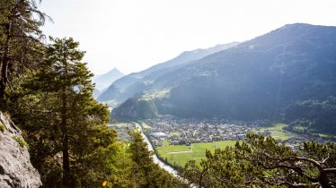
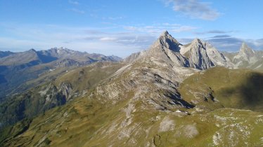
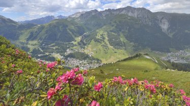
Gullies resemble large ditches, small valleys or narrow chasms, carved into the rock by the cascading waters of thundering creeks and brooks. On this walk you will encounter lots of them, along with notches, crests, ridges, steep flanks and scree slopes that will keep your pace in check. The rewards are great - outstanding views, clean air and relatively few people to share the trail with - but be prepared to work for every view you get. Make your way down into the Parseiertal Valley on steep and exposed tussock slopes, before climbing up to Langkar cirque and the Grießlscharte ridge. Beyond Winterjöchl col, the trail passes behind Stierkopf mountain and resumes its climb up Kopfscharte ridge across rugged terrain. From the ridge, head south towards Ansbacher Hütte on wide open tussock slopes, drinking fine views and savouring precious alpine moments on your way.

Interesting Facts

Eagle View · The reddish-brown rock outcrops that contain iron give the Rotspitze mountain and Rote Platte rock face, both lying north of the trail, their names ("rot" meaning "red" in German). In former times, iron ore was mined in the area west of the Winterjoch col. This is why the plateau on the mountain’s west flank is called "Knappenböden", literally "Miners' Grounds".

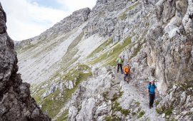
Eagle Kick ·The scramble section to the 2,632-metre Grießlscharte ridge climbs up across a kind of chimney and is assisted by a fixed anchoring system of cables. It is steep in places, and snow may remain here well into summer. It can be treacherous in rain or adverse weather conditions and intimidating to an unseasoned hiker, but it is manageable for the experienced.

Interesting Facts Eagle View · The reddish-brown rock outcrops that contain iron give the Rotspitze mountain and Rote Platte rock face, both…

Read moreShow less
Open interactive map

Starting point  

Memminger Hütte

Finishing point

Ansbacher Hütte

Mountain chain

Lechtal Alps

Length

10 km

Total hiking time

6h

Features

  • Wheelchair-accessible Hiking Route
  • Circular hike

Difficulty rating

difficult (black trails)

Altitude

2,620m 1,740m

Elevation uphill 1,040m
Vertical metres downhill 900m

Fitness level

Technique

Best time of year

Jan
Feb
Mar
Apr
May
Jun

Jul
Aug
Sep
Oct
Nov
Dec

* These are approximate values and recommendations. Please take your personal fitness level, technical ability and the current weather conditions into account. Tirol Werbung cannot guarantee that the information provided is correct and accepts no liability.

Eagle Walk

This is a stage of the Eagle Walk, Tirol's most famous long-distance hiking trail.

Downloads

Trail description

Starting point: Memminger Hütte

Make your way down from Memminger Hütte on a narrow, loamy and in wet conditions slippery singletrack trail, which directly and steeply descends across tussock slopes and heads towards the Parseiertal Valley. Thereafter, the path traverses tussock slopes several times across gorges and then further descends southwards into the Parseiertal Valley. The lower section is assisted by a fixed anchoring system of cables. The first section mostly runs across sloping terrain. On the other side of the valley, a perfectly defined singletrack trail begins a gradual ascent through a grove before ascending more steeply across meadows. Thereafter, you get to the Langkar cirque. On the right side of the cirque (in late summer next to the snowfield), a well-defined singletrack trail (with hardly any rock rubble) gradually ascends. Later, the trail steepens and bears left. Finally, climb up across a kind of chimney with fixed cables up to the Grießlscharte ridge. This section on earthy soil is steep and can be slippery in wet conditions. A short descent is followed by a short and steep counter-ascent up and over to Winterjoch saddle. Just below the Winterjoch saddle, the Augsburger High Trail branches off. The Eagle Walk, however, descends for a short distance over scree slopes from the Winterjoch saddle. It passes behind the Stierkopf mountain and resumes its climb up to the Kopfscharte ridge across rugged terrain. From the ridge, the path traverses tussock slopes and finally heads southward to Ansbacher Hütte with easy ups and downs. At an elevation of 2,376 metres, Ansbacher Hütte is a wonderful lookout situated on the southeastern slopes of the Samspitze mountain.

Finishing point: Ansbacher Hütte

Information on place

Arrival date

How to get here by plane, train, bus or car.

Ihr Ziel: Eagle Walk Stage 22: Memminger Hütte - Ansbacher Hütte (47.200502,10.4786007)

powered by Rome2Rio

Search accommodation

Number of travelers

Hiking trails in this region

show more +

How did you like this article?

Want to receive an answer? If so, please get in touch using the contact form.

Go up

Is your inbox in need of a holiday?

Then subscribe to our weekly newsletter full of exclusive holiday tips from Tirol!