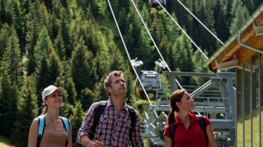
Located in the heart of the Samnaun Alps, the Grübelesee is a crystal-clear mountain lake offering fabulous views of the surrounding landscape. Hikers have to climb 1,200 vertical metres on foot to get there, but the effort is well worth it. Along the way there is the chance to stop off at the Gamperthunalm hut serving hearty local food.

Mountain Hike
Starting point
Kappl, village square
Hike to
Grübelesee lake
Finishing point
Kappl, village square
Mountain chain
Samnaun Mountains
Length
24 km
Total hiking time
9 h 30 min
Features
- Wheelchair-accessible Hiking Route
- Circular hike
Difficulty rating
intermediate (red mountain trails)
Altitude
Elevation uphill 1,206m
Vertical metres downhill 1,206m
Fitness level
Technique
Best time of year
* These are approximate values and recommendations. Please take your personal fitness level, technical ability and the current weather conditions into account. Tirol Werbung cannot guarantee that the information provided is correct and accepts no liability.
Public transport
- Accessible using public transport
Parking
Village square in Kappl, Bäckerei Wechner (house number 300, free parking in summer), next to Kappl cable cars on both sides of the auf Trisanna river (Au 483, 6555 Kappl)
Places serving food & drink
- Gamperthunalm (mid-June until mid-September)
- Various locations in Kappl
Downloads
Trail description
The hike begins in the centre of Kappl, an idyllic village in the Paznauntal Valley. From the village square, next to the parish church, the route leads in a southerly direction over the Trisanna river. There then follows a series of switchbacks up along a forest road, past the Rotwegkapelle chapel, until a trail branches off to the left. Heading east, this trail later merges into a larger forest road and reaches the Grübelebach stream. It is here that another trail heads east to the Grübelesee lake at around 2,100 metres above sea level. The route back initially leads along the same route. After around a kilometre, follow the eastern bank of the Grübelebach stream towards Labebene. There is the opportunity to stop off at the Gamperthunalm, one of the most beautiful alpine huts in the Paznaun Valley. The final section leads through the dense "Ronenmaiswald" forest in a westerly direction, then via Lochau back to the starting point in Kappl.


