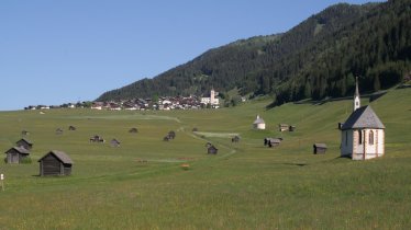
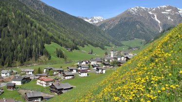
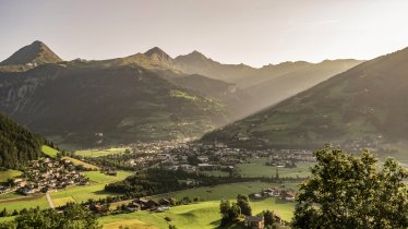
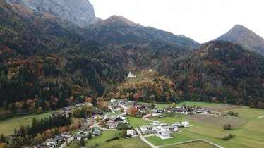
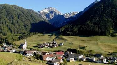
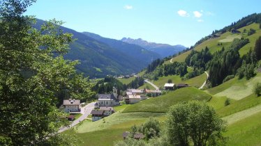
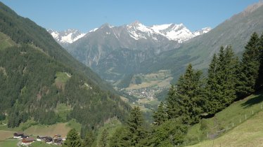
"Find inner peace crossing mountains and borders" is the motto of the "High & Holy" pilgrimage hike in East Tirol. This nine-stage hike covers a total of 191 kilometres from the village of Lavant to the south-east of Lienz, over the Italian border into the Hochpustertal Valley, back into Austria and through the Villgratental, Defereggental and Virgental Valleys, passing the town of Matrei and the village of Kals am Großglockner, before ending in Heiligenblut in the Mölltal Valley. The hike is known for its remote, quiet trails through lush meadows and rocky mountains. Most stages are between 20 and 25 kilometres in length. Some have as much as 1,700 vertical metres of climbing, making the route a real challenge even for fit walkers. Each stage can also be hiked individually.

Pilgrimage Hike
Starting point
Lavant (East Tirol)
Finishing point
Heiligenblut (Carinthia)
Mountain chain
Gailtal Alps
Venediger Mountains
Glockner Mountains
Granatspitz Mountains
Villgraten Mountains
Carnic Alps
Schober Mountains
Length
191.3 km
Duration
9 day(s)
Features
- Wheelchair-accessible Hiking Route
- Circular hike
Difficulty rating
intermediate (red mountain trails)
Altitude
Elevation uphill 12,900m
Vertical metres downhill 12,395m
Fitness level
Technique
Best time of year
* These are approximate values and recommendations. Please take your personal fitness level, technical ability and the current weather conditions into account. Tirol Werbung cannot guarantee that the information provided is correct and accepts no liability.
Public transport
- Accessible using public transport
Bus routes 940, 941, get off at stop Lavant Ort
Parking
Park in Lienz and take the bus from the railway station (bus routes 940/941) to Lavant. The journey takes 18-25 minutes.
Downloads
Trail description
Stage 1: Lavant – Tristacher See – Leisach – St. Korbinian
Ascent/descent: 1090/873 vertical metres, hiking time: 7 hours 45 min., distance: 20 kilometres, highest point: 1054 metres, difficulty: intermediate (red trails)
The first stage starts at the church of pilgrimage in Lavant and leads up past the beautiful Tristacher See lake, along the "Römerweg" trail to Burgfrieden and past the Lienzer Klause as far as St. Korbinian/Thal im Pustertal. This is a relatively easy and gentle start to the hike.
Places serving food and drink: Landgasthaus Kreit-Hof, Parkhotel Tristacher See, Ferienhotel Laserz, Gasthaus Leisacherhof, Gasthof Aue (Thal)
Stage 2: St. Korbinian – Dapra-Kreuz – Kofelpass - Maria Luggau
Ascent/descent: 1713/1449 vertical metres, hiking time: 10 hours 30 min., distance: 19.2 kilometres, highest point: 1880 metres, difficulty: intermediate (red trails)
From the Pustertal Valley hikers walk through the Leisacher Almbach gorge in the Gailtal Alps, up over the lush Leisacher Alm meadows and the Kofelpass and back down to Maria Luggau in the Lesachtal Valley with its basilica. This stage is significantly more challenging than the first stage.
Places serving food and drink: Gasthof Bäckwirt, Maria Luggau, Gasthof Luggau
Stage 3: Maria Luggau – Obertilliach – St. Oswald
Ascent/descent: 1486/1280 vertical metres, hiking time: 10 hours 15 min., distance: 25.3 kilometres, highest point: 2218 metres, difficulty: intermediate (red trails)
Stage three heads west through the Lesachtal Valley and the villages of Untertilliach and Obertilliach. After passing Obertilliach with its listed buildings in the village centre hikers climb up to the Gailtal Valley High Route, a trail which then takes them to St. Oswald above Kartitsch.
Places serving food and drink: Gasthof Hochspitz (slightly off the main trail), diverse huts and guesthouses in Untertilliach, Gasthof Oswalderhof, St. Oswald, several places in St. Ulrich (overnight stay only) and in Kartitsch
Stage 4: St. Oswald – Kartitsch – Sillian – Winnebach – Innichen
Ascent/descent: 824/858 vertical metres, hiking time: 8 hours, distance: 24.2 kilometres, highest point: 1397 metres, difficulty: easy (blue trails)
At 24 kilometres the fourth stage to Innichen in South Tyrol (Italy) is relatively long but not particularly difficult. From Kartitsch hikers pass Hollbruck with its baroque pilgrimage church and continue to Heinfels before re-entering the Pustertal Valley and making their way to Sillian. From there it is just a question of following the Drau river to Innichen with its abbey church.
Places serving food and drink: Hotel Schöne Aussicht, Bar-Restaurant Heimspiel, Heinfels, several places in Sillian, Imbiss Platz-Hirsch, Arnbach, Puschtra-Alm, Pizzeria Tempele, Hotel-Restaurant Waldrast, Winnebach, Hotel-Restaurant Tolderhof, Winnebach, several places in Obervierschach, several places in Innichen
Stage 5: Innichen – Silvesterkapelle – Marchkinkele – Kalkstein
Ascent/descent: 1548/1074 vertical metres, hiking time 9 hours, length: 14.5 kilometre, highest point: 2526 metres, difficulty: intermediate (red trails)
From the busy Hochpustertal Valley in South Tyrol hikers head north into a quiet side valley of the remote Villgratental Valley. The highest point of the day is the summit of the Marchkinkele (2545 metres), which offers fine views of the Dolomites and the Zillertal Alps. Accommodation can be found in Kalkstein or – a little further towards the start of the valley – in Innervillgraten.
Places serving food and drink: Silvesteralm (early June until late September; slightly off the main trail), Badl-Alm (Kalkstein), Gasthof-Pension Bad Kalkstein, selection of places in Innervillgraten (slightly off the main trail)
Stage 6: Kalkstein – Unterstalleralm – Villgrater Törl – St. Jakob in Defereggen
Ascent/descent: 1468/1774 vertical metres, hiking time: 10 hours 30 min., distance: 20.4 kilometres, highest point: 2502 metres, difficulty: intermediate (red trails)
The sixth stage leads in a northerly direction through the charming Villgratental Valley, past the Sinkersee lake and the Unterstalleralm hut (a good place to stop for a meal) and then up a steep climb to the Villgrater Törl, through a series of meadows and past a large waterfall back down to St. Jakob in Defereggen. This is the first of several challenging stages requiring good fitness.
Places serving food and drink: Unterstalleralm (Whitsun until mid-October), Jesachalm (slightly off the main trail), Jausenstation Alpe-Stalle (from the middle of May), selection of places in Rinderschinken and St. Jakob in Defereggen
Stage 7: St. Jakob in D. – Virger Törl – Lasörlinghütte – Gries – Obermauern
Ascent/descent: 1742/1833 vertical metres, hiking time: 11 hours 30 min., distance: 20.2 kilometres, highest point: 2620 metres, difficulty: difficult (black trails)
Stage seven starts in the Defereggental Valley and heads north into the Virgental Valley at the foot of the Großvenediger, one of Austria's highest mountains. This stage is characterised by a lot of climbing and demands good overall fitness. Much of the terrain is alpine, above the treeline. Hikers pass the idyllic Gritzer Seen lakes, the Mullitztörl ridge (2620 metres) and continue all the way to the Lasörlinghütte, where the can enjoy a well-earned rest. The final section leads to Gries im Virgental and then to the Maria Schnee pilgrimage church in Obermauern.
Places serving food and drink: Läsörlinghütte (second half of June until the end of September), Rainer-Alm (early July until late September), Stadleralm (early June until the end of September), Schwaigerhof, selection of places in Virgen and Obermauern
Stage 8: Obermauern – Matrei – St. Veiter Stöckl – Kals-Matreier Törl – Kals am Großglockner
Ascent/descent: 1562/1525 vertical metres, hiking time: 10 hours 45 min., distance: 24.9 kilometres, highest point: 2206 metres, difficulty: difficult (black trails)
The "Kreuzweg", one of Tirol's most well-known pilgrimage trails, takes hikers from the pilgrimage church in Maria Schnee down to Virgen. They then continue along the "Weg der Sinne" and the "Iselweg" trails until reaching the half-way point in Matrei. This is a good chance to top up provisions and stop for a hearty meal to get ready for the final push of the day up to the Kals-Matreier Törl. After a break to gather your breath and admire the view, all that remains is the descent to Kals.
Places serving food and drink: selection of places in Matrei
Stage 9: Kals – Glorerhütte – Bricciuskapelle – Heiligenblut
Ascent/descent: 1694/1717 vertical metres, hiking time: 11 hours 15 min., distance: 22.5 kilometres, highest point: 2654 metres, difficulty: difficult (black trails)
The ninth and final stage of this hike is another challenging one. Starting in Kals, hikers walk via the Lucknerhaus up to the Berger Törl and the Glorer Hütte (2643 metres), the highest point of their entire hike. From here on in it is more or less downhill all the way through the Leitertal Valley, past the Leiterfall waterfall and the Bricciuskapelle chapel and along the "Heilwasserweg" trail to the church of pilgrimage in Heiligenblut, where the hike concludes.
Places serving food and drink: Temblerhof (Großdorf), Gamsalm, Gasthof Ködnitzhof (Kals), Lucknerhaus (late May until the middle of October), Glorer-Hütte (second half of June until the end of September), several places in Heiligenblut
Tip! To travel back to Lienz, take bus 5108 from Heiligenblut to Winklern. Change there onto bus 942, which will take you to the railway station in the centre of Lienz. The total journey takes around an hour.

