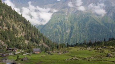
The Serles mountain is known as the "High Altar of Tirol" thanks to its altar-like triple peaks towering into the sky south of Innsbruck. Legend has it that the main peak was once a king known as Serles and that the two smaller peaks left and right are his two sons. Hikers who climb the Serles can look forward some wonderful views of the Stubai Alps with their Seven Summits as well as the Zillertal Alps and the Inn Valley. Instead of following the same route back down, this version of the hike invites walkers to descend to the Maria Waldrast monastery.


Summit Hike
Starting point
Kampler Staumauer, Neustift im Stubaital
Hike to
Serles
Finishing point
Kampler Staumauer, Neustift im Stubaital; alternativ: Abstieg über Maria Waldrast nach Mieders
Mountain chain
Stubai Alps
Length
11 km
Total hiking time
8h
Features
- Wheelchair-accessible Hiking Route
- Circular hike
Difficulty rating
difficult (black trails)
Altitude
Elevation uphill 1,800m
Vertical metres downhill 1,800m
Fitness level
Technique
Best time of year
* These are approximate values and recommendations. Please take your personal fitness level, technical ability and the current weather conditions into account. Tirol Werbung cannot guarantee that the information provided is correct and accepts no liability.
Public transport
- Accessible using public transport
Bus route 590, get off at stop Neustift i. S. Kampl
Downloads
Trail description
The steep forest path begins at the Kampler dam wall on the edge of the forest in Kampl and leads in hairpin bends to the Wildeben snack station in around 2 hours. From there, the trail continues behind the snack station on a steep path to the Serlesjöchl (2,384 metres). There, a small rock face has to be climbed using a short ladder. This is followed by a short passage secured with steel cables, then the path winds its way uphill over the widening south-west ridge covered in scree. Finally, you reach the large summit cross via a somewhat exposed rocky ledge.
The descent follows the same route as the ascent. Alternatively, you can descend via the Maria Waldrast monastery to the top station of the Serles cable car. To do this, turn left at the Serlesjöchl towards the south-east and follow the path first over gravel, then through a mountain pine bushes and finally through a forest to the Maria Waldrast monastery (walking time: around 3 hours). From there, a relatively flat path leads to the top of the Serles cable car in 45 minutes. From there you can either use the cable car to descend or walk down to Mieders in 1.5 hours.


