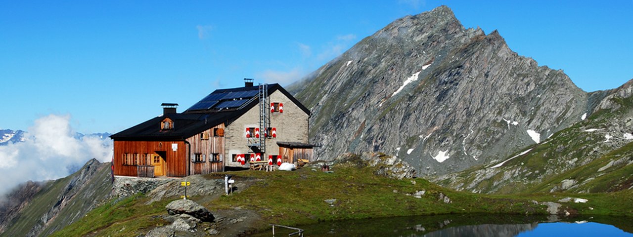
The Sudetendeutsche Hütte (2,656 metres) is a German Alpine Club mountain refuge in a superb vantage point in the Granatspitz Mountains, East Tirol.
Impressive high-mountain refuge with mountain lake
German Alpine Club, Schwaben Division
Take a deep breath upon arrival! Not because the journey was so arduous, but because it is so very beautiful here. The builders of the Sudetendeutschen Hütte found a wonderful vantage point for their mountain refuge at the Obere Steineralm in the Granatspitz Mountains. The hut is surrounded by the 3,000m peaks of the Muntanitz Mountains and even has a small mountain lake in the “front garden”. Construction took place from 1927–1929, and it has since been extended and thoroughly renovated. The lounges and rooms are comfortable and the food is excellent. High quality is also guaranteed by the environmental accolade "Mit Kindern auf Hütten" ("Visit Huts with Children"). Supplies are delivered using a small cable car from the Steiner Alm.
How to get to the Sudetendeutsche Hütte
From the top of the Blauspitz-Bergbahn cable car via the "Sudetendeutschen Höhenweg" trail in 4 hours, from the top of the Matreier Goldriedbahn cable car in 5 hours. From Matrei-Glanz via Steiner Alm in 4 hours, from Lublaß on the Felbertauernstraße road via Steiner Alm in 4 hours, from Matreier Tauernhaus via Dr.-Karl-Jirsch-Weg trail in 5 hours
Walks and hikes in the area (walking time to summit)
Wellachköpfe (3,037/3,117 metres), 1.5 hours, intermediate
Gradötzkogel (3,063 metres), 1.5 hours, intermediate
Kleiner Muntanitz (3,192 metres), 2 hours, intermediate
Großer Muntanitz (3,232 metres), 2.5 hours, difficult
Vorderer Kendlspitz (3,088 metres), 2.25 hours, difficult
Further huts in the area, long-distance hiking trails
Kalser Tauernhaus, 4 hours
Berghotel Rudolfshütte, 7 hours
Matreier Tauernhaus, 5,5 hours
Kals-Matreier Törlhaus, 4 hours
The Sudetendeutsche Hütte marks the end of Stage 6 and the start of Stage 7 of the Eagle Walk East Tirol. This is part of a long-distance hiking trail crossing Tirol in 33 stages.
Impressive high-mountain refuge with mountain lake German Alpine Club, Schwaben Division Take a deep breath upon arrival! Not because the journey was…


