Stage 1: Schanz/Burggraben – Weidachsee – Katzenkopf – Weidach
Uphill/downhill: 383/297 vertical metres, walking time: 5 hours 30 minutes, distance: 19.4 kilometres, difficulty level: intermediate
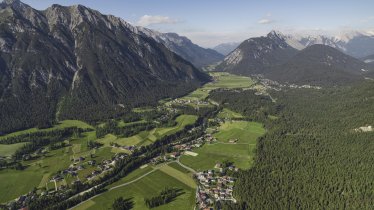
The hike begins at the Schanz car park in the settlement of Burggraben, located in the north-eastern section of the Leutaschtal Valley. The first section leads along the banks of the Leutascher Ache river through the Leutaschtal Valley in a south-western direction. En route you will pass through the quiet hamlets of Lochlehn, Reindlau, Ahrn and Gasse. Continue towards Kirchplatzl, then through the wetlands of Aumoos and past the Weidachsee lake to the settlement of Oberweidach. Those with enough energy should hike up onto the Katzenkopf (5 kilometres, 245 vertical metres). This detour heads uphill through the hamlet of Seewald, the Bergwald forest and a small ski resort all the way to the Katzenkopfhütte hut, which is a good place for a rest. Return the way you came, then head to the tourist information office in Weidach, where this first stage ends.
Stage 2: Weidach – Wildmoosalm – Lottensee – Mösern
Uphill/downhill: 422/324 vertical metres, walking time: 4 hours 30 minutes, distance: 16.1 kilometres, difficulty level: intermediate
Day two begins at the tourist information office in Weidach. The first section heads south, past the bottom of the Katzenkopf ski lifts, then turns right into the Fludertal Valley following trails 1 and 3. Cross the Wildmoos wetlands, a protected area of natural beauty, to the Wildmoosalm hut and then the Wildmoossee (a lake which appears and disappears periodically depending on the groundwater level). After completing the trail around the Lottensee lake (which also comes and goes periodically) head back to the Wildmoosalm hut and then walk south on trails 2 and 60, following an arc around the Brunschkopf mountain to the Möserer See lake. From there it is just a few minutes to the centre of Mösern.
Stage 3: Mösern – Buchen – Klamm – Wettersteinhütte
Uphill/downhill: 716/208 vertical metres, walking time: 5 hours, distance: 14.4 kilometres, difficulty level: intermediate
Stage three begins at the tourist information office in Mösern. Take trails 2 and 27 heading in a north-westerly direction. To the right you will soon see the Lottensee lake. Shortly afterwards, follow the trail left to Buchen. The Ropferstub'm is a cosy guesthouse which is a good place to stop for a rest overlooking the Inn Valley. Continue along trail 24 via Katzenloch and then Moos, Obern and Klamm to the start of the Gaistal Valley at the foot of the Wetterstein Mountains. There, take trail 9 up along the wide trail (steep in places) to the Wettersteinhütte (500 vertical metres to the hut). This hut marks the end of stage 3. Please be aware that it is not always possible to offer a luggage transport service to this hut.
Stage 4: Wettersteinhütte – Kirchplatzl – Weidach
Uphill/downhill: 33/629 vertical metres, walking time: 3 hours, distance: 9.2 kilometres, difficulty level: intermediate
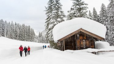
The fourth and final stage leads from the Wettersteinhütte into the valley. Follow the trail to the edge of Klamm. There, turn left onto the Oberer Wiesenweg (trail number 33) leading through the snowy meadows of the Plaikner Mähder to Kirchplatzl. Turn right onto the trail towards the Weidachsee. Shortly after passing this lake you will reach the local tourist information office, which marks the end of this four-day hike.
Tip! If you have parked your car in Schanz/Burggraben you can either walk from Kirchplatzl along the banks of the Leutascher Ache river back to the starting point or take bus 431 from the bus stop "Weidach Zentrum" back to Schanz.


