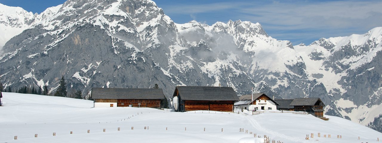
In all her winter splendour, Walderalm Alpine Pasture Hut in Gnadenwald is among the most beautiful places to snowshoe in Tirol. Towered by the snowcapped peaks of Karwendel Range, the route offers pretty views, deep forest environments and wide open Alpine pastures to explore and experience. The trail climbs gradually and the grade is moderate. There are enchanting opportunities to extend you route at both trailhead and destination, offering a great chance to tromp through the deep snows in the midst of snow-covered Alpine meadows.


Snowshoe
Starting point
Gnadenwald St. Michael, Kranzach Car Park (elev. 900m)
Finishing point
Gnadenwald St. Michael, Kranzach Car Park (elev. 900m)
Mountain chain
Karwendel Mountains
Length
8.9 km
Total hiking time
3h
Features
- Circular hike
Difficulty rating
easy
Altitude
Elevation uphill 600m
Vertical metres downhill 600m
Trail description
Starting at the car park, the route first heads along the road between the homes (signpost) and then follows the wide trail to the sports ground. Go past this and on as far as the point where the logging roads divide. There, take the well-graded Walderalmweg Trail northwestward and cross the bridge over Klammbach Creek. The route switchbackes up through forest and eventually enters the world of wide open Alpine pastures. The bend at an elevation of 1,430 meters gives hikers the opportunity to head straight up in a northerly direction to the signpost and to reach Walderalm Alpine Pasture Hut. Alternatively, hikers can carry on along Walderalmweg Trail, which merges with the trail leading to Hinterhornalm at an elevation of 1,480 meters. From there, you head east along a flat section to get to Walderalm (elev. 1,511 meters).
Before walking back down, it is worth taking some extra time to explore Sölenböden around Walderalm. Retrace your steps and walk back the same route to Klammbach Bridge (elev. 980 meters). After the bridge, a forest path brings you back to the trailhead.
Please Note: Be prepared to adjust your activity based on current conditions. As a general rule, if there is fresh snow, conditions may be better suited for snowshoeing; if the snow is old and well-travelled, it may be better for winter walking. For avalanche conditions visit lawine.tirol.gv.at.


