
Opening hours:Open today
Place:Obergurgl
:Alpine pasture / hut / mountain restaurant
Scenic mountain and e-bike route surrounded by countless glaciers in the Ötztal Nature Park.
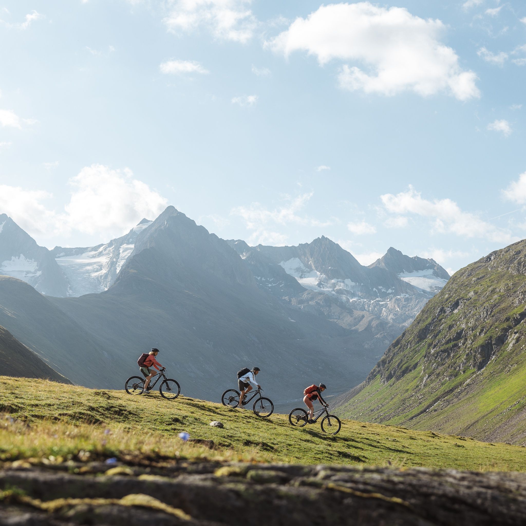
Sporty cycling skills and defensive riding behavior are required for the partly steep ascents and more challenging downhill sections, and the demands on fitness and riding technique are rated as medium. 'The focus is on sporty, active (enjoyment) cycling'
Suitable equipment such as breathable clothing and weather-appropriate outdoor wear, bike helmet, gloves, sunglasses, and a GPS device or map material. For bike tours without refreshment stops, sufficient provisions are necessary.
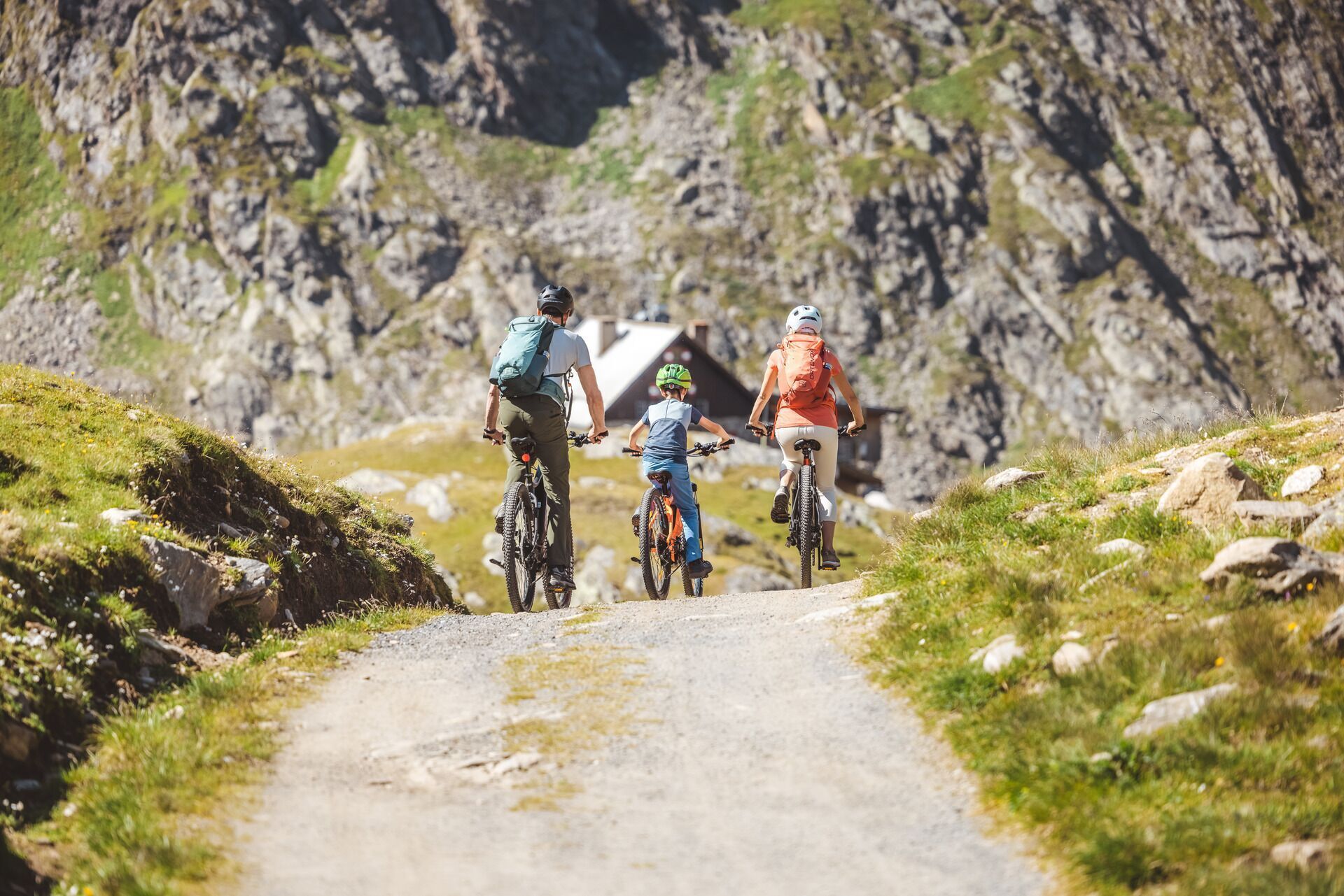
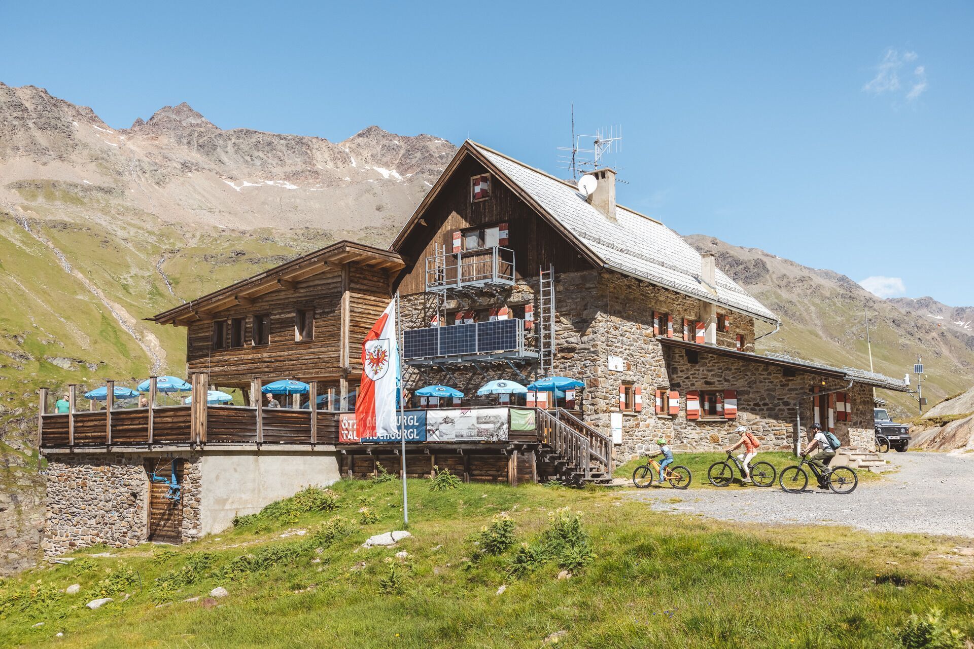
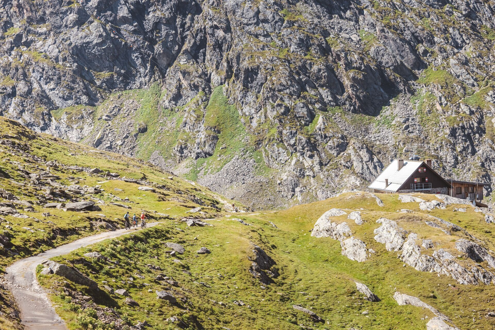
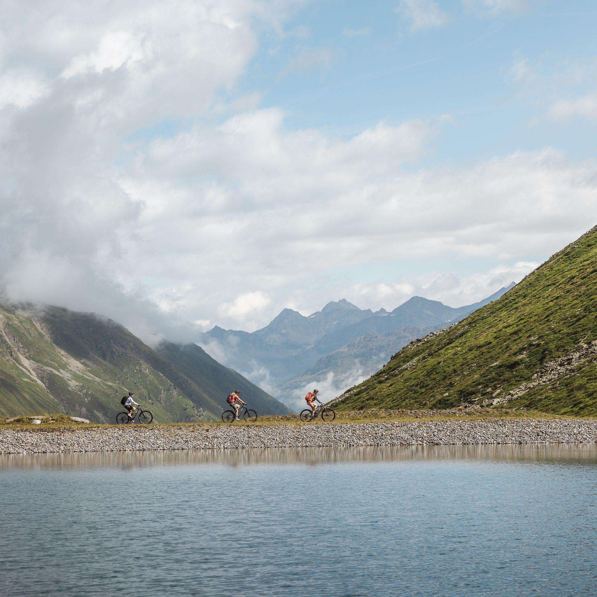
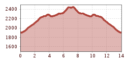
One of the top routes in the region leads deep into the Ötztal glacier world, up to the Langtalereckhütte. The starting point Obergurgl, located at the end of the Gurgler valley, is already at 1,910 meters above sea level. Technically, the approx. 7-kilometer-long gravel road is not overly demanding. However, the consistently high gradient percentages take their toll.
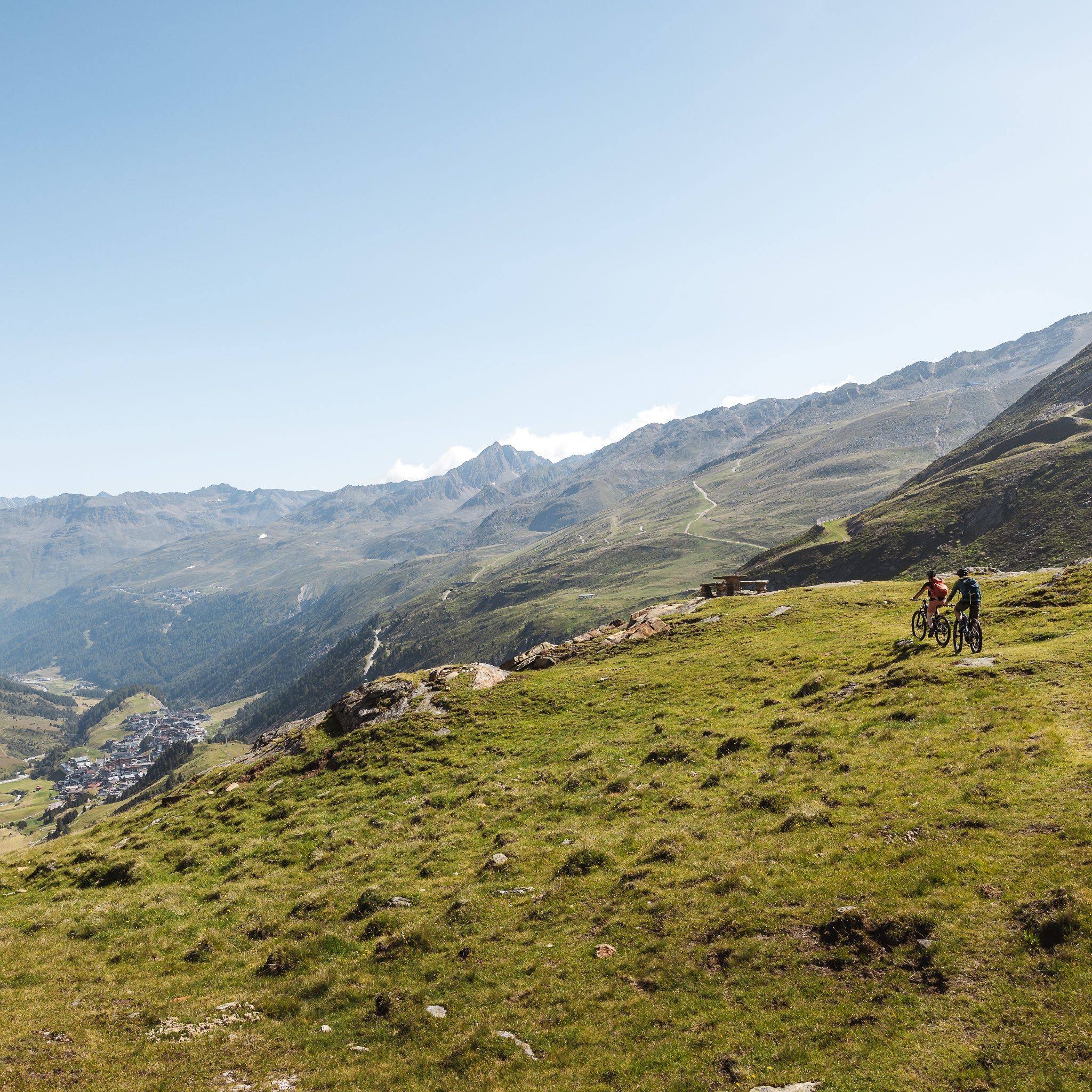
Along the Gurgler ski area, the ramp first climbs to the Schönwieshütte (2,270 m, refreshment stop). You circle the Schönwieskopf and lose 50 meters of elevation on a short descent. A good chance to catch your breath before the final climb.
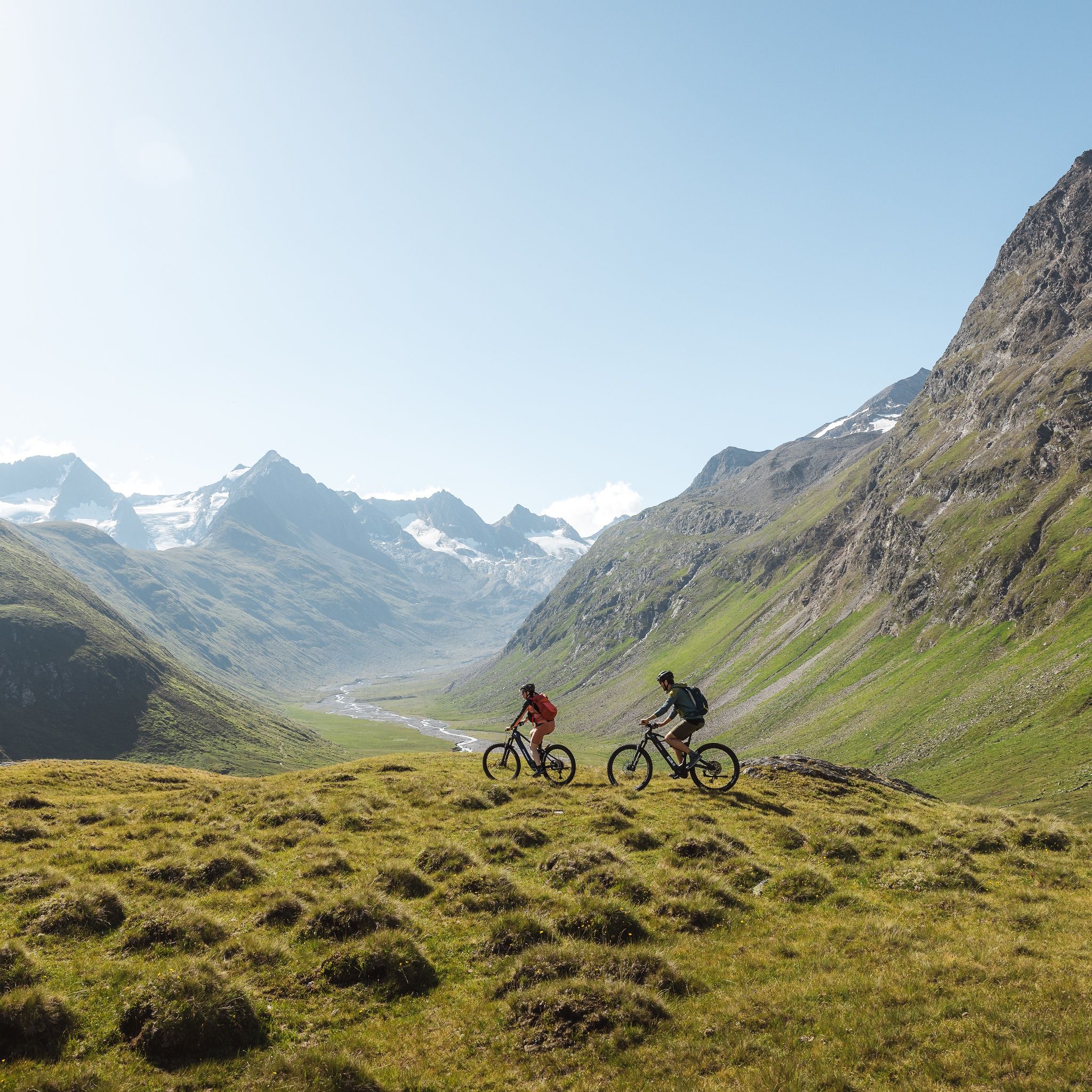
The path then climbs in several stages to the destination at Langtalereckhütte, and thus to the well-deserved snack. The hut lies at the edge of a peculiar valley basin, whose planed rock shows that here once ended the tongue of the Gurgler Ferner. Today, however, the eternal ice has retreated towards the main ridge. Nevertheless, the view of the sparkling snowfields at Kleinleitenspitze and Schalfkogel impresses. The descent leads back to Obergurgl along the approach route.
Travel comfortably and safely by train to the Ötztal station. The final stop or exit point is ÖTZTAL station. Afterwards, you can conveniently and quickly travel through the entire valley to your desired destination by public transportation or local taxi companies! The current bus schedule is available at: fahrplan.vvt.at
The following parking options are available in Gurgl:
Parking garage village center Obergurgl (down to the right in front of the church), paid | € 2.00 per hour
Parking garage entrance of the village – valley station Festkoglbahn, paid | € 6.00 per day
Parking lot Hochgurglbahn valley station, free of charge – no overnight parking
Parking lot Top Mountain Crosspoint, free of charge
Parking lot Hochgurgl, free of charge (very small parking lot)

")


_FULL110.jpg")


")


.jpg")
.jpg")


")

