Road bike tour Around the Wilder Kaiser, Tour Nr. 8

Route length: 88.0 km
Duration: 3:00 h

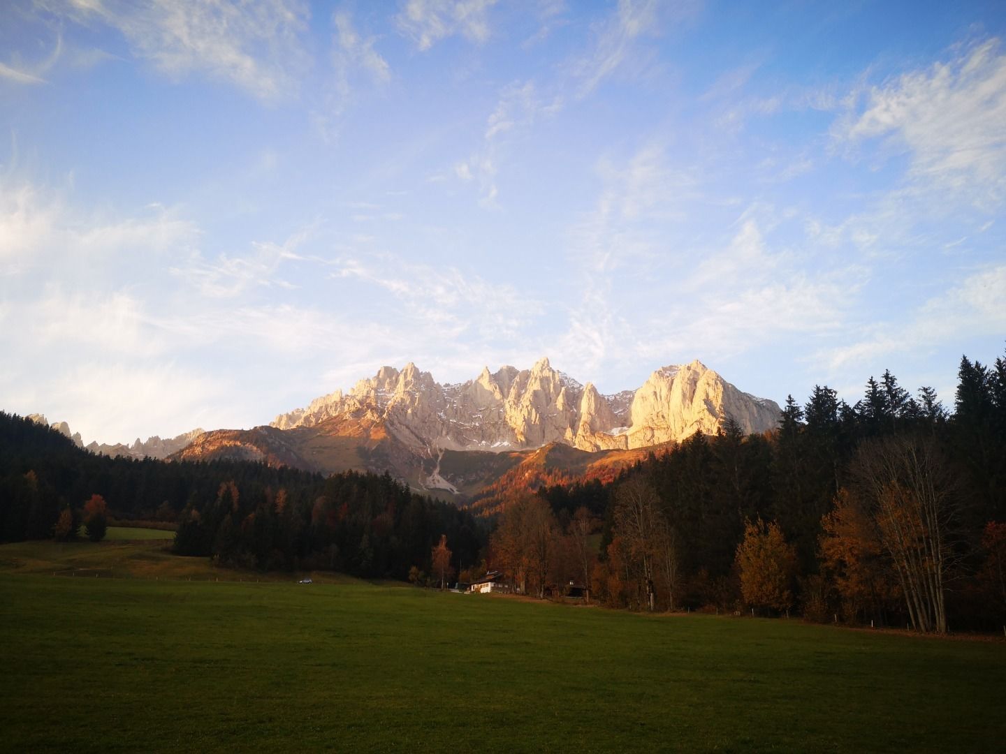
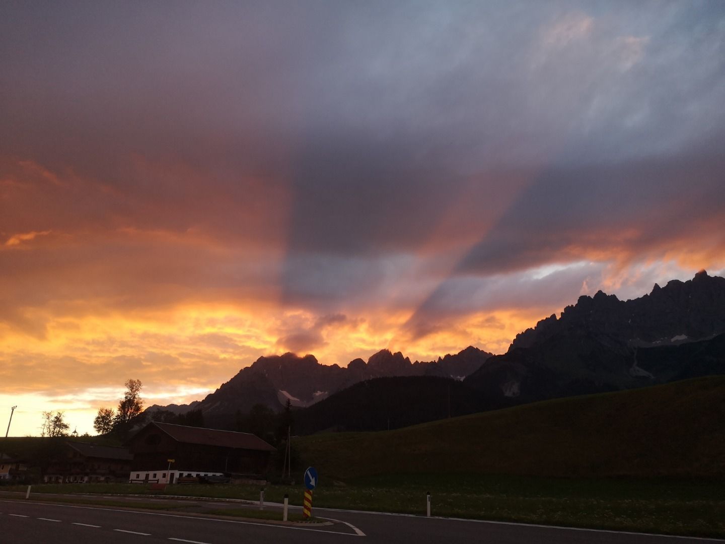
A beautiful and varied circular tour around the Wilder Kaiser. Wonderful views of the impressive rock formations.

Tour information

  • Length: 88.0 km
  • Duration: 3:00 h
  • Elevation uphill:995 hm
Highest point802 m

Starting point

Kitzbühel - Stadtzentrum

Finishing point

Kitzbühel - Stadtzentrum

Best time of year

  • January
  • February
  • March
  • April
  • May
  • June
  • July
  • August
  • September
  • October
  • November
  • December

Equipment

road bike, helmet, clothing according to weather, light wind jacket recommended, sun blocker and sufficient drinks

Description

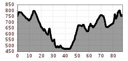
The starting point is the town centre of Kitzbühel. Proceed along the Schwarzseestraße, go on past the Schwarzsee lake on the Reither Landesstraße until you come to the Stanglwirt. Here turn onto the bike path and on past Going and Ellmau. After Ellmau turn onto the Eiberg-Bundesstraße (B173). There follows a quick descent from Eiberg. At the second roundabout turn off onto the Inn bike path, follow the bike path to the Austrian-German border. Here leave the bike path and take the secondary road passing Niederndorf. About 500 m after Sebi leave the secondary road to your left, proceed onto Pöttingsteigung and on through the wonderful landscape to the Walchsee lake. Shortly after the Walchsee turn right onto a side road which leads to the hamlet of “Bichlach” and then to Schwendt. Continue through Schwendt, Griesenau and Gasteig onto the Huberhöhe then enjoy the rapid descent to the centre of St. Johann. From here head along the left side of the valley (along the Kitzbüheler Horn), pass the Egger company and continue on the Römerweg through glorious countryside into Kitzbühel (see Kitzbühel Circuit).

More tours in the surrounding area

  • Stubai Radroute 19

    Opening hours: closed
    Difficulty: easy
    Length: 24.0 km Elevation uphill: 364 m
  • Milky Way

    Opening hours: closed
    Difficulty: easy
    Length: 2.9 km
  • Innradweg Ötztal

    Difficulty: easy
    Length: 50.5 km Duration: 3:45 h Elevation uphill: 728 m
  • Lechradweg

    Length: 244.6 km Duration: 18:00 h Elevation uphill: 1,702 m
  • Bannwaldsee circuit

    Difficulty: medium
    Length: 94.5 km Duration: 3:45 h Elevation uphill: 877 m
  • Peter Sagan Trail No. 141

    Difficulty: medium
    Length: 5.0 km Duration: 0:30 h Elevation uphill: 90 m
  • Bifang Tour

    Opening hours: closed
    Difficulty: easy
    Length: 10.4 km Duration: 1:00 h Elevation uphill: 320 m
  • Högtrail 7081

    Opening hours: open
    Difficulty: easy
    Length: 3.8 km
  • Lichte Trail 882

    Opening hours: closed
    Difficulty: difficult
    Length: 3.4 km Duration: 0:15 h Elevation uphill: 5 m
  • Leithetrail 7128

    Opening hours: open
    Difficulty: easy
    Length: 4.3 km
  • Ötztal Cycle Trail (11)

    Opening hours: closed
    Difficulty: medium
    Length: 60.2 km Duration: 6:00 h Elevation uphill: 915 m
  • 401 | Zillertaler Höhenstraße

    Difficulty: difficult
    Length: 52.6 km Duration: 7:40 h Elevation uphill: 1,890 m
  • Ehrwalder Alm Seebensee

    Difficulty: medium
    Length: 9.0 km Duration: 2:30 h Elevation uphill: 630 m
  • Karlsbaderhütte No. 154

    Difficulty: difficult
    Length: 26.2 km Duration: 4:00 h Elevation uphill: 1,590 m
Newsletter

The mountain is calling? So does our newsletter!

In our monthly newsletter we reveal the best holiday tips for Tyrol.