Mountainbike-Tour Astbergrunde

Kirchberg in Tirol / Kitzbühel Alps
Difficulty ratings: medium
Route length: 28.0 km
Duration: 3:00 h

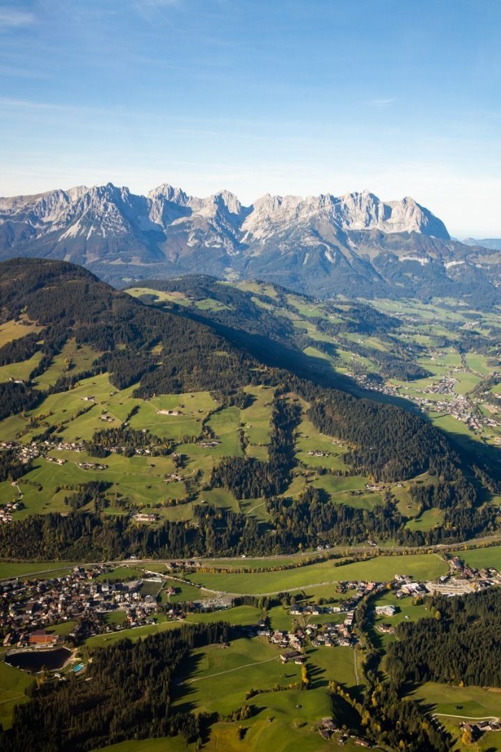
The Wilder Kaiser always in view!

Tour information

  • Requirement: medium
  • Length: 28.0 km
  • Duration: 3:00 h
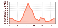
  • Elevation uphill:676 hm
  • Elevation downhill:676 hm
Highest point1,182 m

Starting point

Kirchberg in Tirol

Finishing point

Kirchberg in Tirol
  • Fitness level 3 / 6
  • Technique 2 / 6

Features

  • Circular route

Best time of year

  • January
  • February
  • March
  • April
  • May
  • June
  • July
  • August
  • September
  • October
  • November
  • December

Trail condition

Asphalt, gravel

Equipment

Mountain bike, helmet, weather protection, provisions, first aid kit
Source: Kitzbüheler Alpen Management GmbH

Description

Route: Kirchberg - Reith b. Kitzbühel - Astberg - Ellmau - Going - Reith - Kirchberg
From the center of Kirchberg, follow the cycle path towards Reith bei Kitzbühel. Shortly after the center of Reith, before the Zimmerei Hölzl, turn left onto the Astbergweg. The route climbs steadily in serpentines on a quiet, narrow road up to the Astberg. Gradients of up to 12% must be mastered. At the top, you are rewarded with a magnificent view of the Kitzbühel mountain celebrities: the nearby Wilde Kaiser, the Kitzbüheler Horn, the Hahnenkamm, and the Große Rettenstein. A stop at the Gasthaus "Hollenauer Kreuz" rewards us after this climb. The descent leads us to Ellmau/center. On the side road to the right of the B178 federal road, we reach Going. In the center of Going, we turn onto the Söllnerweg and thus reach the Astberg again. Passing the Zimmerei Hölzl, we return to Kirchberg via the same route.

Getting here

  • Parking

    Via the B170 coming from Wörgl or Kitzbühel to Kirchberg in Tirol.
    Parking garage Pöllmühle

More tours in the surrounding area

  • KAT BIKE SPORT+

    Difficulty:difficult
    Length:146.0 kmDuration:3 daysElevation uphill:5,686 m
  • Kalkstein Loop

    Difficulty:medium
    Length:41.7 kmDuration:3:30 hElevation uphill:341 m
  • 1. Etappe KAT Bike Sport+

    Difficulty:medium
    Length:25.0 kmDuration:3:30 hElevation uphill:1,108 m
  • OD Trails

    Opening hours:open
    Difficulty:medium
  • Wilder Kaiser cycle route no. 14

    Difficulty:medium
    Length:38.3 kmElevation uphill:520 m
  • Angereralm - Harschbichl

    Opening hours:closed
    Difficulty:medium
    Length:18.2 kmDuration:2:00 hElevation uphill:942 m
  • Brixental cycling tour Nr. 21

    Difficulty:easy
    Length:46.7 kmDuration:3:30 hElevation uphill:450 m
  • Salvenaradrunde

    Difficulty:medium
    Length:62.7 kmDuration:3:30 hElevation uphill:648 m
  • Fleckalm Trail

    Opening hours:open
    Difficulty:difficult
    Length:7.1 kmDuration:0:45 h
Newsletter

The mountain is calling? So does our newsletter!

In our monthly newsletter we reveal the best holiday tips for Tyrol.