
Opening hours:Open today
Place:Hochsölden
:Restaurant, Alpine pasture / hut / mountain restaurant
The enduro route Glacier Express reloaded is not for the faint-hearted, as even the best enduro riders will break a sweat here. With a total length of 35.5 km and about 1600 meters of elevation gain, you can really push your endurance to the limit.
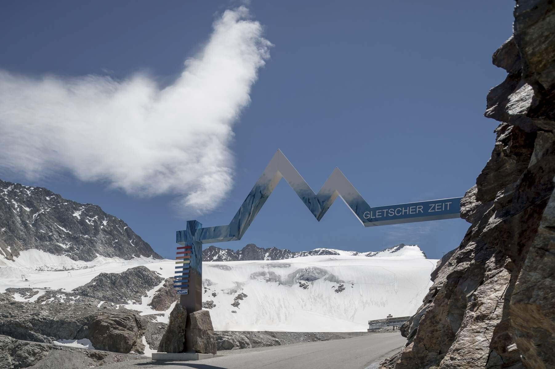
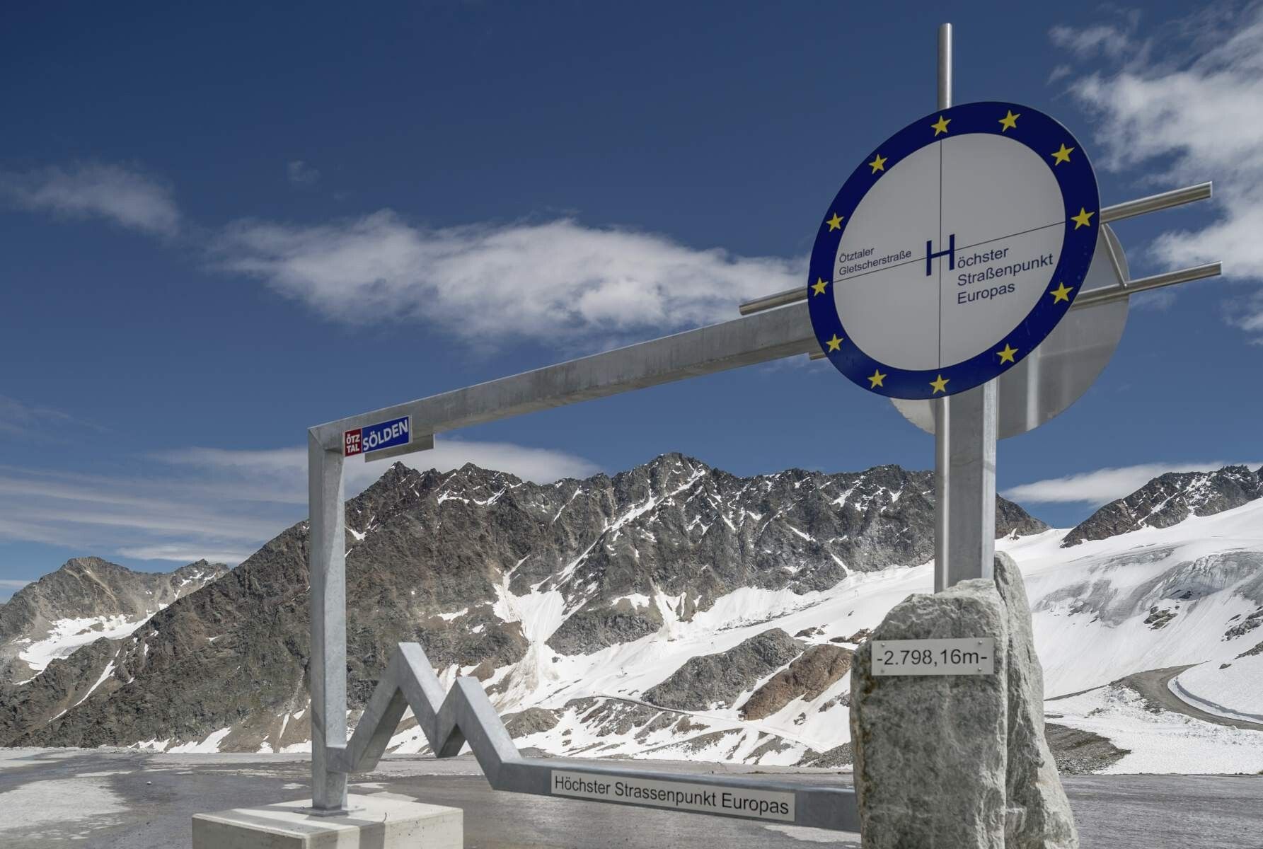
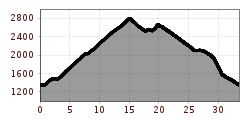
Start and finish point of the Enduro route Glacier Express reloaded H is the Freizeit Arena in the center of Sölden. Facing the Freizeit Arena, start to the right and follow the Ötztal bike path 11 to the valley station of the Gaislachkogelbahn. Upon reaching the Gaislachkogelbahn, turn right to get onto federal road B186, follow it to the junction of the Glacier Road from the federal road. Then continue right up the steep Glacier Road, following it to the Rettenbach Glacier. At the glacier summit, you will need to mobilize your last reserves to conquer the last hundred meters to the highest point of the route and simultaneously the highest road point in Europe at 2,800 m.
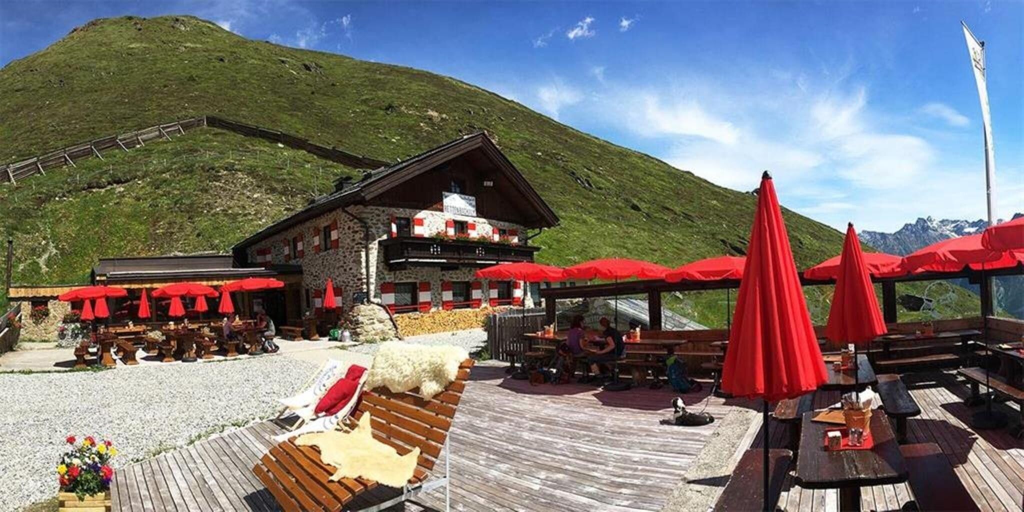
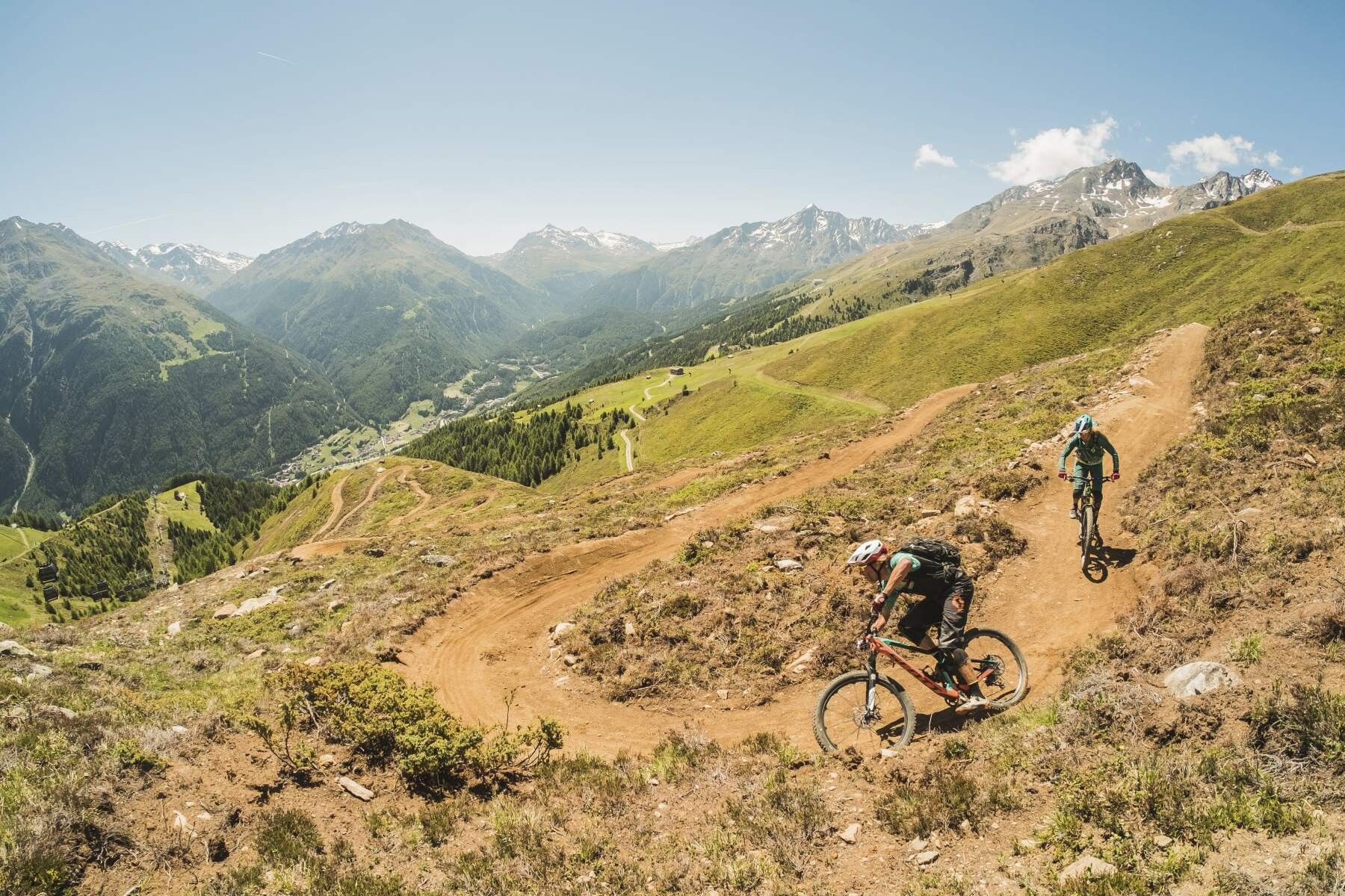
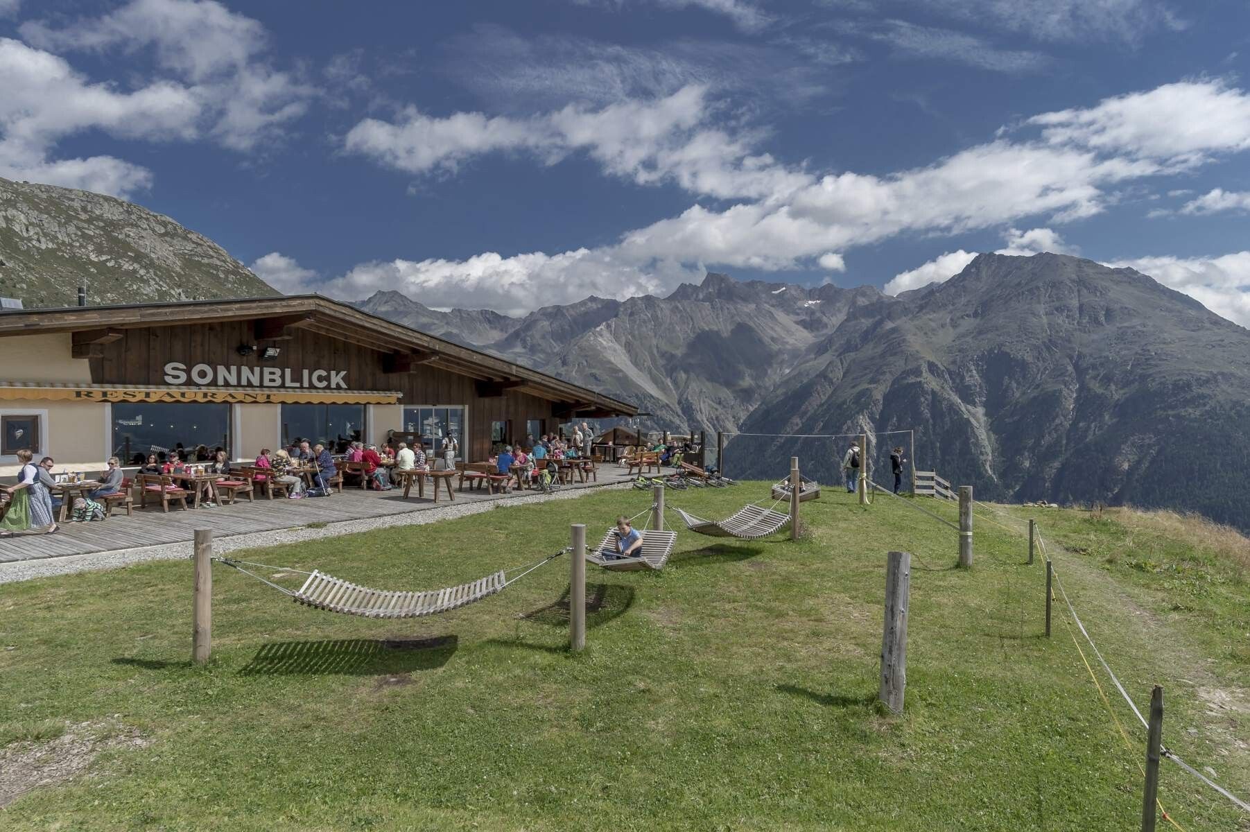
After taking in the breathtaking panorama, descend along the Glacier Road until you reach the silo tower, where you turn left onto the gravel path. Here, you need to pedal hard once more to climb steep ski slopes to the Rotkogel hut. Now it's downhill on the red Ollweite Line (6010) to the connection to Hochsölden, which branches off left after about 2/3 of the Ollweite Line (wooden bridge). The transfer path takes you to Hochsölden to the mountain restaurant Sonnblick - a place to take a break.
The restaurant is located directly at the start of the 7.4 kilometers (!!!) long blue GAHE LINE. After a thorough rest on the terrace, you continue on the blue Gahe Line 6028 to Leitn - enjoy the flow show. From there, continue on the blue LETTN LINE, which ends directly at the valley station of the Giggijochbahn and from there back to Freizeit Arena.
Arrival by train
Travel comfortably and safely by train to Ötztal train station. A bus line departs directly from the station forecourt towards Obergurgl. The bus ride to Sölden takes approx. 1 - 1.5 hours.
All important information on bus schedules, connections, and taxi companies can be found here.
At the valley station of the Gaislachkoglbahn and the Giggijochbahn, sufficient parking spaces are available; parking garages are also available.The parking spaces are subject to a fee.
Paid overnight parking of cars in the Gaislachkogl parking garage is possible:


Andi Frank (247).jpg")
")

")


Erwin Haiden, bikeboard.at.jpg")

-min.jpg")


")
