Mountainbike-Tour Lochle Alm Trail (6014)

Sölden / Stubaier Alpen
Difficulty ratings: medium
Route length: 960 m
Duration: 0:30 h

On the quiet (lift-free) side of the BIKE REPUBLIC SÖLDEN, the natural trail leads from Lochle Alm towards Kleble Alm (or vice versa).

Tour information

  • Requirement: medium
  • Length: 960 m
  • Duration: 0:30 h
  • Elevation uphill:33 hm
  • Elevation downhill:115 hm
Highest point1,922 m

Starting point

In front of Kleble Alm

Finishing point

In front of Lochle Alm
  • Fitness level 3 / 6

Best time of year

  • January
  • February
  • March
  • April
  • May
  • June
  • July
  • August
  • September
  • October
  • November
  • December

Equipment

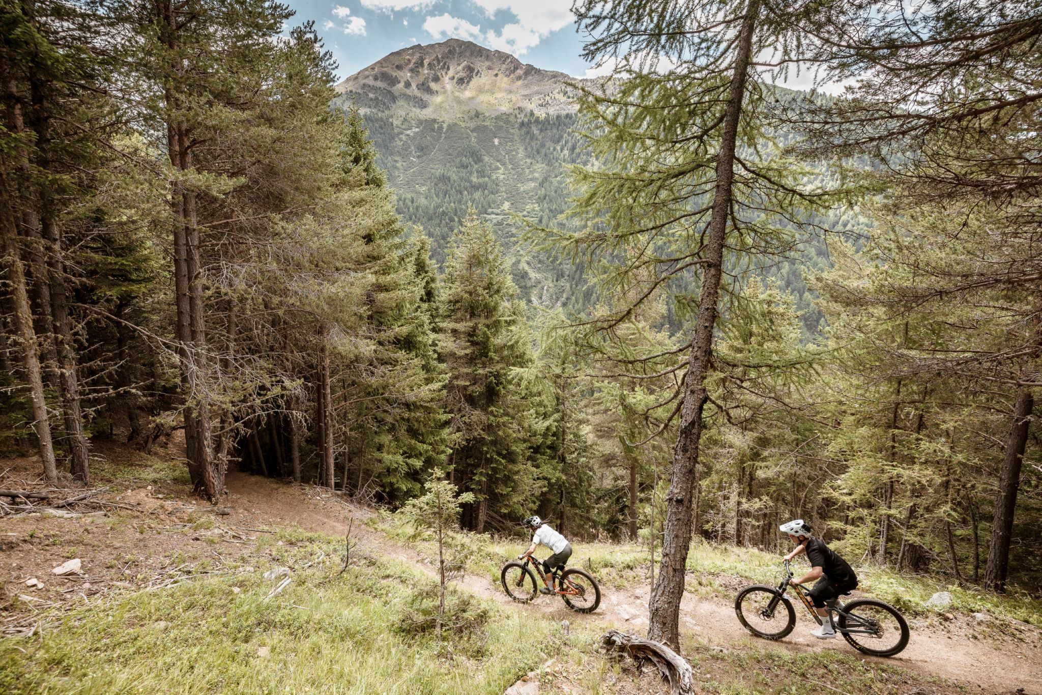
The Lochle Alm Trail is a red route. It is generally rideable but includes a few tight switchbacks.

At BIKE REPUBLIC SÖLDEN, it’s all about the shared fun of bike sport – no matter your riding level. Be considerate of each other and support one another. Also behave respectfully towards all other people on the mountain and in the valley – and towards nature.

-> Stay on the paved and signposted trails. Do not ride across open meadows!

-> Avoid locking the rear wheel and help preserve the trails.

-> Be considerate of animals & close the pasture gates. There may be cows on the trails and lines. Ride cautiously and keep distance!

-> Please note: Hikers also use the natural trails of BIKE REPUBLIC SÖLDEN. Ride carefully, stop, yield thoughtfully, and greet nicely.

Well equipped rules! We recommend wearing MTB protective gear (helmet, protectors for knees, elbows, back, ...) on all lines, trails, enduro routes, and mountain bike routes in BIKE REPUBLIC SÖLDEN. All trails are exclusively intended for use with mountain bikes that meet current quality standards.
Source: Ötztal

Description

The Lochle Alm Trail goes from the last switchback before Kleble Alm towards the Windachtal and the unmanaged Lochle Alm (or in the opposite direction). It runs entirely through forest, is quite flowy, but also spiced with short, sharp climbs and a steep downhill section near the end. In the middle, there is a hiking trail branching off towards Stallwiesalm: keep left here! Also great is that the forest ground is barely affected by rain, so it’s almost always pleasant to ride on.

As with all trails on the quiet side of Sölden: there is no shuttle here, you have to pedal uphill yourself. About 500 meters of elevation gain is required for the route up to the trail entrance.

A complete trail loop is offered by the route Enduro Windach B.

Please watch out for hikers!


Getting here

  • Arrival by public transport

    Arrival by train

    Get to Ötztal train station at the valley entrance easily by train. A scheduled bus departs right from the station square towards Obergurgl. The bus ride to Sölden takes about 1 to 1.5 hours. On the designated bike line buses, bike transport (including eMTBs) is free with a valid bus ticket.

    You can find all important information about bus timetables, connections, and taxi companies here.

  • Parking

    At the valley stations of the Gaislachkoglbahn and the Giggijochbahn, there are sufficient parking spaces available, including parking garages.Parking spaces are subject to fees.

    Paid overnight parking of cars in the Gaislachkogl parking garage is possible:

    more information about overnight parking

    Please respect that wild camping is forbidden!

More tours in the surrounding area

Newsletter

The mountain is calling? So does our newsletter!

In our monthly newsletter we reveal the best holiday tips for Tyrol.