
Opening hours:Open today
Place:Sölden/Zwieselstein
:Alpine pasture / hut / mountain restaurant
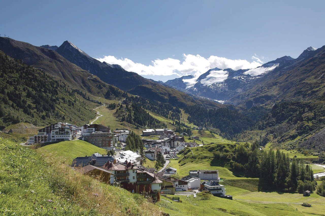
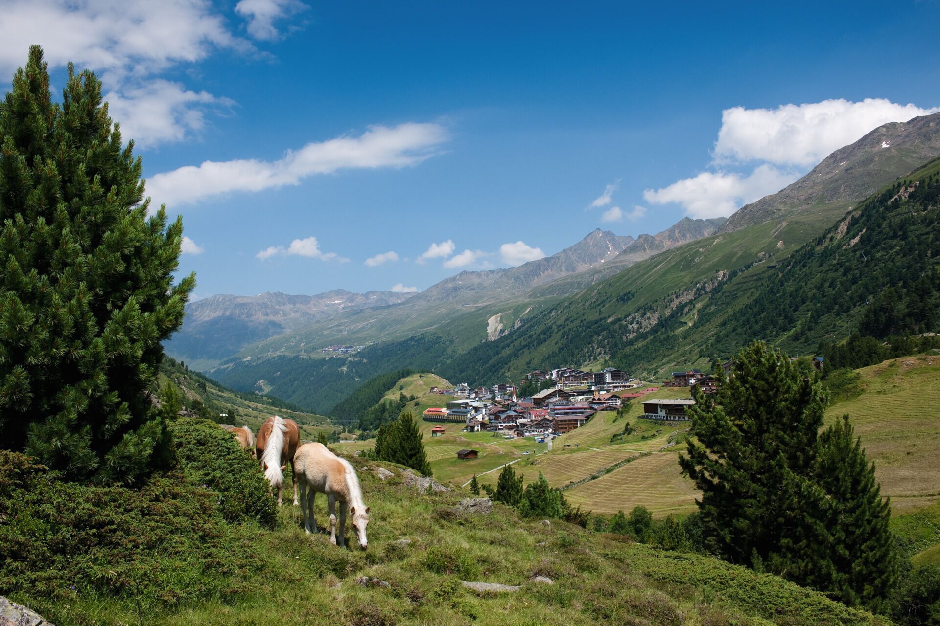
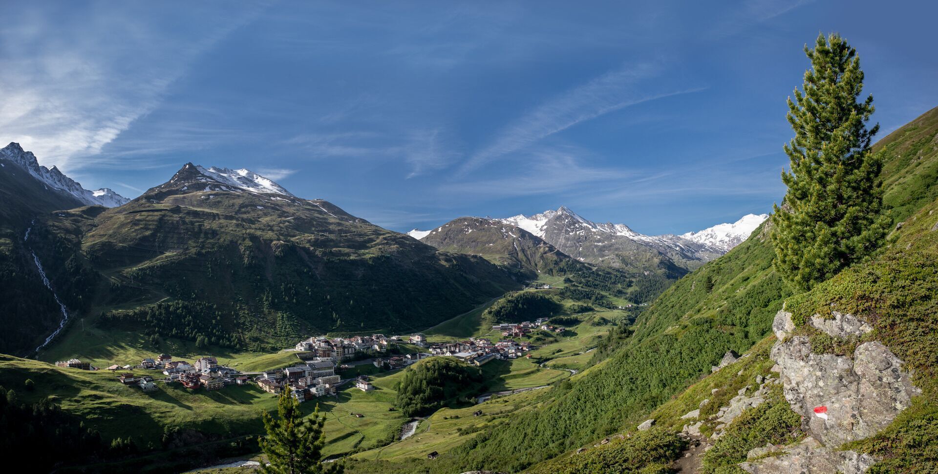
Obergurgl "the highest church village in Austria" reveals itself as a true dream ski resort and is rightly called the diamond of the Alps, but it is also worth a visit in the summer.
The Road Traffic Regulations (StVO) apply. General valid and usual rules of conduct.
It should be noted that road cycling carries an increased risk of accidents and injuries. Despite careful route planning, a basic risk always remains. Preparing for the route through endurance sports, appropriate training and education, as well as personal caution reduce the risk of accidents and dangers.
Personal equipment must be safe, usable, and meet the respective technical standard. Every road cyclist is recommended to inform themselves in specialist literature or on site about the planned routes. Full road cycling equipment is strongly recommended even for experienced riders!
Tip: For the partially poorly lit tunnels, lighting is advisable.
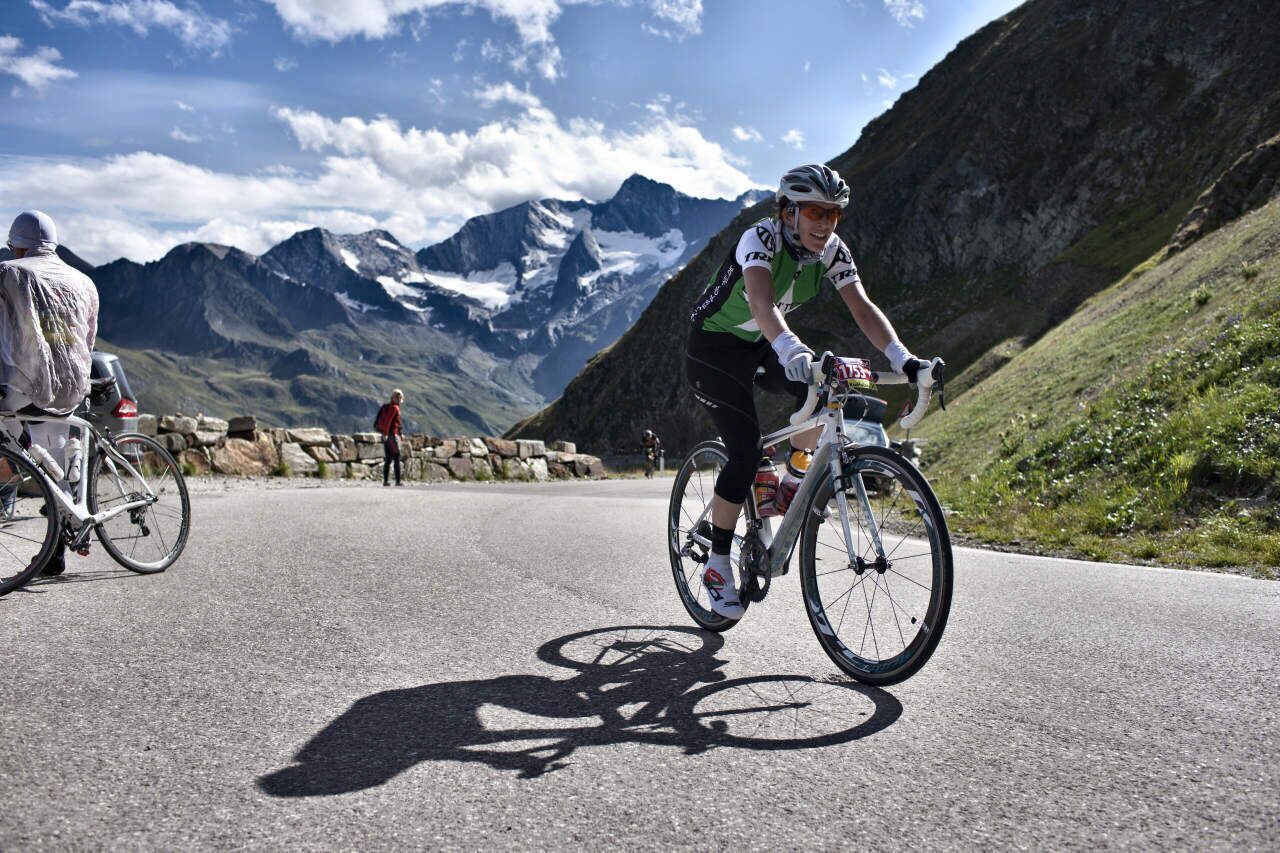
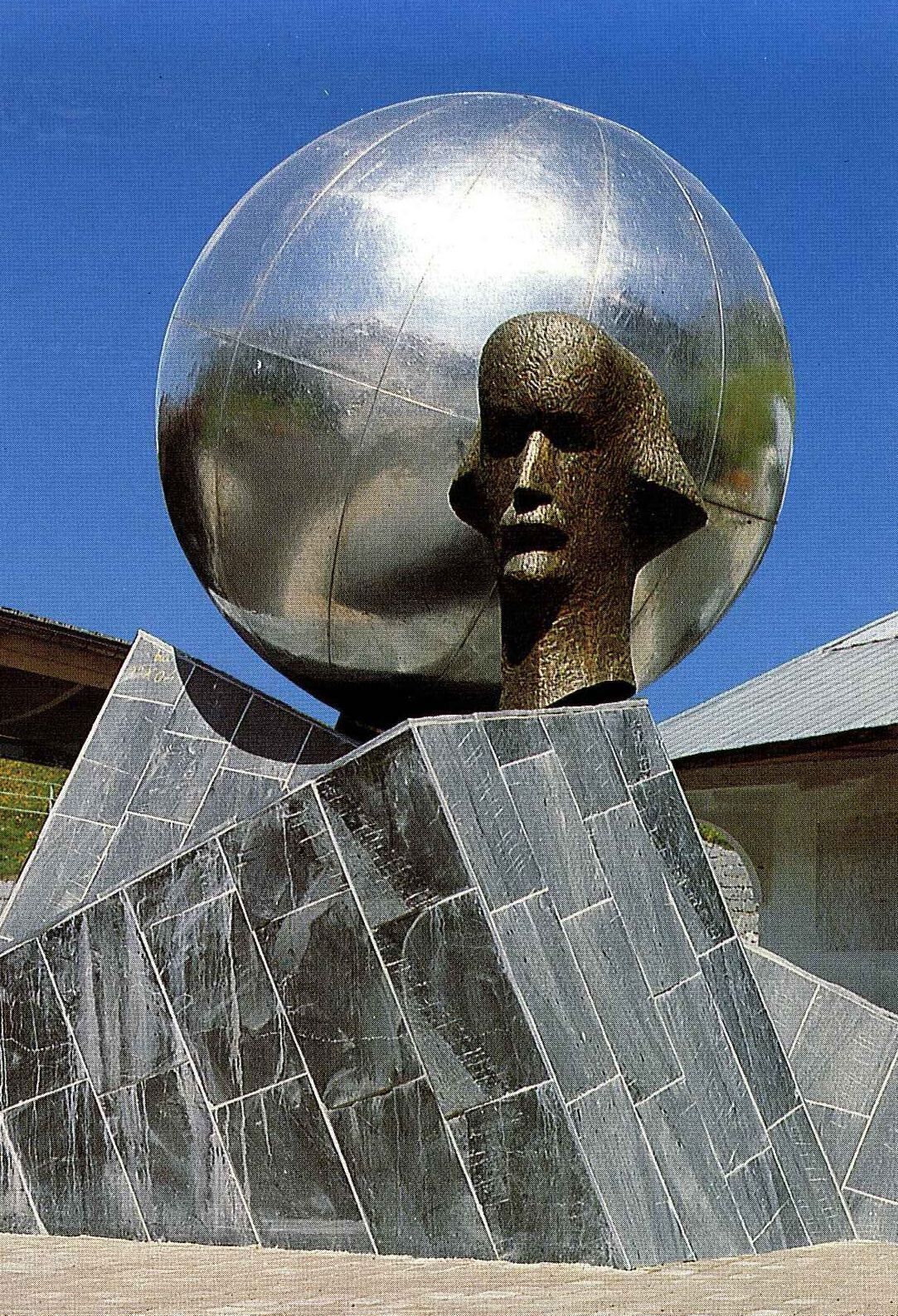
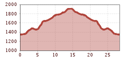
The Gurgler Valley branches off southwards from the end of the Ötztal near Zwieselstein and thus forms, together with the Venter Valley branching off at the same point, the continuation of the Ötztal. The last town in the 10-kilometer-long Gurgler Valley is Obergurgl – the valley ends at the Gurgler Ferner glacier. From the Gurgler Valley, the Timmels Valley branches off to the east, which, with the Timmelsjoch, forms the connection of the Ötztal to South Tyrol via the Timmelsjoch High Alpine Road.The just over 600 meters of altitude over 13.5 kilometers are manageable for an average trained rider and provide a foretaste of the route to the Timmelsjoch. From Zwieselstein, it goes steeply with gradients of up to 13 percent until shortly before Obergurgl, where for the first time far in the background the panorama of the 3,500-meter peaks of the Ötztal Alps unfolds. The valley also features a fascinating surrounding mountain world. You also do not have to miss wonderful buildings and architectural highlights here. Particularly noteworthy are the parish church of St. Johannes Nepomuk as well as the monument erected in memory of the emergency landing and rescue of Auguste Piccard in 1931.
Arrival by train
Travel comfortably and safely by train to the Ötztal train station. A local bus departs directly from the station forecourt towards Obergurgl. The bus ride to Sölden takes about 1 to 1.5 hours.
All important information about bus schedules, connections, and taxi companies can be found here.
At the valley stations of the Gaislachkoglbahn and Giggijochbahn, there are plenty of free parking spaces available, and free parking garages are also provided. Parking is free from 8:00 a.m. to 7:00 p.m.
Paid overnight parking is available at the Gaislachkogl parking garage:
more information about overnight parking
.jpg")


.jpg")


.jpg")


")


")


Erwin Haiden, bikeboard.at.jpg")
-min.jpg")

