Mountainbike-Tour Schleierwasserfall

Kirchdorf in Tirol / Kitzbühel Alps
Difficulty ratings: medium
Route length: 15.0 km

A varied tour with impressive views at the foot of the Wilder Kaiser mountain.
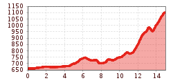
Tour information

  • Requirement: medium
  • Length: 15.0 km
  • Elevation uphill:524 hm
  • Elevation downhill:86 hm
Highest point1,105 m

Starting point

St. Johann in Tirol

Finishing point

St. Johann in Tirol
  • Fitness level 3 / 6
  • Technique 3 / 6

Best time of year

  • January
  • February
  • March
  • April
  • May
  • June
  • July
  • August
  • September
  • October
  • November
  • December

Trail condition

Asphalt, mountain trails

Equipment

- outdoor clothing
-helmet
- sturdy shoes
- Sufficient food and drinks
- First aid kit
- Mobile phone with full battery & charger
- Hiking map & guide literature
- GPS device or download the GPS data to your mobile phone if necessary
- Sun protection (sunglasses, sun cream, cap)
- Rain protection
- Cash
-opt. Multitool & repair kit, bike pump
Source: Kitzbüheler Alpen Management GmbH

Description

 Innsbrucker Straße. The Sperten bridge leads you to Oberndorf, where you come through Eberhartling and up the Rerobichl onto Reither Straße, which you follow to the Stanglwirt junction. Cross the road at the subway and continue along Berghof, past the Goingen bathing lake, towards the Hüttling car park, Aschinger Chapel.

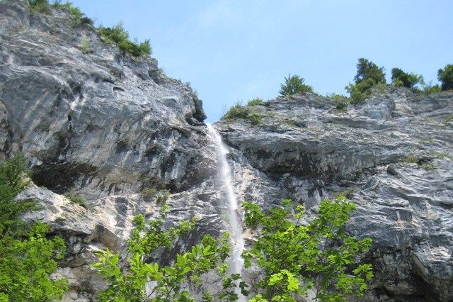
From here a forest road, mostly through forest, leads to just below the Schleierwasserfall


Getting here

  • Arrival by public transport

    Bus: Linie 4000, 4012, 4060 Bus stop: Haltestelle St. Johann in Tirol Steinlechnerplatz
    Train: 201 Giselabahn Bahnhof St. Johann in Tirol

    Bus and traintimes: 
    kitzalps.cc/mobile

  • Parking

    Nearest Parking possibility:
    Parking place Steinlechnerplatz (you will have to pay a parking fee)

More tours in the surrounding area

  • OD Trails

    Opening hours:open
    Difficulty:medium
  • 1. Etappe KAT Bike Sport+

    Difficulty:medium
    Length:25.0 kmDuration:3:30 hElevation uphill:1,108 m
  • Wilder Kaiser cycle route no. 14

    Difficulty:medium
    Length:38.3 kmElevation uphill:520 m
  • Angereralm - Harschbichl

    Opening hours:closed
    Difficulty:medium
    Length:18.2 kmDuration:2:00 hElevation uphill:942 m
  • Salvenaradrunde

    Difficulty:medium
    Length:62.7 kmDuration:3:30 hElevation uphill:648 m
  • Brixental cycling tour Nr. 21

    Difficulty:easy
    Length:46.7 kmDuration:3:30 hElevation uphill:450 m
  • KAT BIKE SPORT+

    Difficulty:difficult
    Length:146.0 kmElevation uphill:5,686 m
  • Kalkstein Loop

    Difficulty:medium
    Length:41.7 kmDuration:3:30 hElevation uphill:341 m
  • Fleckalm Trail

    Opening hours:open
    Difficulty:difficult
    Length:7.1 kmDuration:0:45 h
Newsletter

The mountain is calling? So does our newsletter!

In our monthly newsletter we reveal the best holiday tips for Tyrol.