Mountain hikes Bergdoktor tour of Ellmau

Ellmau / Kaiser Mountains
Difficulty ratings: easy
Route length: 7.5 km
Duration: 2:15 h

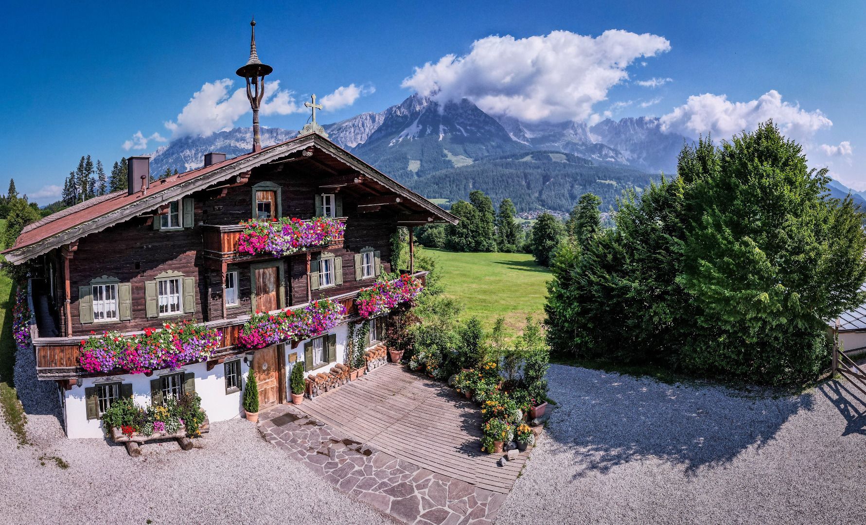
A tour of the main filming locations of the TV series “Der Bergdoktor” (The Mountain Doctor) in Ellmau, with a refreshment stop at the inn used during filming
Tour information

  • Requirement: easy
  • Length: 7.5 km
  • Duration: 2:15 h
  • Elevation uphill:200 hm
  • Elevation downhill:200 hm
Highest point858 m

Starting point

Hiking starting point Tourist Info, Ellmau (798 m)

Finishing point

Hiking starting point Tourist Info, Ellmau (798 m)
  • Fitness level 1 / 6
  • Technique 1 / 6

Features

  • Circular route
  • Suitable for families
  • suitable for pushchairs

Best time of year

  • January
  • February
  • March
  • April
  • May
  • June
  • July
  • August
  • September
  • October
  • November
  • December

Trail condition

The composition of the trail varies between forest road, meadow path, forest trail and asphalt road.

Equipment

Rucksack, hiking boots, hiking gear, sun protection, waterproofs, cold protection in winter, water bottle, hiking poles if desired, first aid kit, hiking map/route description
Source: TVB Wilder Kaiser

Description

This pleasant circular walk starts at the centre of Ellmau and takes you across the overpass at the maintenance yard, heading in the direction of the golf course.
The hike continues towards KaiserBad in the district of Auwald. Now follow the Ellmau circuit around the district of Wald. Here, the footpath continues towards Scheffau in the district of Auwald.
The Gasthof Föhrenhof restaurant, which acts as the location for the interior of the “Gasthof Wilder Kaiser” inn during filming, offers a refreshment stop.
Afterwards, you can follow the trail marked “Bergdoktorrunde” (“Mountain Doctor circuit”) through the district of Auwinkl.
On the way back is another key filming location – the Bergdoktor practice.
After an exhaustive visit and having taken lots of beautiful photos, you should head back to the starting point in the village of Ellmau.

Nearby huts and mountain restaurants

Getting here

  • Arrival by public transport

    KaiserJet stop “Ellmau Hotel Alte Post” or Postbus stop “Ellmau Dorf Bauhof”. More information at: www.wilderkaiser.info/mobility

  • Parking

    Heading from Wörgl or Kufstein on the B178 road, take the first exit to Ellmau and then take the first exit at the roundabout. Drive along the bypass, then turn towards the centre of Ellmau when you reach the end (between MPreis and the Sporthotel). Continue straight on until you see the Tourist Info on the right-hand side (short-stay parking zone). The hiking starting point is located opposite this on the left-hand side. Heading from St. Johann on the B178 road, take the first exit to Ellmau and drive straight on through the town until you see the Tourist Info on the right-hand side (short-stay parking zone). The hiking starting point is located opposite this on the left-hand side.
    Public car parks in Ellmau centre or west - subject to a charge

Weather

Today

mainly clear
8°C/0°C
10%0l5 km/h

Mon

partly Cloudy
9°C/0°C
80%3.8l5 km/h

Tue

light rain
9°C/3°C
80%4.1l5 km/h
Go to weather forecast

More tours in the surrounding area

  • Kaiserkrone - stage 3

    Difficulty:medium
    Length:9.3 kmDuration:4:30 hElevation uphill:840 m
  • Tauernblick panorama circular hiking route

    Difficulty:medium
    Length:13.6 kmDuration:6:00 hElevation uphill:980 m
  • Hintere Goinger Halt summit tour

    Difficulty:difficult
    Length:9.3 kmDuration:6:30 hElevation uphill:1,090 m
  • Panoramic circuit Brandstadl–Hartkaiser

    Difficulty:easy
    Length:6.0 kmDuration:1:50 hElevation uphill:170 m
  • “Moor & more” Rocky Way

    Difficulty:easy
    Length:8.0 kmDuration:3:00 hElevation uphill:380 m
  • Hochalm hike

    Difficulty:medium
    Length:19.6 kmDuration:7:00 hElevation uphill:1,140 m
  • 3-day hut tour Wilder Kaiser

    Difficulty:difficult
    Length:24.6 kmDuration:14:00 hElevation uphill:2,060 m
  • Astberg circular hiking route

    Difficulty:easy
    Length:1.5 kmDuration:0:30 hElevation uphill:80 m
  • Kaiserkrone - stage 1

    Difficulty:medium
    Length:8.0 kmDuration:4:30 hElevation uphill:1,120 m
  • Eagle Walk Stage 02: Gaudeamushütte - Kaindlhütte

    Difficulty:medium
    Length:15.1 kmDuration:6:30 hElevation uphill:888 m
Newsletter

The mountain is calling? So does our newsletter!

In our monthly newsletter we reveal the best holiday tips for Tyrol.
