
Opening hours:Today closed
Place:Scharnitz
:café
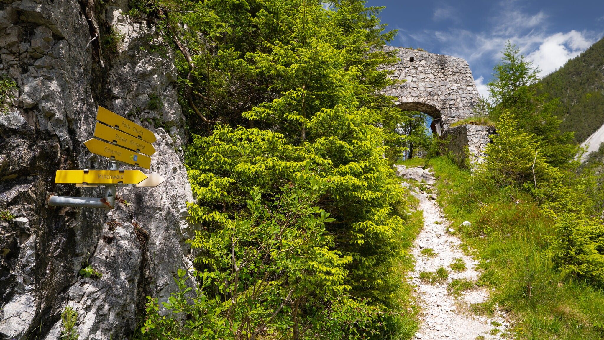
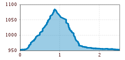
Easy circular hike from Scharnitz to the historic fortress ruins of Porta Claudia, offering insights into the history of the Alpine fortification and beautiful views of the surrounding nature.
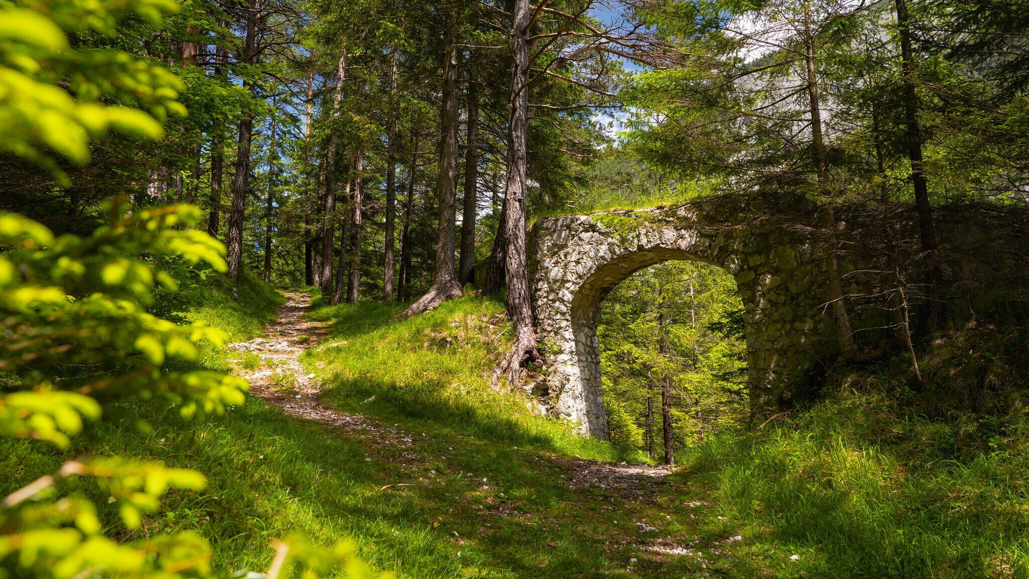
Forest roads, woodland paths, and gravel trails.
All current information about the trail closures in the Region Seefeld can be found here.
Have you been out and about in the Region and discovered a spot that we should rework or repair? Fill out the form "Report a danger zone" and let us know where work is needed.
Comfortable footwear, weather-appropriate clothing, a light backpack, enough water, and a small snack are recommended for this hike.
Additionally, a hiking map or GPS, a first aid kit, sun protection, and hiking poles, if needed, are also advisable.
From the Ried P1 parking lot, walk in the direction of Scharnitz. Turn right before the Isar bridge and follow the path up to Porta-Claudia. Return via the Calvary to Scharnitz. In Scharnitz turn left and follow the Porta-Claudia-Str. to the Isar bridge and cross it. After the bridge turn left again and walk along the Isar back to the starting point.
The stations:
Station 1: The construction
The Porta Claudia was built in several construction phases. The oldest construction was built in 1633 - 1634 and 1645 - 1648 directly behind the bridge over the river Isar in the present village center. After destructions the fortress is rebuilt in 1705 - 1711 and 1719, especially in the north a new dam is built. In the 1760s and 1770s it is extended and in 1796 - 1800 construction phases follow, which lead to its largest extent.
Station 2: The fortress complex
The fortification of Porta Claudia extends in the north from the eastern walls of the Brunstein up to the western rocky outcrop. Between the former customs buildings was the main gate of Porta Claudia, behind it the barracks, the powder magazine and the armory. A moat had been constructed in front of the walls. West of the Isar there were four sections of buildings along the fortification.
Station 3: The destructions
The Porta Claudia was subjected to several destructions: in 1703 in the course of the "Bavarian Rumble", in 1762 due to a flood disaster, in 1782 due to an officially ordered dismantling including the sale of individual components and in 1805 due to the demolition ordered by the French troops. Throughout its existence, the fortress was also regularly exposed to decay through weathering.
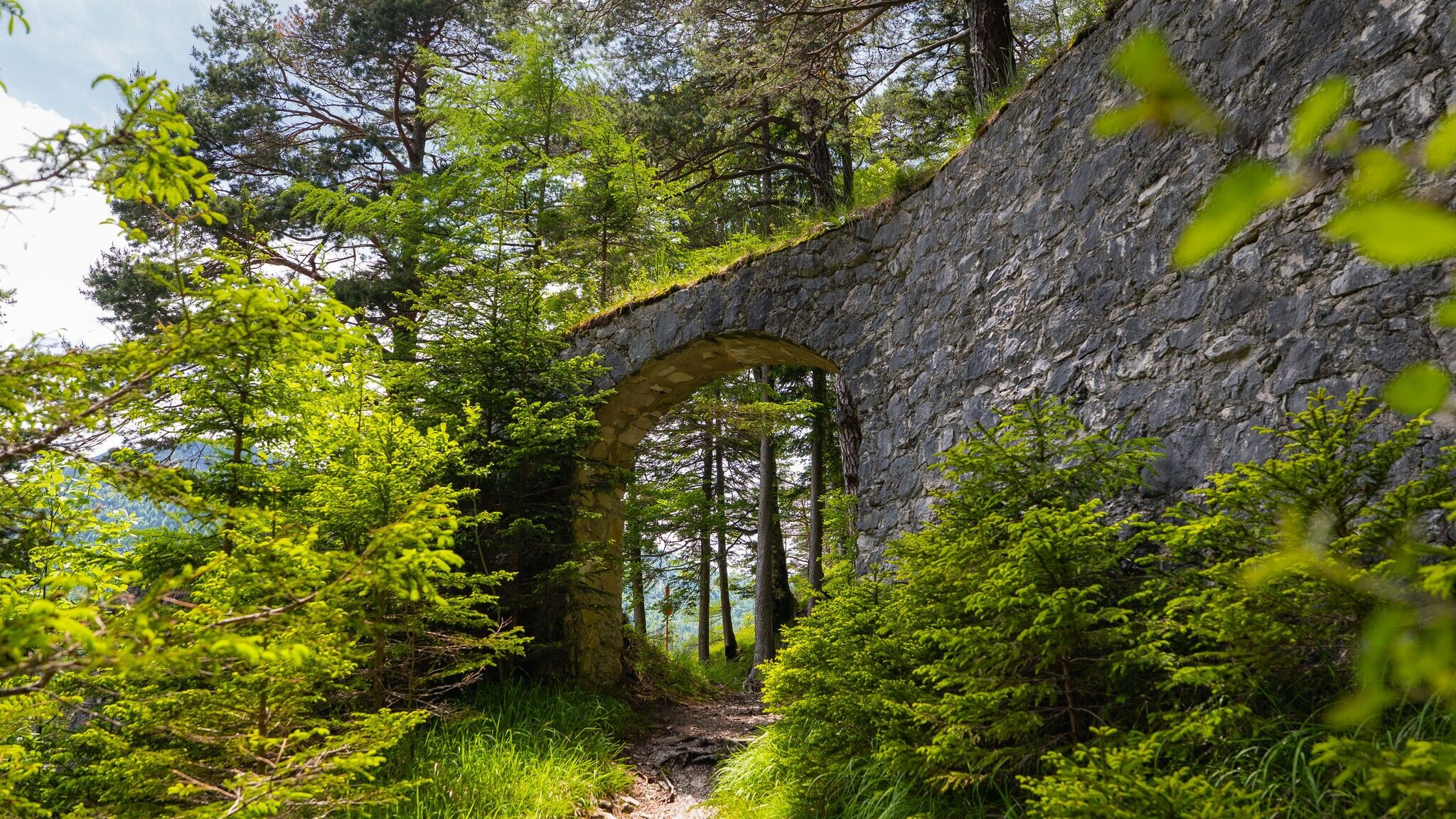
Station 4: The main gate
Above the main gate there was a chapel (dedicated to St. Joseph) and the apartment of the military chaplain. The main gate was built in the construction period 1705-1711. Coming from the north, one also had to cross a moat before passing the gate. On the side of the eastern former customs building, one can still easily see remains of the connecting wall between the main gate and the eastern facilities.
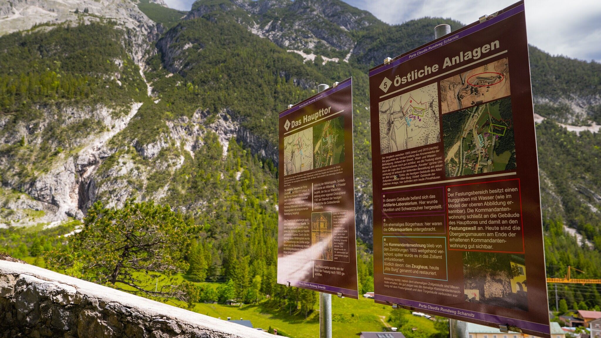
Station 5: Eastern buildings
The eastern installations of Porta Claudia include the artillery laboratory, where ammunition and black powder were produced, a former burgher's house, where the officers were housed, the commander's residence, where today stands as the eastern old customs house, and the armory, now called the "Old Castle". The crown mill and the gun emplacement "Cavalier" date back to the 1760s.
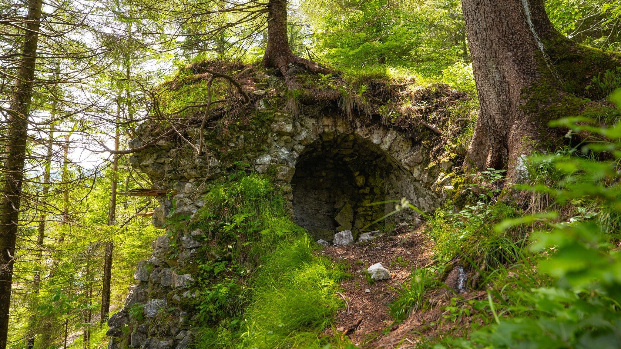
Station 6: The barracks
Behind the present western former customs building there are still old walls and the relatively well preserved powder magazine. In this arena-like area were the barracks with a main building and the inner guardhouse. Both no longer exist, the location of the main building is at the roadside entrance of the arena, that of the guardhouse at the parking lot in front of the customs building.
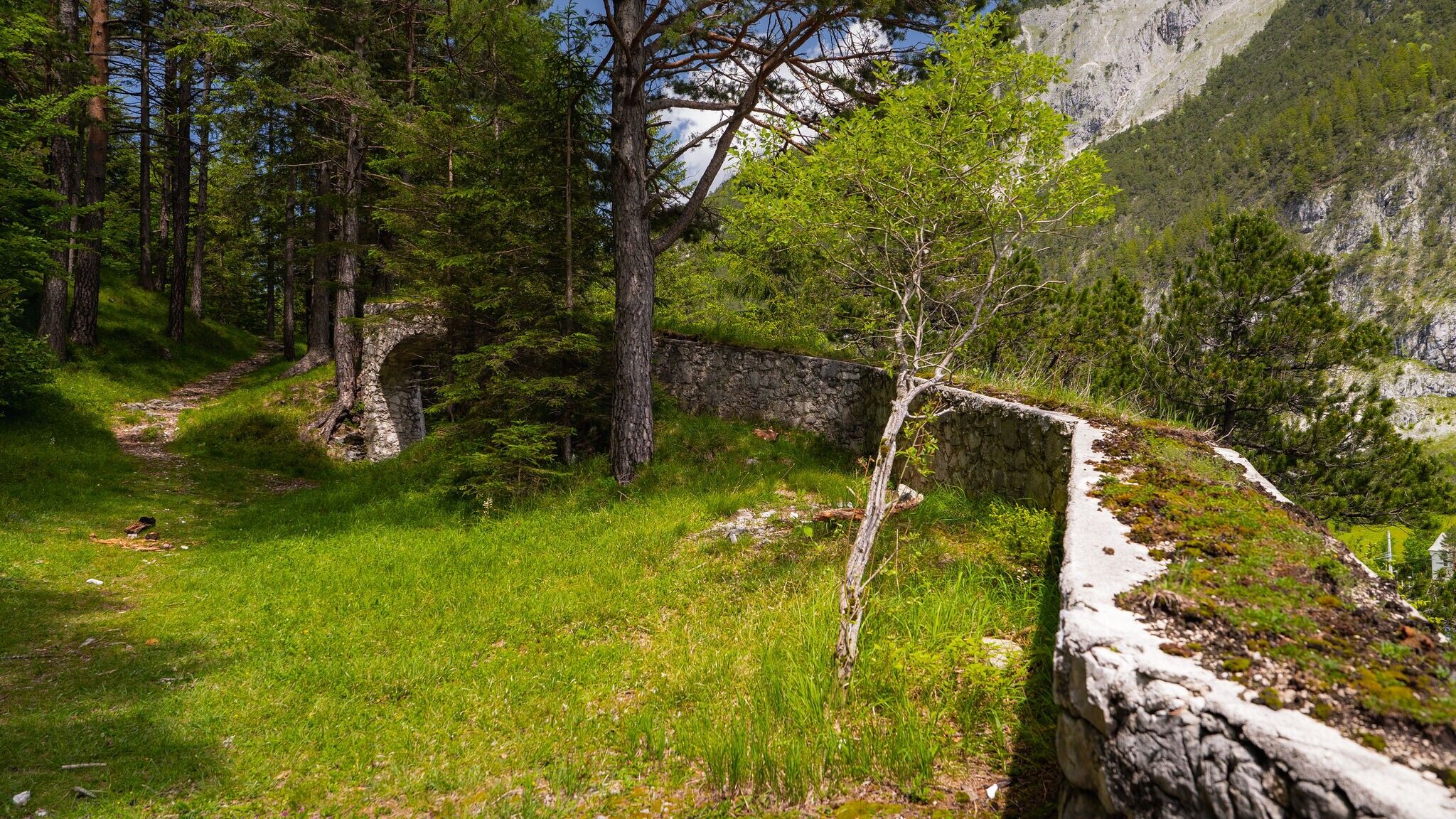
Station 7: The rampart
The youngest part of the Porta Claudia is the forework (also called Maulögg-Redoute), with defensive walls, gun emplacements and embrasures. It was connected with the upper part of the bastion. Passages are still preserved today. The area near the outwork is also called "Devil's Kitchen" in the tradition, although this may have been the original name for the artillery laboratory.
Station 8: The Stables
The stables, whose vaults are still well preserved, belong to the two uppermost sections of Porta Claudia. From the stables, stairs lead to the upper part of the building, where there was also a kitchen in a supply building. Next to the stables there was also a warehouse, where all kinds of goods were stored. These facilities were also built in the 1760s and 1770s.
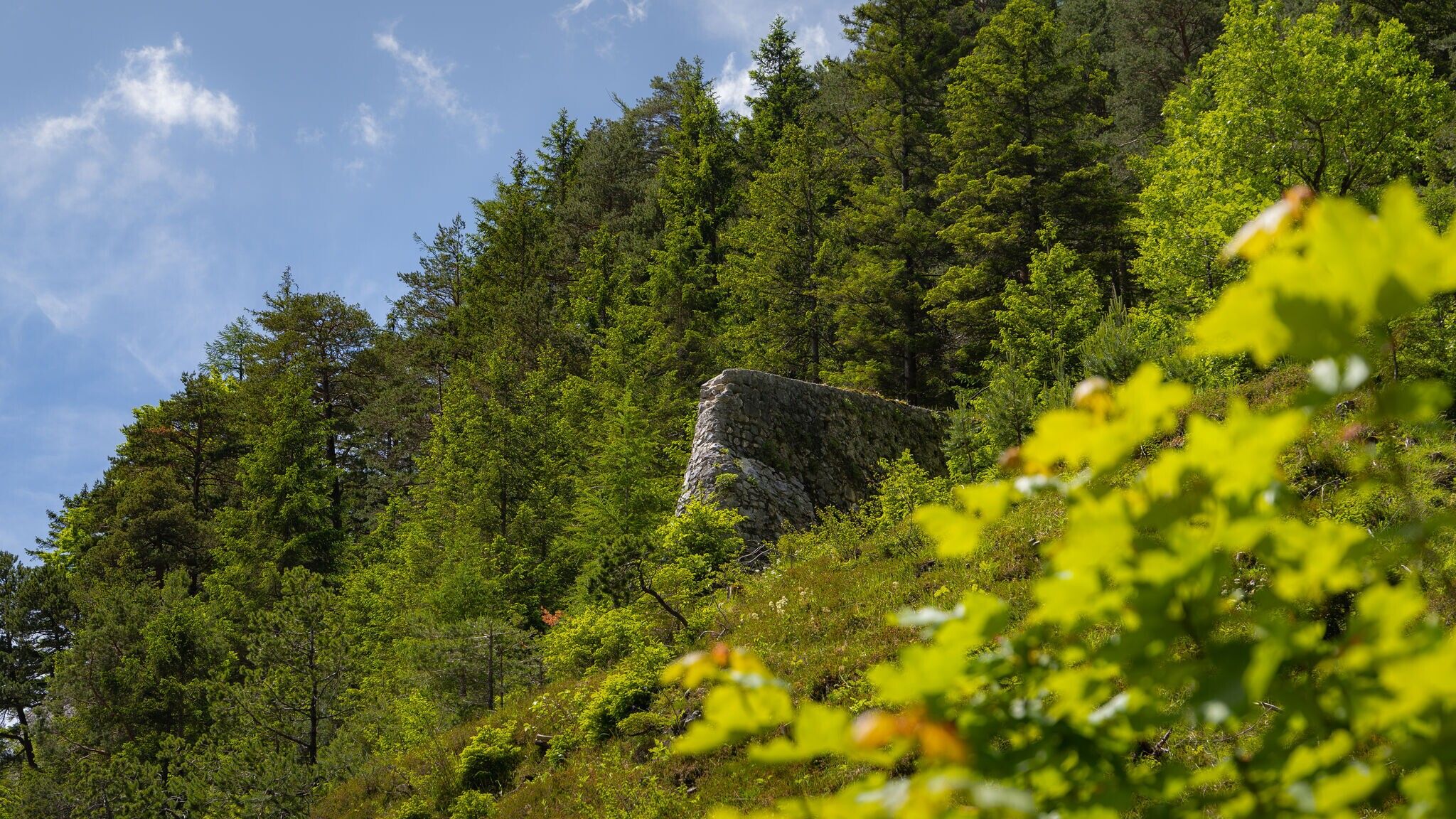
Station 9: The mountain bastion
West of the Isar River there are four sections with strong fortifications that existed along the defense wall. The mountain bastion was equipped with fortifications and embrasures, the walls of a building in the uppermost section are still clearly visible - in such buildings there were guardrooms or even a kitchen. Casemates, rampart vaults reaching into the hillside, were an important part of the fortification.
Station 10: Fort St. Nikolo
In 1645 Fort St. Nikolo is built, first as a simple wooden hut for a scout post, after 1705 the wooden structure is replaced by an outwork and the building is rebuilt. After the destruction in 1805, a Calvary is built, a large cross is erected on the site of the building in 1898, and the burial chapel is built between 1900 and 1930 where the gate to the fort used to be.
Station 11: The first plant
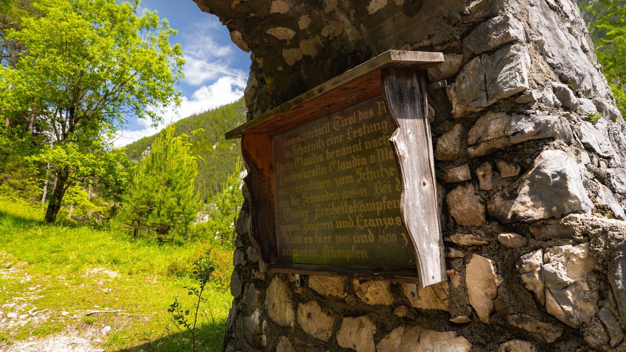
The original Porta Claudia was built just after the Isar Bridge in the center of the village. Archduchess Claudia de'Medici ordered its construction in 1633 in order to secure Tyrol in the north against the Swedes fighting in the Thirty Years' War. As early as 1632, the Gumpp brothers, who were in the service of the Tyrol as master builders, had visited Scharnitz and drawn designs for a fortification.
By train to Scharnitz train station, then a 10-minute walk to the starting point at the Scharnitz Parkplatz P1 Riedboden.
All real-time connections can be found in the route planner.


.jpg")


.jpg")


.jpg")


.jpg")


.jpg")
 Olympiaregion Seefeld")


.jpg")

.jpg")


