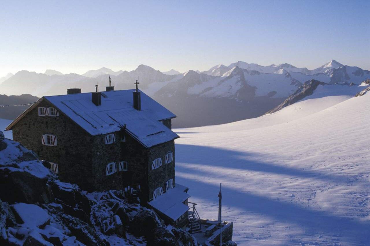
Mountain hikes Fluchtkogel (from Brandenburger Haus)

Kaunertal /
Difficulty ratings: difficult
Route length: 2.7 km
Duration: 3:00 h

Fluchtkogel (from Brandenburger Haus)

Tour information

  • Requirement: difficult
  • Length: 2.7 km
  • Duration: 3:00 h
  • Elevation uphill:301 hm
  • Elevation downhill:94 hm
Highest point3,500 m

Starting point

Brandenburger Haus

Finishing point

Fluchtkogel
  • Fitness level 5 / 6

Best time of year

  • January
  • February
  • March
  • April
  • May
  • June
  • July
  • August
  • September
  • October
  • November
  • December

Equipment

It is recommended to wear hiking equipment such as outdoor clothing, weather-resistant outdoor clothing, ankle-high mountain boots, wind, rain and sun protection, cap and gloves. It is also important to have sufficient food and a first-aid package, a cell phone and a hiking map. 
Source: Nauders - Tiroler Oberland - Kaunertal

Description

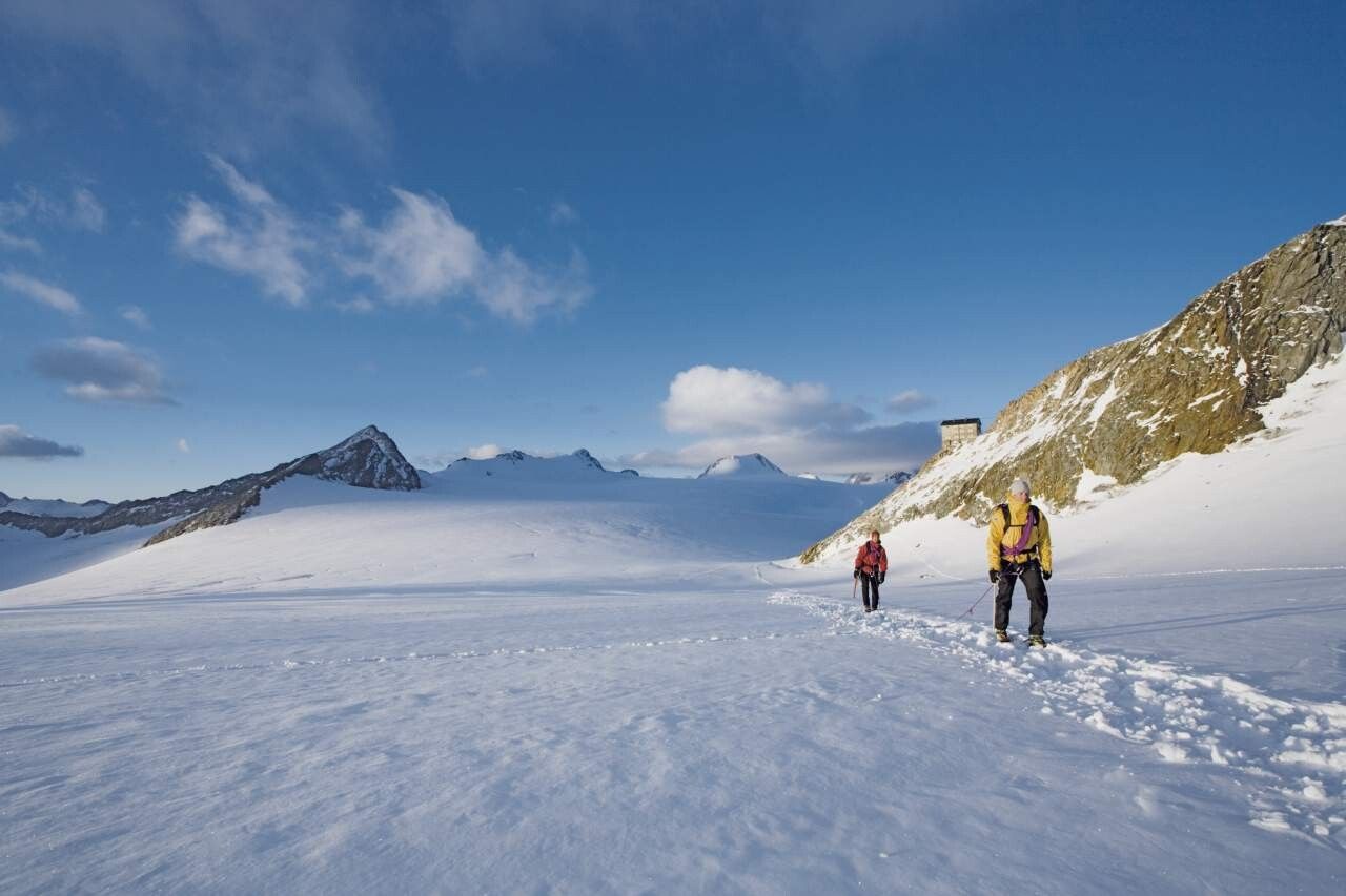
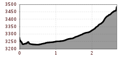
From the Brandenburger House via the Kesselwandferner in north-east direction to the Obere Guslarjoch (3,361 m). From here steeply over the Firnhang (sometimes icy). Finally, again flattering on the summit.

Nearby huts and mountain restaurants

Getting here

  • Arrival by public transport

    Enjoy a both comfortable and relaxing train ride to the train station in Ötztal Bahnhof. You get off the train in ÖTZTAL Bahnhof where you change to a public bus or local taxi. The current bus schedule can be found at: http://fahrplan.vvt.at

  • Parking

    The following parking facilities are available in Vent:

    In front of the village and at the valley station from the chair lift (payable)

More tours in the surrounding area

Newsletter

The mountain is calling? So does our newsletter!

In our monthly newsletter we reveal the best holiday tips for Tyrol.