
Opening hours:
closed
Difficulty:
easy
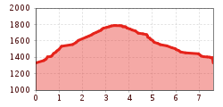
Length:
1.1 km
Duration:
0:45 h
Elevation uphill:
50 m
Impressive, hardly used snowshoe hike in the rear Navistal. This quite demanding snowshoe hike is a real insider tip. A stop at the Naviser Hütte is the icing on the cake.
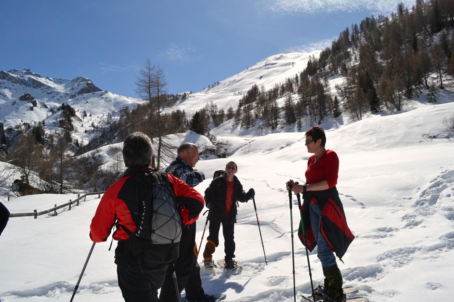
From the starting point at the municipal office, take the road into the Weirichtal valley, go straight ahead at the first bend and then turn left over a bridge. The trail continues steeply uphill to a fork in the road, where you keep left and continue up to the ridge. After the first meadow you have to cross a fence gate, then at the end of the second meadow there is an open gate and a path sign. Follow the barbed wire fence to the end and then head northeast (downhill) across an open wooded area followed by a wooded area. Beware in this part of the tour, there are some tricky spots in the terrain. You come to a clearing with a high point at the bottom. At the lowest point, climb back up over meadows to the road and along it to the Stöcklalm.
The descent is north-west across a ditch, then in an arc across the slopes to the Naviser Hütte. From there, descend through a forest aisle until you meet the toboggan run. Follow this to the second bend, leave it again and descend along a path into the Grüner Au. The trail leads out along the Klammbach stream and back to the municipal office.
.JPG")


.jpg")
")

 (1).jpg")


