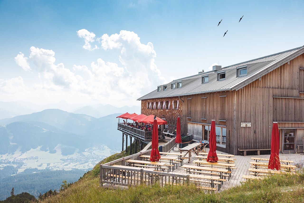
Mountain hikes Gruttenhütten Runde

Ellmau / Kaiser Mountains
Difficulty ratings: medium
Route length: 15.7 km
Duration: 6:00 h

Scenic circular hike to the highest managed mountain hut in the Wilder Kaiser.

Tour information

  • Requirement: medium
  • Length: 15.7 km
  • Duration: 6:00 h
  • Elevation uphill:870 hm
  • Elevation downhill:870 hm
Highest point1,620 m

Starting point

Hiking starting point Tourism Info, Ellmau (800 m)

Finishing point

Hiking starting point Tourism Info, Ellmau (800 m)
  • Fitness level 5 / 6
  • Technique 3 / 6

Features

  • Circular route

Best time of year

  • January
  • February
  • March
  • April
  • May
  • June
  • July
  • August
  • September
  • October
  • November
  • December

Trail condition

The path conditions vary between access roads, hiking trails, gravel paths, mountain tracks, and rocky passages.

Equipment

Backpack, sturdy hiking/mountaineering boots with non-slip tread soles, weather-appropriate hiking clothing (breathable), change of clothes, sun protection (sunglasses, sunscreen, lip balm, headwear), rain protection (rain jacket/poncho, pocket umbrella, backpack cover), cold protection (beanie, gloves), provisions (sufficient drinks and snacks), optional hiking poles (height-adjustable), first-aid kit incl. rescue blanket & bivouac sack, mobile phone with fully charged battery, headlamp, plastic bag for waste, hiking map, tour description and information material (GPX track), ID, insurance card, cash.
Source: TVB Wilder Kaiser

Description

This challenging mountain hike starts at the hiking information center in the village center. You cross the main road towards Kaiserbad, walk along the 27-hole golf course and, at the end of the avenue, continue on trail no. 23 through the district of Wimm and the hamlet of Riesen uphill towards Riedlhütte until you reach the Biedringer Platte. Here you will be rewarded with a unique panoramic view of Ellmau and the Kitzbühel Alps. You continue walking across alpine meadows to the Riedlhütte. After a short break, take hiking trail no. 14/14a steeply uphill to the Gruttenhütte. There, while enjoying a Tyrolean "Brettljause", you are very close to the Wilder Kaiser. Refreshed for the way back, you now follow the steep and partly rocky path no. 825 downhill towards Wochenbrunner Alm. Here you can enjoy the view and the beautifully laid out wildlife park before starting your way back down to the valley. You hike through the Spatlahner-Klamm and follow hiking trail no. 14. This leads along the Hausbach stream across the 27-hole golf course back to the hiking information center in Ellmau.

Nearby huts and mountain restaurants

  • Gruttenhütte (Hut)

    Opening hours:Today closed
    Place:Ellmau
    :Alpine pasture / hut / mountain restaurant
  • Riedlhütte (Hut)

    Opening hours:Today closed
    Place:Ellmau
    :Alpine pasture / hut / mountain restaurant

Getting here

  • Arrival by public transport

    80 KaiserJet: Ellmau Dorfplatz (Steig A)
    865+866 VVT-Regiobuslines: Ellmau Dorf/Bauhof

    You can find further information and the timetables on this page: Local Transport | Wilder Kaiser

  • Parking

    Heading from Wörgl or Kufstein on the B178 road, take the first exit to Ellmau and then take the first exit at the roundabout. Drive along the bypass, then turn towards the centre of Ellmau when you reach the end (between MPreis and the Sporthotel). Continue straight on until you see the Tourist Info on the right-hand side (short-stay parking zone). The hiking starting point is located opposite this on the left-hand side.

    Heading from St. Johann on the B178 road, take the first exit to Ellmau and drive straight on through the town until you see the Tourist Info on the right-hand side (short-stay parking zone). The hiking starting point is located opposite this on the left-hand side.

    Public car parks in Ellmau centre or west (800 m) - pay & display

Weather

Today

light rain showers
10°C/5°C
90%16.7l5 km/h

Fri

cloudy
6°C/-4°C
75%0.3l10 km/h

Sat

clear sky
6°C/-5°C
0%0l5 km/h
Go to weather forecast

More tours in the surrounding area

  • Kaiserkrone - stage 3

    Difficulty:medium
    Length:9.3 kmDuration:4:30 hElevation uphill:840 m
  • Tauernblick panorama circular hiking route

    Difficulty:medium
    Length:13.6 kmDuration:6:00 hElevation uphill:980 m
  • 3-day hut tour Wilder Kaiser

    Difficulty:difficult
    Length:24.6 kmDuration:14:00 hElevation uphill:2,060 m
  • Hochalm hike

    Difficulty:medium
    Length:19.6 kmDuration:7:00 hElevation uphill:1,140 m
  • “Moor & more” Rocky Way

    Difficulty:easy
    Length:8.0 kmDuration:3:00 hElevation uphill:380 m
  • Hintere Goinger Halt summit tour

    Difficulty:difficult
    Length:9.3 kmDuration:6:30 hElevation uphill:1,090 m
  • Panoramic circuit Brandstadl–Hartkaiser

    Difficulty:easy
    Length:6.0 kmDuration:1:50 hElevation uphill:170 m
  • Astberg circular hiking route

    Difficulty:easy
    Length:1.5 kmDuration:0:30 hElevation uphill:80 m
  • Kaiserkrone - stage 1

    Difficulty:medium
    Length:8.0 kmDuration:4:30 hElevation uphill:1,120 m
  • Eagle Walk Stage 02: Gaudeamushütte - Kaindlhütte

    Difficulty:medium
    Length:15.1 kmDuration:6:30 hElevation uphill:888 m
Newsletter

The mountain is calling? So does our newsletter!

In our monthly newsletter we reveal the best holiday tips for Tyrol.