Mountain hikes Heilbronner Hut - 2.138m

St. Anton am Arlberg / Verwall
Difficulty ratings: medium
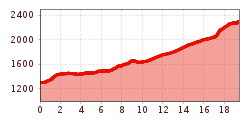
Route length: 19.5 km
Duration: 7:00 h

Heilbronner Hut - 2.138m

Tour information

  • Requirement: medium
  • Length: 19.5 km
  • Duration: 7:00 h
  • Elevation uphill:1,044 hm
  • Elevation downhill:47 hm
Highest point2,300 m

Starting point

Arlberg WellCom

Finishing point

Heilbronner Hut

Best time of year

  • January
  • February
  • March
  • April
  • May
  • June
  • July
  • August
  • September
  • October
  • November
  • December

Trail condition

Gravel and hiking trail.

Equipment

Good walking boots, poles and drinks/snacks, rain jacket, sun protection
Source: TVB St Anton am Arlberg

Description

Begin as described in Tour 23 (Trail 15). At the Konstanzer Hütte, turn right on the forest road onto the
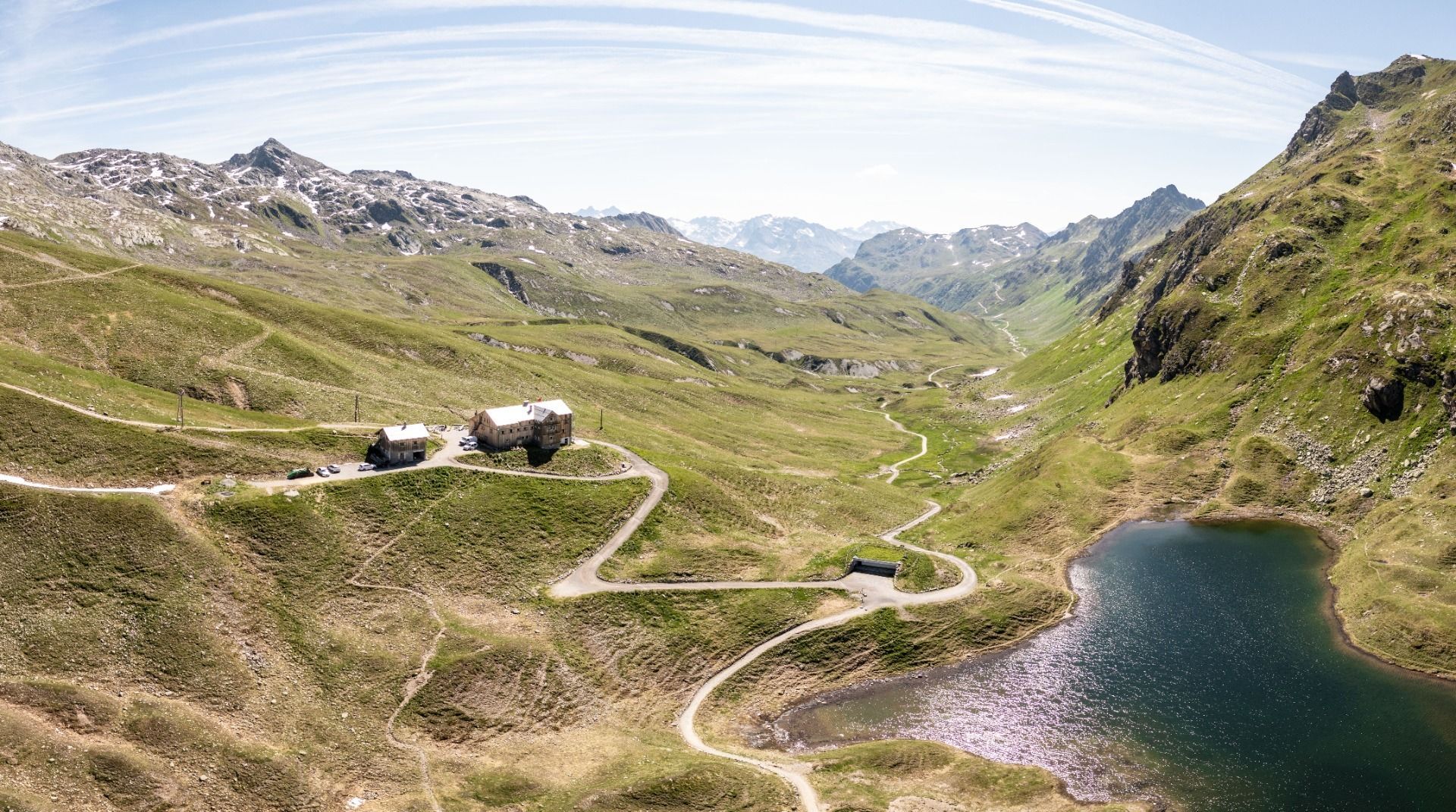
Schönverwall and follow the Rosanna (AV 517) to the Schönverwallhütte (unwardened). Follow the hiking trail to the junction, take a right and continue on the steep climb past the Scheidsee lakes to the Heilbronner Hütte
(St), which is situated in a magnificent location.

Nearby huts and mountain restaurants

  • Wagner Hütte

    Opening hours:Open today
    Place:St. Anton am Arlberg
    :Restaurant, Alpine pasture / hut / mountain restaurant
  • Konstanzer Hütte - 1.688m

    Opening hours:Open today
    Place:St. Leonhard i. P.
    :Alpine pasture / hut / mountain restaurant

Getting here

  • Arrival by public transport

    Bus or train.

  • Parking

    At Arlberg WellCom and Terminal West.

Weather

Today

light rain
17°C/8°C
55%2.5l5 km/h

Sat

mainly clear
21°C/6°C
0%0l5 km/h

Sun

mainly clear
22°C/7°C
10%0l5 km/h
Go to weather forecast

More tours in the surrounding area

Newsletter

The mountain is calling? So does our newsletter!

In our monthly newsletter we reveal the best holiday tips for Tyrol.