Mountain hikes Imsterberger Venetalm

Imsterberg /
Difficulty ratings: easy
Route length: 8.8 km
Duration: 5:00 h

"Imsterberg zur Venetalm: Enjoy nature with a view"

Tour information

  • Requirement: easy
  • Length: 8.8 km
  • Duration: 5:00 h
  • Elevation uphill:1,099 hm
  • Elevation downhill:1,099 hm
Highest point1,980 m

Starting point

Municipal office Imsterberg

Finishing point

Imsterberger Venetalm
  • Fitness level 3 / 6
  • Technique 2 / 6

Trail condition

Asphalt, hiking trail

Equipment

good shoes, enough liquid
Source: Outdoorregion Imst

Description

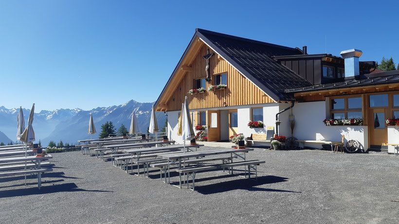
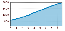
Start your adventure right in the picturesque village of Imsterberg and set off on a wonderful tour to the Venetalm. The trail leads across green meadows and fragrant forests, not technically difficult, but with over 1000 meters of elevation gain and almost 10 kilometers, it is a challenge for basic fitness levels. Enjoy the tranquillity of nature and reward yourself at the Venetalm with a well-earned snack and a magnificent view of the surrounding mountains and valleys.


Further information at: www.venetalm.com

Getting here

More tours in the surrounding area

Newsletter

The mountain is calling? So does our newsletter!

In our monthly newsletter we reveal the best holiday tips for Tyrol.