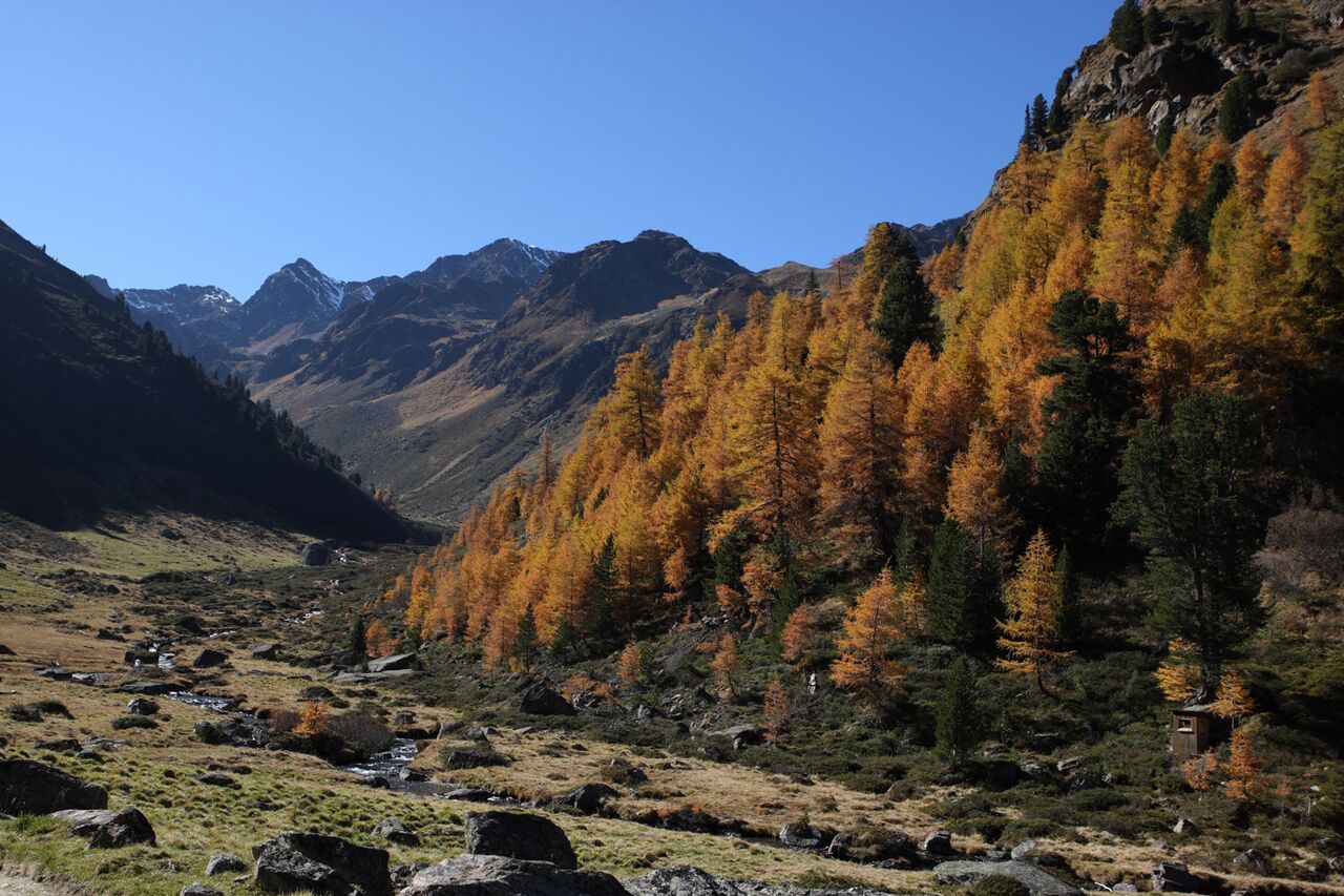
Mountain hikes Lader Schlossweiher to the Schöngampalm

open
Ladis / Samnaun Group
Difficulty ratings: easy
Route length: 10.2 km
Duration: 3:00 h

A narrow asphalted road leads to Neuegg, then take the forest track, partly ascending, partly flat, through the forest. Stopover opportunities in Neuegg and at Schöngampalm. Mountain bike rental at Schöngampalm possible. The length of the trail (including return) should not be underestimated.

Tour information

  • Requirement: easy
  • Length: 10.2 km
  • Duration: 3:00 h
  • Elevation uphill:857 hm
  • Elevation downhill:200 hm
Highest point1,837 m

Starting point

Lader Schlossweiher

Finishing point

Schöngampalm
  • Fitness level 3 / 6

Best time of year

  • January
  • February
  • March
  • April
  • May
  • June
  • July
  • August
  • September
  • October
  • November
  • December
Source: Serfaus-Fiss-Ladis

Description

From castle pond in Ladis  (L009) walk to the village district Greit (L057), then to the Waldkapelle chapel. After 10 minutes, you reach a crossing. Go right towards to the Wodeturm tower (L030). Half right (L029) to Hochgallmig (belongs to the village of Fließ) with the Fliesser trail no. 16 (2 3/4 hrs.). Take the trail up to the left (L032), then on the flat trail through the forest to the Maisbach brook (L034), further on to the Fisser Almweg trail no. 4 (F036). On this trail you reach the Schöngampalm (F039) in about 30 minutes (to this point, 3 hrs). Shortly before the Schöngampalm, the trail turns off to the right to the Urgsee lake (F038, 20 min.) and through the scenically beautiful Urgtal valley. For tour descriptions, see Fiss hiking trails. Since the valley region is so isolated, it is recommended to use the Schönjochbahn in Fiss to reach it.

Nearby huts and mountain restaurants

Getting here

  • Arrival by public transport

    Travel by train to Landeck-Zams railway station. From there, change to bus line 220 towards Serfaus-Fiss-Ladis.

  • Parking

    By car via the A12 motorway to the Landeck exit, then follow the B171 and L76 towards Ladis. In Ladis, follow the signs to the respective starting point of the tour.


    Parking is available in Ladis. Depending on the starting point of the tour, different car parks are available. The car parks are subject to a fee.

Weather

Today

light rain
7°C/3°C
65%0.6l5 km/h

Sun

mainly clear
8°C/1°C
15%0.2l5 km/h

Mon

cloudy
8°C/1°C
75%5.3l5 km/h
Go to weather forecast

More tours in the surrounding area

  • Panorama - Genussweg

    Opening hours:open
    Difficulty:easy
    Length:5.1 kmDuration:1:15 hElevation uphill:42 m
  • Marmot Trail

    Opening hours:open
    Difficulty:easy
    Length:573 mDuration:0:20 hElevation uphill:12 m
  • Wild Animals Trail

    Opening hours:open
    Difficulty:easy
    Length:1.5 kmDuration:0:31 hElevation uphill:1 m
  • Forscherpfad

    Opening hours:open
    Difficulty:easy
    Length:3.4 kmDuration:1:30 hElevation uphill:219 m
  • Oberer Spinnsee

    Opening hours:open
    Difficulty:medium
    Length:11.2 kmDuration:5:00 hElevation uphill:427 m
  • Fiss to the Oberen Sattelkopf

    Opening hours:open
    Difficulty:medium
    Length:5.6 kmDuration:3:00 hElevation uphill:1,057 m
  • Murmeltiersteig (Marmot alpine trail)

    Opening hours:open
    Difficulty:medium
    Length:6.9 kmDuration:3:00 hElevation uphill:302 m
  • Six Senses trail

    Opening hours:open
    Difficulty:easy
    Length:6.5 kmDuration:4:00 hElevation uphill:99 m
Newsletter

The mountain is calling? So does our newsletter!

In our monthly newsletter we reveal the best holiday tips for Tyrol.