Mountain hikes Lake round from Kramsach

Kramsach / Brandenberger Alpen (Rofan)
Difficulty ratings: easy
Route length: 6.8 km
Duration: 2:00 h

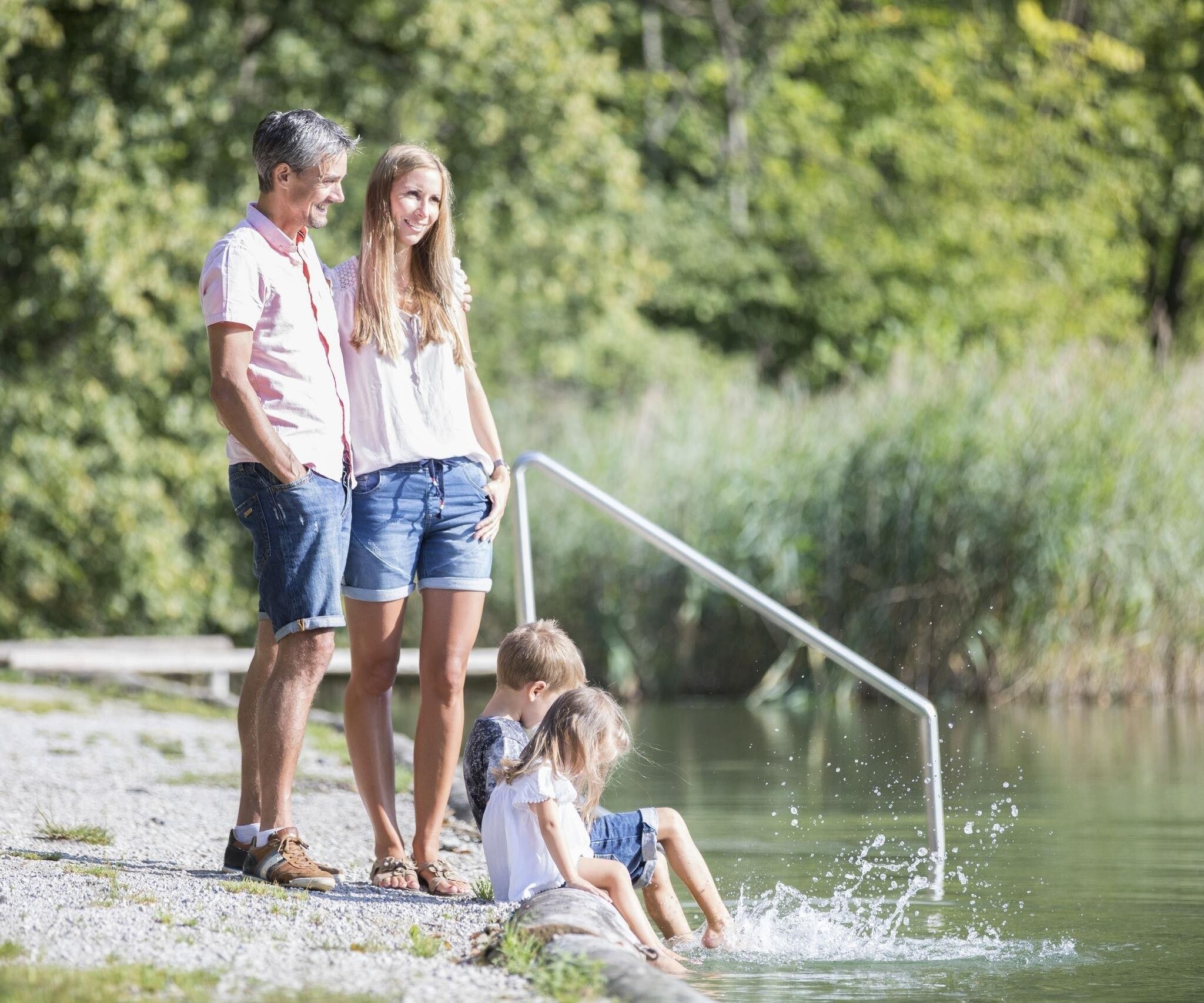
Family-friendly hiking route with swimming and play experience

Tour information

  • Requirement: easy
  • Length: 6.8 km
  • Duration: 2:00 h
  • Elevation uphill:72 hm
  • Elevation downhill:72 hm
Highest point585 m

Starting point

Kramsach village center

Finishing point

Kramsach village center
  • Fitness level 1 / 6

Best time of year

  • January
  • February
  • March
  • April
  • May
  • June
  • July
  • August
  • September
  • October
  • November
  • December

Equipment

good shoes

Source: Alpbachtal

Description

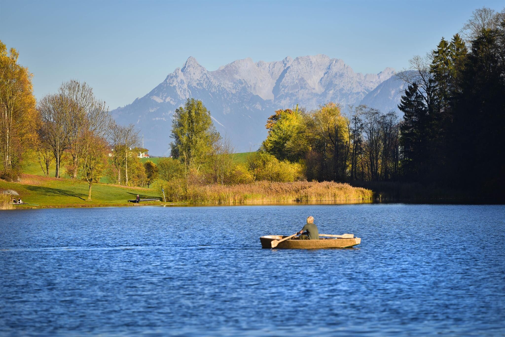
On this easy and family-friendly route you hike on varied paths from the village center in Kramsach to the beautiful Kramsach Lake Plateau. If arriving by public bus, please get off at Kramsach municipal office, cross the bridge and take the path straight ahead at the chapel. If arriving by car, you can park it for free at the gravel parking lot next to Kramsach primary school. At Reintalersee you will find bathing beaches, playgrounds, restaurants and much more to relax. Via the Haflingerhof it goes along the lakeshore and through the forest towards Krummsee and back to the village center.


Nearby huts and mountain restaurants

Getting here

  • Arrival by public transport

    www.vvt.atBus 621 stop is Kramsach municipal office

  • Parking

    Gravel parking lot next to Kramsach primary school - free of charge

More tours in the surrounding area

  • 3-day Family Tour Alpbachtal

    Difficulty: easy
    Length: 18.3 km Duration: 7:00 h Elevation uphill: 998 m
  • Day 3: 4 days - 4 summits tour

    Difficulty: medium
    Length: 19.3 km Duration: 8:00 h Elevation uphill: 1,371 m
  • 4 days - 4 summits tour

    Difficulty: medium
    Length: 54.4 km Duration: 23:00 h Elevation uphill: 3,408 m
  • Discovering the Tiefenbach Gorge Hike

    Opening hours: closed
    Difficulty: medium
    Length: 5.7 km Duration: 3:30 h Elevation uphill: 669 m
  • Kaiser Gorge - loop trail

    Opening hours: closed
    Difficulty: easy
    Length: 4.2 km Duration: 1:00 h Elevation uphill: 198 m
  • Voldöpper Spitze Loop Hike

    Difficulty: medium
    Length: 12.9 km Duration: 5:00 h Elevation uphill: 988 m
  • Kundler Klamm

    Opening hours: closed
    Difficulty: easy
    Length: 6.4 km Duration: 2:00 h Elevation uphill: 116 m
  • Farmkehralm 1.521 m

    Difficulty: medium
    Length: 9.3 km Duration: 3:30 h Elevation uphill: 506 m
  • Wiedersberger Horn Panorama Path

    Difficulty: easy
    Length: 4.1 km Duration: 1:30 h Elevation uphill: 195 m
  • Barrier-free path Lake Reintal

    Difficulty: easy
    Length: 6.5 km Duration: 1:45 h Elevation uphill: 15 m
  • Day 1: 4 days - 4 summits tour

    Difficulty: medium
    Length: 9.8 km Duration: 5:00 h Elevation uphill: 984 m
  • 3-peak-tour Kienberg-Plessenberg-Heuberg

    Difficulty: medium
    Length: 8.6 km Duration: 4:30 h Elevation uphill: 779 m
  • Loop tour Juppi Zauberwald

    Difficulty: easy
    Length: 2.5 km Duration: 1:00 h Elevation uphill: 93 m
Newsletter

The mountain is calling? So does our newsletter!

In our monthly newsletter we reveal the best holiday tips for Tyrol.