Mountain hikes Lesach Riegel – Schönleitenspitze – Lesach AlmAlm

Kals am Großglockner / Schobergruppe
Difficulty ratings: difficult
Route length: 17.6 km
Duration: 6:30 h

Lesach Riegel – Schönleitenspitze – Lesach AlmAlm

Tour information

  • Requirement: difficult
  • Length: 17.6 km
  • Duration: 6:30 h
  • Elevation uphill:1,583 hm
  • Elevation downhill:1,579 hm
Highest point2,761 m

Starting point

Lesach

Finishing point

Lesach
  • Fitness level 4 / 6
  • Technique 3 / 6

Features

  • Circular route

Best time of year

  • January
  • February
  • March
  • April
  • May
  • June
  • July
  • August
  • September
  • October
  • November
  • December
Source: TVB Osttirol

Description

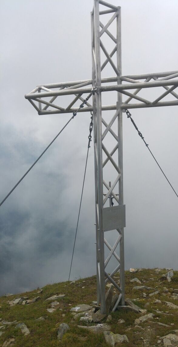
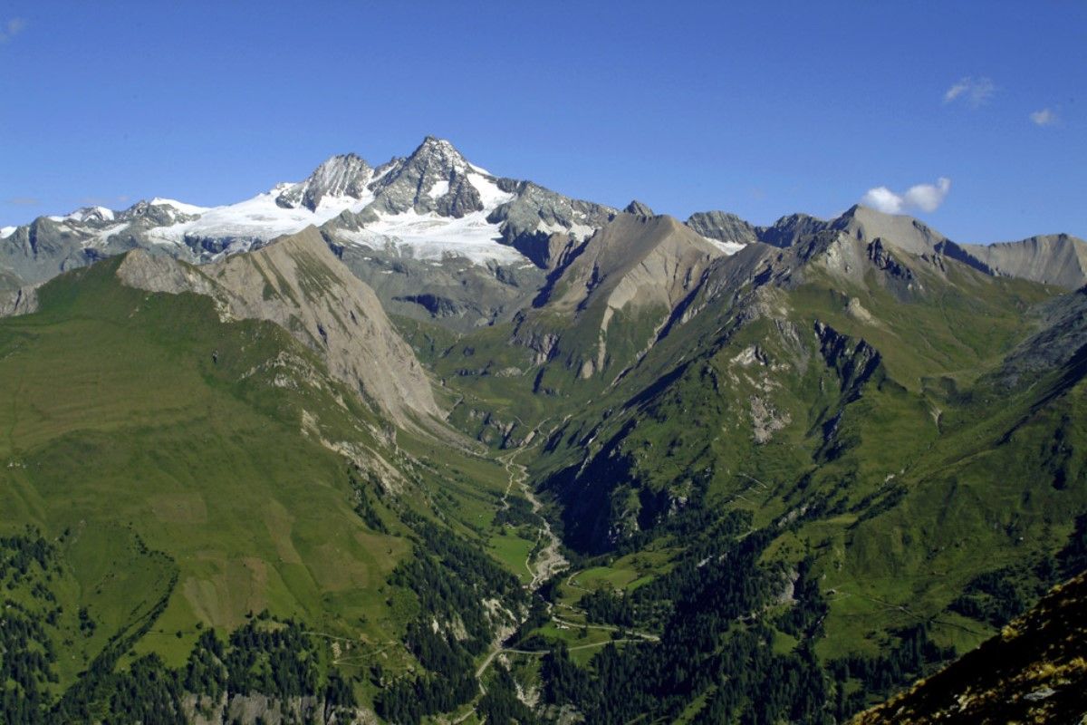
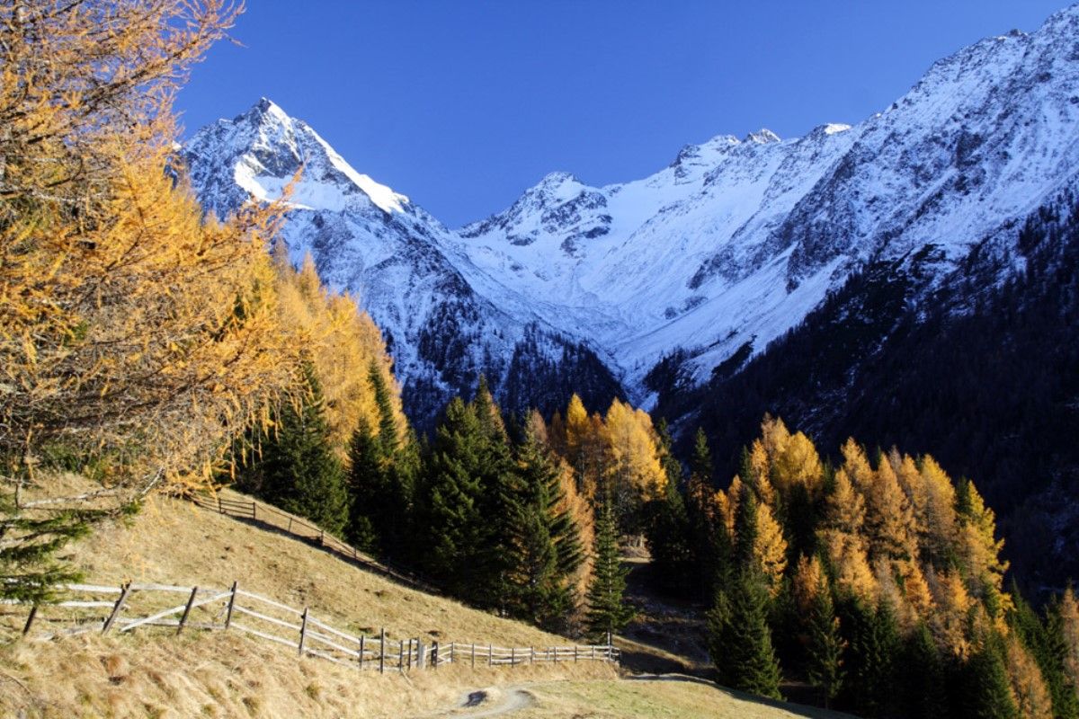
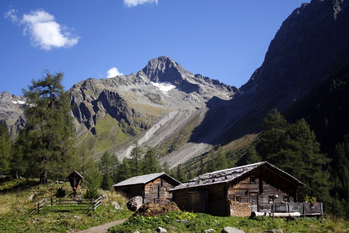
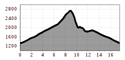
The route starts directly in Lesach and proceeds via Oberlesach on a forest trail, some 2 ½ hours walk to the Lesachriegel. It is somewhat strenuous from here, however it is recommended for good, surefooted hikers, taking some 2 hours to get up to the Schönleitenspitze (2810m, far-reaching, superb viewing point to the surrounding mountain groups and into Kalser Tal). The descent to the Lesachalmhütte is somewhat steep, with lots of metres altitude to cover and is therefore only recommended for fit hikers. Please remember to factor in walking times from and into the valley and to bring food with you – the Alpine lodges are not open for business.

Getting here

  • Arrival by public transport

    Bus line 952, bus stop Kals/Lesacherhof

  • Parking

    parking in Kals/Oberlesach

More tours in the surrounding area

  • Rotenkogel

    Difficulty:difficult
    Length:3.9 kmDuration:3:00 hElevation uphill:383 m
  • Lasörling 3.098m

    Difficulty:difficult
    Length:21.9 kmDuration:12:00 hElevation uphill:1,940 m
  • Circular walk church St. Nikolaus

    Difficulty:easy
    Length:5.4 kmDuration:1:39 hElevation uphill:150 m
  • Umbal waterfalls nature force trail

    Difficulty:easy
    Length:6.0 kmDuration:2:30 hElevation uphill:257 m
  • Hike to the Venedigerhaus Innergschlöß

    Difficulty:easy
    Length:8.6 kmDuration:2:30 hElevation uphill:184 m
  • Lucknerhaus - Stüdlhütte

    Difficulty:medium
    Length:9.3 kmDuration:5:30 hElevation uphill:862 m
  • Badener Hütte

    Difficulty:difficult
    Length:23.2 kmDuration:11:30 hElevation uphill:1,754 m
  • Hike to Kalser Tauernhaus

    Difficulty:medium
    Length:12.2 kmDuration:4:00 hElevation uphill:244 m
  • Hiking tour to Neue Sajathütte 2.600m

    Difficulty:medium
    Length:10.3 kmDuration:6:50 hElevation uphill:1,086 m
  • Hike to Neuen Reichenberger Hütte

    Difficulty:medium
    Length:18.2 kmDuration:9:00 hElevation uphill:1,252 m
  • Hiking tour to Lasörlinghütte 2.350m

    Difficulty:medium
    Length:14.6 kmDuration:7:10 hElevation uphill:1,080 m
  • Theme path "Virgen crossroads"

    Difficulty:easy
    Length:3.2 kmDuration:1:00 hElevation uphill:104 m
  • Lasörling altitude trail

    Difficulty:medium
    Length:57.0 kmDuration:25:00 hElevation uphill:3,740 m
  • Venediger altitude trail

    Difficulty:difficult
    Length:55.5 kmDuration:27:00 hElevation uphill:3,915 m
  • Figerhorn

    Difficulty:difficult
    Length:6.5 kmDuration:6:00 hElevation uphill:807 m
  • Muhs panorama trail

    Difficulty:medium
    Length:15.2 kmDuration:6:00 hElevation uphill:1,090 m
  • Böses Weibl

    Difficulty:difficult
    Length:14.1 kmDuration:8:00 hElevation uphill:1,193 m
  • Rollitour with Swiss Trac

    Difficulty:easy
    Length:3.2 kmDuration:1:30 hElevation uphill:135 m
Newsletter

The mountain is calling? So does our newsletter!

In our monthly newsletter we reveal the best holiday tips for Tyrol.