Mountain hikes Marketplace tour Stöcklalm

Söll / Kitzbühel Alps
Difficulty ratings: easy
Route length: 1.7 km
Duration: 0:40 h

Experience culinaric highlights for the whole family.
Tour information

  • Requirement: easy
  • Length: 1.7 km
  • Duration: 0:40 h
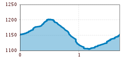
  • Elevation uphill:90 hm
  • Elevation downhill:90 hm
Highest point1,205 m

Starting point

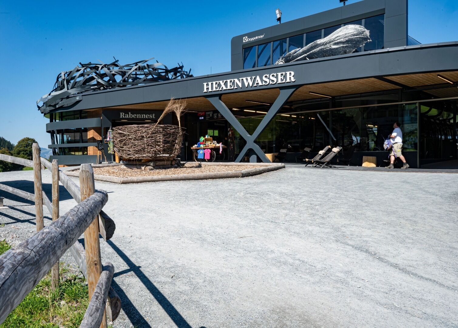
Bergstation Rabennest (1.150 m)

Finishing point

Bergstation Rabennest (1.150 m)
  • Fitness level 1 / 6
  • Technique 1 / 6

Features

  • Circular route

Best time of year

  • January
  • February
  • March
  • April
  • May
  • June
  • July
  • August
  • September
  • October
  • November
  • December

Trail condition

The composition of the trail varies between path and gravel.

Equipment

Rucksack, weather-appropriate hiking gear (breathable), a change of clothes, sun protection (sunglasses, sun cream, lip protection, headgear), waterproofs (rain jacket/poncho, pocket umbrella, rucksack protector), cold protection (hat), sufficient drink, plastic bag for waste, cash
Source: TVB Wilder Kaiser

Description

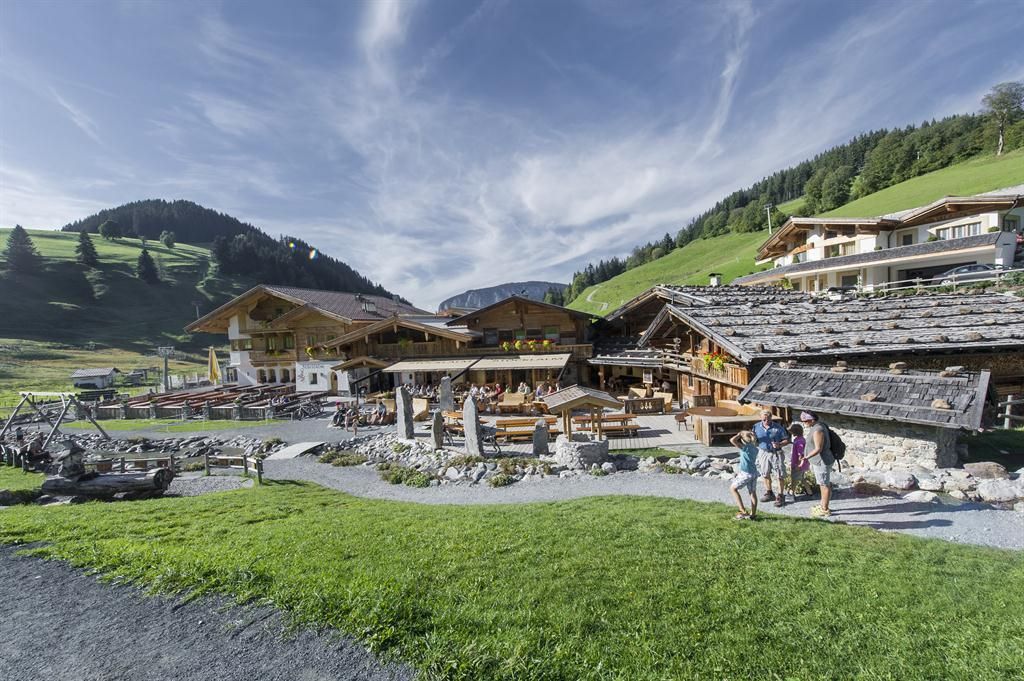
Start your tour comfortable with the gondola from the valley station Söll up to the Hexenwasser. Past the Gründlalm, hike to the signpost "Abzw. Gründlalm" and keep right. At the junction to the Simonalm follow the path to the right into the forest. Along the barefoot path, there is much to discover for young and old. The resting place at the edge of the forest invites you to stay and rest for a while. Follow the path in direction "Hochsöll Hexenwasser". After a short time you will reach the Stöcklalm.
After you have collected many exciting impressions, walk back along the path to the starting point

Nearby huts and mountain restaurants

  • Stöcklalm

    Opening hours:Open today
    Place:Söll
    :Restaurant, Alpine pasture / hut / mountain restaurant, Bar / Pub

Getting here

  • Arrival by public transport

    KaiserJet stop “Söll Gondelbahn Hochsöll – Hexenwasser”.
    More information at: www.wilderkaiser.info

  • Parking

    Parking area cable car valley station, Söll (725 m) – free

Weather

Today

light rain showers
24°C/10°C
90%27.4l0 km/h

Thu

partly Cloudy
19°C/10°C
40%0.2l5 km/h

Fri

light rain showers
18°C/9°C
45%2.7l0 km/h
Go to weather forecast

More tours in the surrounding area

  • Kaiserkrone - stage 3

    Difficulty:medium
    Length:9.3 kmDuration:4:30 hElevation uphill:840 m
  • 3-day hut tour Wilder Kaiser

    Difficulty:difficult
    Length:24.6 kmDuration:14:00 hElevation uphill:2,060 m
  • Tauernblick panorama circular hiking route

    Difficulty:medium
    Length:13.6 kmDuration:6:00 hElevation uphill:980 m
  • Hochalm hike

    Difficulty:medium
    Length:19.6 kmDuration:7:00 hElevation uphill:1,140 m
  • Hintere Goinger Halt summit tour

    Difficulty:difficult
    Length:9.3 kmDuration:6:30 hElevation uphill:1,090 m
  • Panoramic circuit Brandstadl–Hartkaiser

    Difficulty:easy
    Length:6.0 kmDuration:1:50 hElevation uphill:170 m
  • “Moor & more” Rocky Way

    Difficulty:easy
    Length:8.0 kmDuration:3:00 hElevation uphill:380 m
  • Eagle Walk Stage 02: Gaudeamushütte - Kaindlhütte

    Difficulty:medium
    Length:15.1 kmDuration:6:30 hElevation uphill:888 m
  • Astberg circular hiking route

    Difficulty:easy
    Length:1.5 kmDuration:0:30 hElevation uphill:80 m
  • Kaiserkrone - stage 1

    Difficulty:medium
    Length:8.0 kmDuration:4:30 hElevation uphill:1,120 m
Newsletter

The mountain is calling? So does our newsletter!

In our monthly newsletter we reveal the best holiday tips for Tyrol.