Mountain hikes Maurach - Eben - Notburgasteig - Panorama-Restaurant Kanzelkehre - Maurach

Difficulty ratings: easy
Route length: 7.5 km
Duration: 2:30 h

From the Rofan cable car, the route leads mostly downhill to the Kanzelkehre with a beautiful view over the Inn Valley. Same route back, with 235 metres of elevation gain.

Tour information

  • Requirement: easy
  • Length: 7.5 km
  • Duration: 2:30 h
  • Elevation uphill:235 hm
  • Elevation downhill:235 hm
Highest point1,040 m

Starting point

Maurach, valley station of the Rofan cable car

Finishing point

Maurach, valley station of the Rofan cable car

Best time of year

  • January
  • February
  • March
  • April
  • May
  • June
  • July
  • August
  • September
  • October
  • November
  • December

Trail condition

forest path

Equipment

Sturdy boots (ankle-high hiking boots), weather appropriate clothing. Telescopic hiking poles are recommended.
Source: Achensee Tourismus

Description

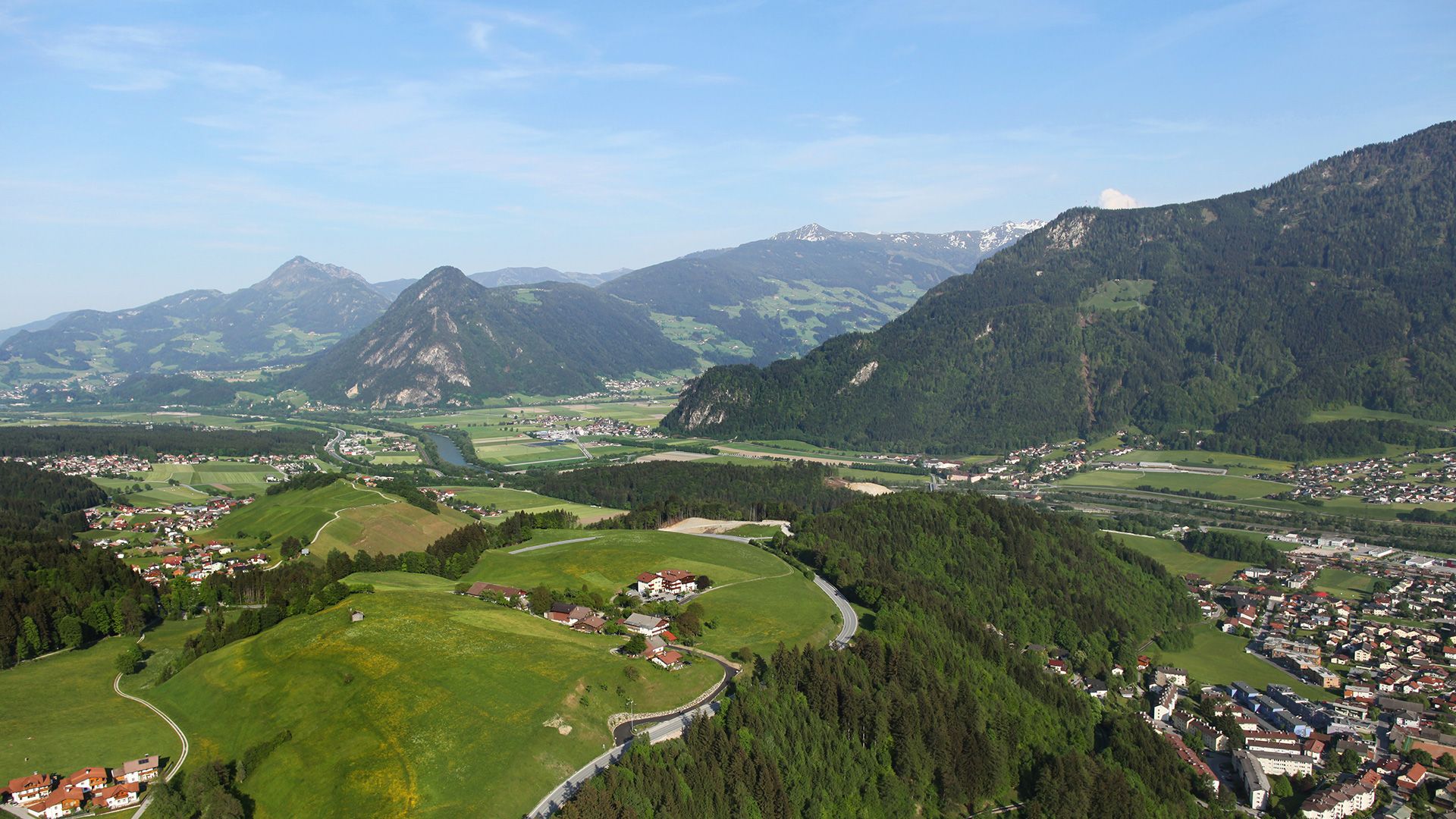
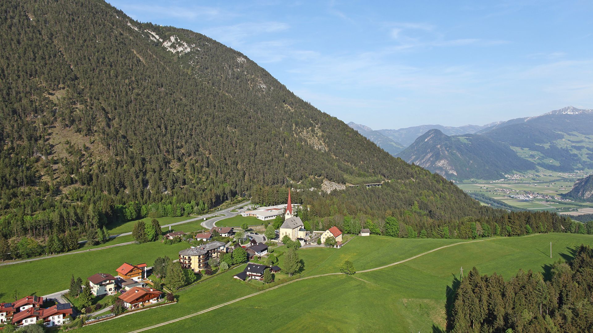
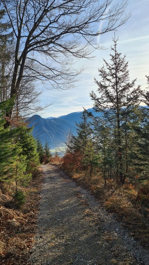
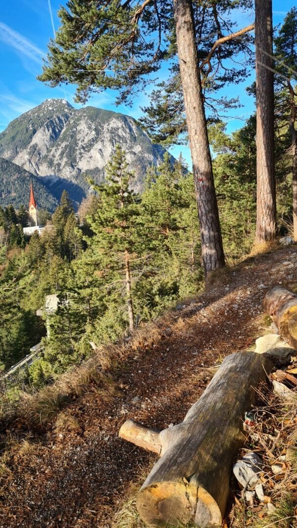
From the valley station of the Rofan cable car, follow the Achensee main road for ca. 200 metres in the direction of Eben. Turn left and follow the forest road. After ca. 50 metres, follow the signpost “Notburgaweg”. At the end of the path, the trail “Notburgasteig” branches off to the left. Continue along the scenic path to the Panorama-Restaurant Kanzelkehre. The return is via the same route.

Nearby huts and mountain restaurants

Getting here

  • Arrival by public transport

    Take the regional bus to Maurach (lines 8332, 4080 or 390) and get off at the "Maurach a. A. Rofan Seilbahn" stop.

  • Parking

    Car park of the Rofan cable car no. 1 or 2 in Maurach (paid parking)

More tours in the surrounding area

  • Wilder-Kaiser-Steig - Detour

    Difficulty: difficult
    Length: 33.0 km Duration: 16:49 h Elevation uphill: 2,311 m
  • 3-day Family Tour Alpbachtal

    Difficulty: easy
    Length: 18.3 km Duration: 7:00 h Elevation uphill: 998 m
  • Voldöpper Spitze Loop Hike

    Difficulty: medium
    Length: 12.9 km Duration: 5:00 h Elevation uphill: 988 m
  • Kundler Klamm

    Opening hours: closed
    Difficulty: easy
    Length: 6.4 km Duration: 2:00 h Elevation uphill: 116 m
  • 3-peak-tour Kienberg-Plessenberg-Heuberg

    Difficulty: medium
    Length: 8.6 km Duration: 4:30 h Elevation uphill: 779 m
  • Discovering the Tiefenbach Gorge Hike

    Opening hours: closed
    Difficulty: medium
    Length: 5.7 km Duration: 3:30 h Elevation uphill: 669 m
  • Loop tour Juppi Zauberwald

    Difficulty: easy
    Length: 2.5 km Duration: 1:00 h Elevation uphill: 93 m
  • Barrier-free path Lake Reintal

    Difficulty: easy
    Length: 6.5 km Duration: 1:45 h Elevation uphill: 15 m
  • Day 1: 4 days - 4 summits tour

    Difficulty: medium
    Length: 9.8 km Duration: 5:00 h Elevation uphill: 984 m
  • Kaiser Gorge - loop trail

    Opening hours: closed
    Difficulty: easy
    Length: 4.2 km Duration: 1:00 h Elevation uphill: 198 m
  • Farmkehralm 1.521 m

    Difficulty: medium
    Length: 9.3 km Duration: 3:30 h Elevation uphill: 506 m
  • Wiedersberger Horn Panorama Path

    Difficulty: easy
    Length: 4.1 km Duration: 1:30 h Elevation uphill: 195 m
  • Day 3: 4 days - 4 summits tour

    Difficulty: medium
    Length: 19.3 km Duration: 8:00 h Elevation uphill: 1,371 m
  • 4 days - 4 summits tour

    Difficulty: medium
    Length: 54.4 km Duration: 23:00 h Elevation uphill: 3,408 m
  • Ötztal Trek Stage 6

    Difficulty: difficult
    Length: 7.6 km Duration: 3:30 h Elevation uphill: 640 m
Newsletter

The mountain is calling? So does our newsletter!

In our monthly newsletter we reveal the best holiday tips for Tyrol.