Arrival by public transport
Unfortunately, Kelmen is no longer connected to the public transport network.
You are therefore dependent on traveling by car.
Hike from Kelmen to the Schlierewand
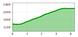
The hiking trail to the Schlierewand begins at Gasthof Wetterspitze in Kelmen, following the road and crossing the main road.
Here the trail leads through the Rotmooswald forest along the Karbach stream to the fork in the path.
This then continues to the left, signposted Sandegg and Schlierewand (on the right you reach the Kalten Stein).
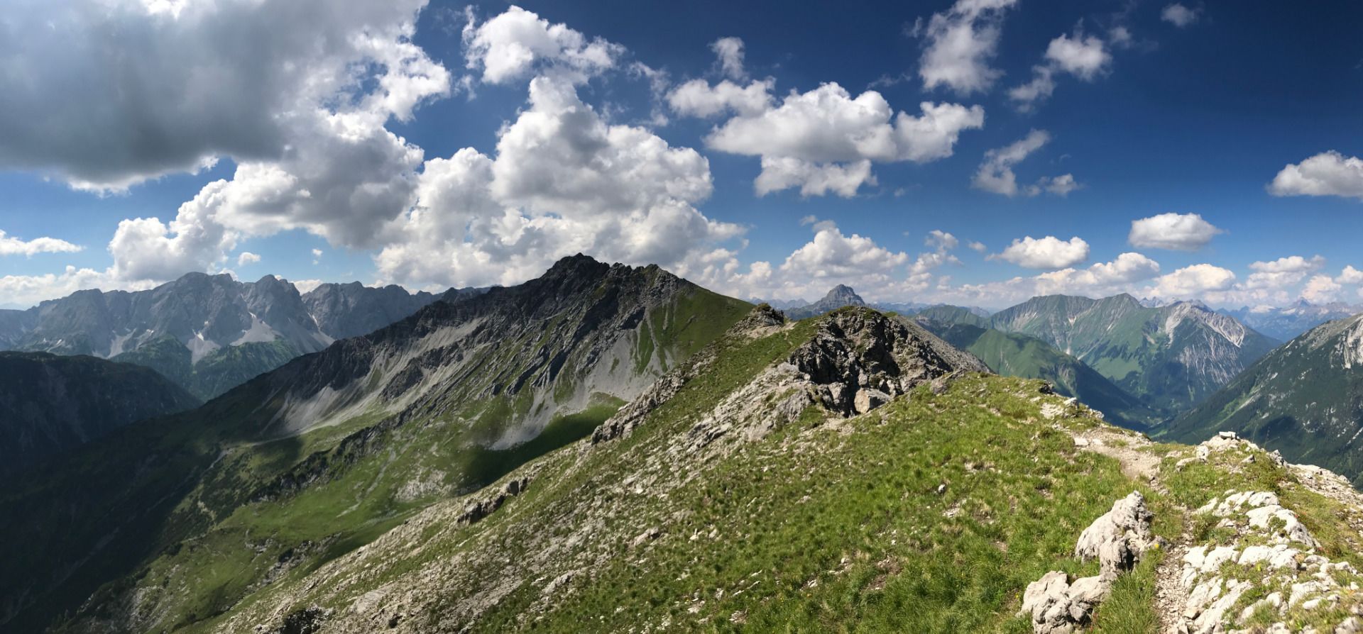
After an ascent of approx. 1 hour you reach the summit Sandegg 2,216 m.
Now the path is relatively flat, along the ridge, up to the Schlierewand 2,217 m.
Descent options:
- The same trail back to Kelmen
- Descent to Mitteregg
- Descent to the Rotlechsäge
IMPORTANT NOTES:
● Stay on the marked hiking trails
● Keep your distance from grazing animals
● Observe the opening hours of the huts
● Alpine emergency call: 140
Unfortunately, Kelmen is no longer connected to the public transport network.
You are therefore dependent on traveling by car.
You will find parking spaces in Kelmen.


