Mountain hikes Namlos - to lake Dreiensee

Namlos / Lechtaler Alpen
Difficulty ratings: medium
Route length: 3.7 km
Duration: 2:40 h

beautiful hike to the idyllic lake Dreiensee

Tour information

  • Requirement: medium
  • Length: 3.7 km
  • Duration: 2:40 h
  • Elevation uphill:633 hm
Highest point1,850 m

Starting point

Namlos village centre

Finishing point

Dreiensee
  • Fitness level 3 / 6
  • Technique 3 / 6

Best time of year

  • January
  • February
  • March
  • April
  • May
  • June
  • July
  • August
  • September
  • October
  • November
  • December

Trail condition

Gravel road and hiking trail.
Gravel and natural ground.

Equipment

Appropriate clothing, sturdy shoes, rain protection, sun protection, hiking poles, sufficient water. No climbing equipment required.
Source: Tiroler Zugspitz Arena

Description

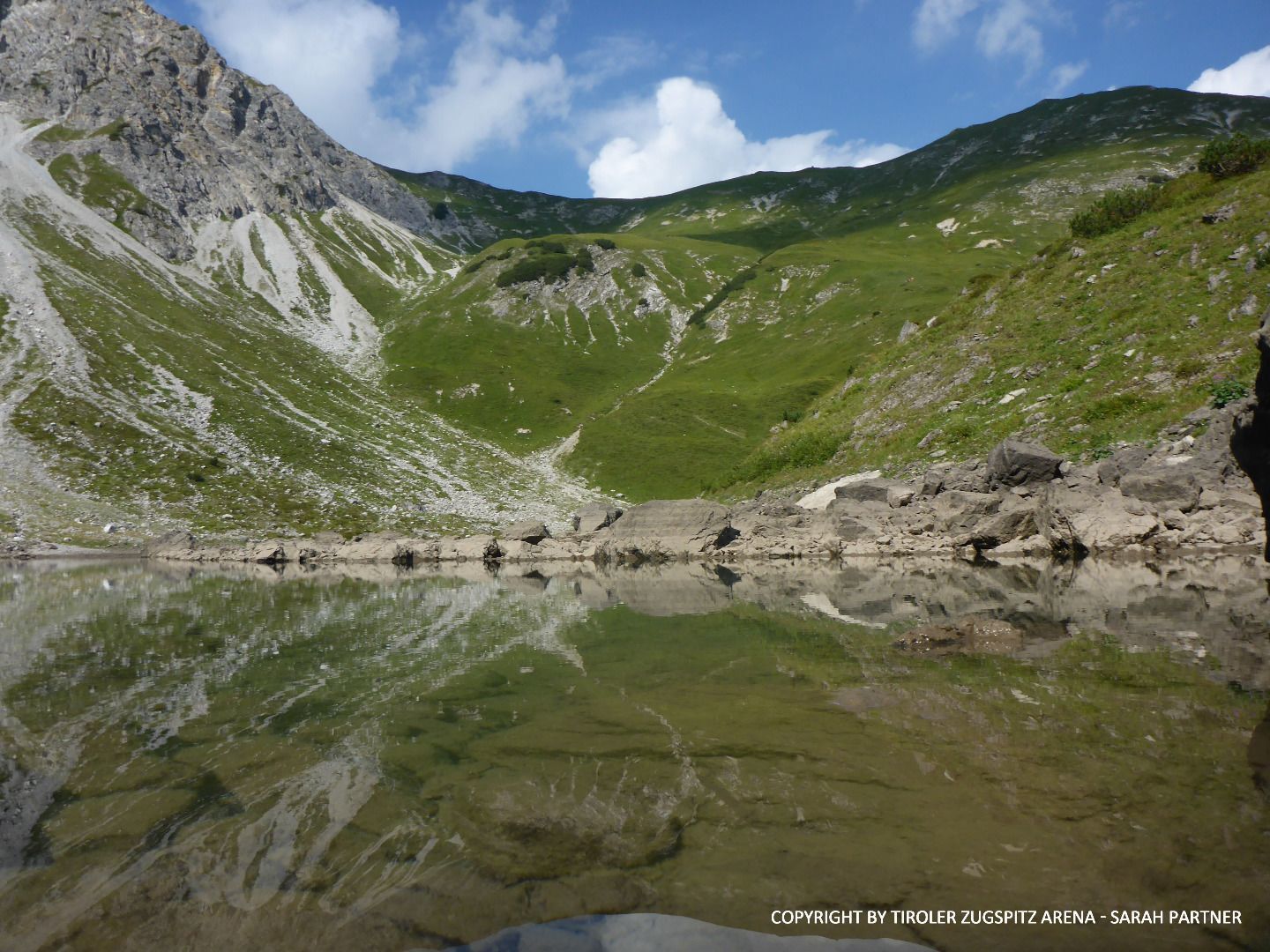
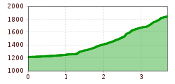
The lake hike’s starting point is in Namlos. Walk from there to the end of the village in the direction of Kelmen.
Keep right under the bend in the road and take the forest road (No. 152) and follow it for approx. 700 m along the Namlos stream until you reach the meadows. Cross the creek bed and narrow bridge on the right and take
the path (No. 152) to lake Dreiensee. The trail is steep in parts above the Dreienbach stream. After about one and a half hours you will pass the Dreienalpe (not open) and then hike directly up to lake Dreiensee.

IMPORTANT NOTES:
●   Stay on the marked hiking trails
●   Keep your distance from grazing animals
●   Be aware of the mountain hut opening hours
●   Alpine emergency call: 140

Nearby huts and mountain restaurants

Getting here

  • Arrival by public transport

    Unfortunately, Namlos is no longer connected to the public transport network.
    You are therefore dependent on traveling by car.

  • Parking

    You will find a parking lot at the entrance to Namlos.

More tours in the surrounding area

Newsletter

The mountain is calling? So does our newsletter!

In our monthly newsletter we reveal the best holiday tips for Tyrol.