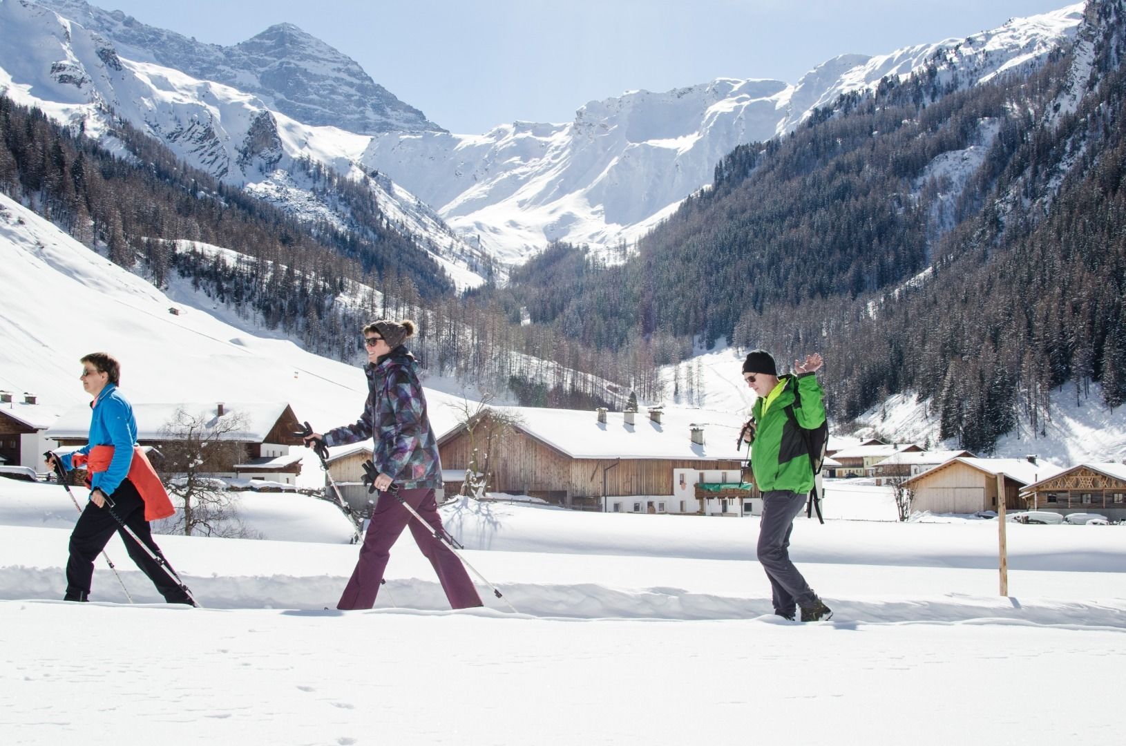
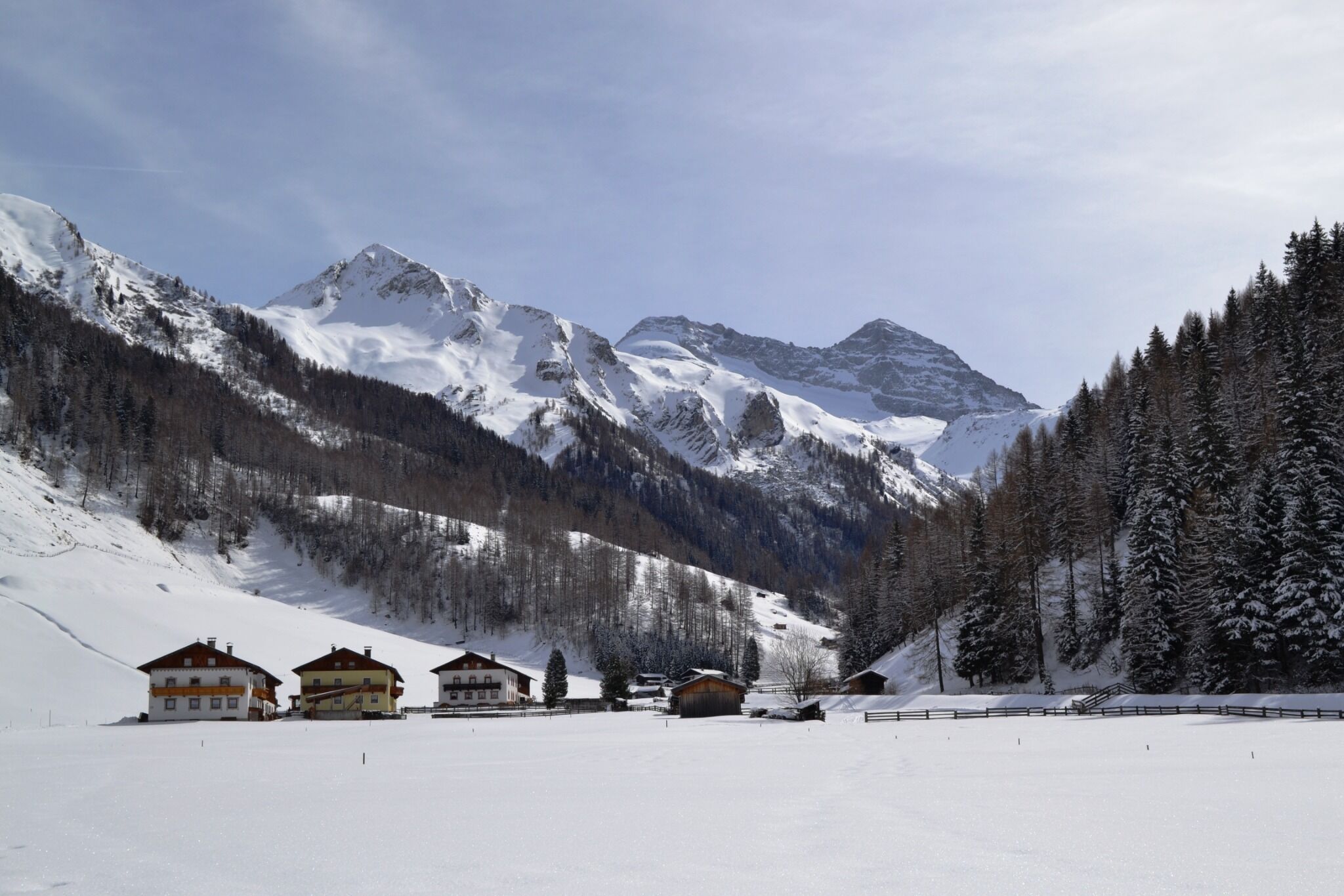
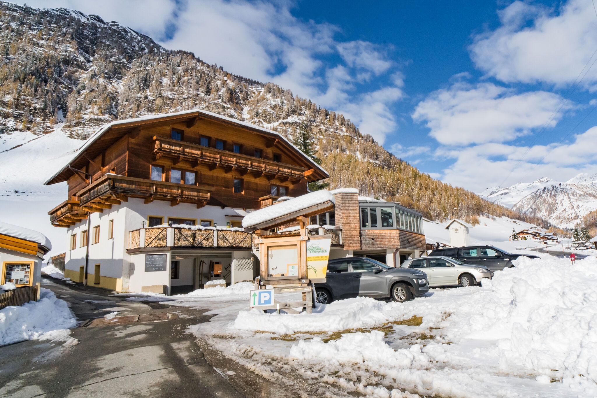
Dieser einfache Rundwanderweg führt ausgehend vom Gh Olpererblick durch den Ortsteil Toldern. Den imposanten Olperer hat man dabei immer im Blick.
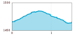
Open interactive mapOpen this POI on the interactive mapElevation profilePremium Winterwanderweg Olpererblick.gpx
Round tour Griesberg-Wolfendorn-Wildseespitz-Landshuter Hütte-VenntallDifficulty: difficult Length: 25.0 km Duration: 10:00 h Elevation uphill: 1,780 m See trailSee trail: Round tour Griesberg-Wolfendorn-Wildseespitz-Landshuter Hütte-Venntall
StöcklalmDifficulty: medium Length: 14.0 km Duration: 3:40 h Elevation uphill: 828 m See trailSee trail: Stöcklalm
Hike to LaponesalmDifficulty: easy Length: 6.2 km Duration: 2:00 h Elevation uphill: 242 m See trailSee trail: Hike to Laponesalm
Peter Habeler RundeDifficulty: difficult Length: 41.3 km Duration: 17:00 h Elevation uphill: 2,236 m See trailSee trail: Peter Habeler Runde
Rundtour Gargglerin - TribulaunhütteDifficulty: medium Length: 12.3 km Duration: 5:30 h Elevation uphill: 1,387 m See trailSee trail: Rundtour Gargglerin - Tribulaunhütte
Stage 7: Bremer Hut - Innsbrucker HutDifficulty: difficult Length: 9.5 km Duration: 7:00 h Elevation uphill: 839 m See trailSee trail: Stage 7: Bremer Hut - Innsbrucker Hut
Kirchdachspitze (2.840m) from TrinsDifficulty: difficult Length: 16.0 km Duration: 8:00 h Elevation uphill: 1,609 m See trailSee trail: Kirchdachspitze (2.840m) from Trins
BlaserDifficulty: medium Length: 11.0 km Duration: 4:30 h Elevation uphill: 1,067 m See trailSee trail: Blaser
Ridge hike to the LichtseeDifficulty: medium Length: 13.0 km Duration: 3:30 h Elevation uphill: 834 m See trailSee trail: Ridge hike to the Lichtsee
Wildlahner round tour via Ramsgrubnersee, Schoberspitzen (2,602m) and Steinernes Lamm (2,528m)Difficulty: medium Length: 13.0 km Duration: 8:00 h Elevation uphill: 1,380 m See trailSee trail: Wildlahner round tour via Ramsgrubnersee, Schoberspitzen (2,602m) and Steinernes Lamm (2,528m)
To the pilgrimage church of St. Magdalena (1,661 m)Difficulty: medium Length: 3.0 km Duration: 2:30 h Elevation uphill: 450 m See trailSee trail: To the pilgrimage church of St. Magdalena (1,661 m)
Serles (2.717m)Difficulty: difficult Length: 8.0 km Duration: 4:30 h Elevation uphill: 1,080 m See trailSee trail: Serles (2.717m)
Lake Obernberg circular routeDifficulty: easy Length: 6.0 km Duration: 2:30 h Elevation uphill: 269 m See trailSee trail: Lake Obernberg circular route
Gschnitztal Valley Hut HikeDifficulty: difficult Length: 60.0 km Duration: 38:50 h Elevation uphill: 5,500 m See trailSee trail: Gschnitztal Valley Hut Hike
Round tour OttenspitzDifficulty: medium Length: 7.0 km Duration: 3:30 h Elevation uphill: 735 m See trailSee trail: Round tour Ottenspitz
Round hike to Padauner KogelDifficulty: medium Length: 12.0 km Duration: 5:00 h Elevation uphill: 936 m See trailSee trail: Round hike to Padauner Kogel
Hike to the Geraer Hütte | Austrian TyrolDifficulty: medium Length: 7.0 km Duration: 5:30 h Elevation uphill: 1,000 m See trailSee trail: Hike to the Geraer Hütte | Austrian Tyrol
Descent from the Innsbrucker HutDifficulty: medium Length: 12.6 km Elevation uphill: 25 m See trailSee trail: Descent from the Innsbrucker Hut
Rundweg MühlendorfOpening hours: closed Difficulty: easy Length: 1.1 km Duration: 0:45 h Elevation uphill: 50 m See trailSee trail: Rundweg Mühlendorf
Water Trail GschnitzDifficulty: easy Length: 15.0 km Duration: 4:30 h Elevation uphill: 300 m See trailSee trail: Water Trail Gschnitz
Give feedback for a chance to win a special holiday experience!Click here for the surveyClick here for the survey

")


.jpg")


 (1).jpg")
.JPG")


