Mountain hikes Rettenschöss Feistenau - in Richtung Wandberg

Rettenbach / Chiemgau Alps
Difficulty ratings: easy
Route length: 9.0 km
Duration: 3:30 h

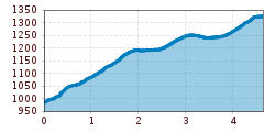
Trail Nr.: 47A, 14Family-friendly as well as for strollers suitable walk along the partially paved

Tour information

  • Requirement: easy
  • Length: 9.0 km
  • Duration: 3:30 h
  • Elevation uphill:353 hm
  • Elevation downhill:353 hm
Highest point1,326 m

Starting point

Gasthaus Schöne Aussicht in Rettenschöss

Finishing point

Gasthaus Schöne Aussicht in Rettenschöss

Features

  • Suitable for families

Best time of year

  • January
  • February
  • March
  • April
  • May
  • June
  • July
  • August
  • September
  • October
  • November
  • December

Trail condition

Gravel

Equipment

Breathable outdoor clothing suitable for the weather, sturdy footwear, food (snacks, drinks),
sun protection (sunglasses, sun cream & cap), rain protection, cash; guest card if using the bus
Source: TVB Kaiserwinkl

Description

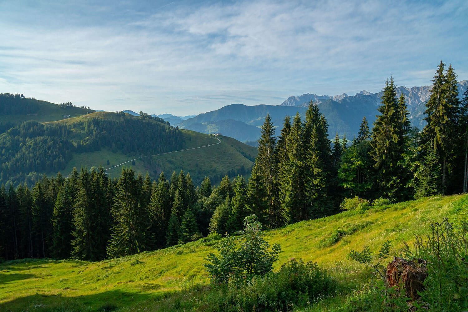
200m after the Gasthaus Schöne Aussicht you will find a barrier that you cross. Follow the paved road through the cool shady forest in the direction of the Rettenbachalmen. After the forest the asphalt changes into a gravel road and the alpine area begins. Along the Rettenbachalmen you can enjoy a great view of the Zahmer Kaiser. After another 45 minutes on the public alpine road, you will find the two mountain pastures "Wandberghütte" and "Almkäserei Burgeralm". onths, grazing livestock is also on the pasturecessary.

Nearby huts and mountain restaurants

Getting here

More tours in the surrounding area

Newsletter

The mountain is calling? So does our newsletter!

In our monthly newsletter we reveal the best holiday tips for Tyrol.