
Mountain hikes Schönjöchl Rundweg

open
Fiss / Samnaun Group
Difficulty ratings: medium
Route length: 2.5 km
Duration: 1:00 h

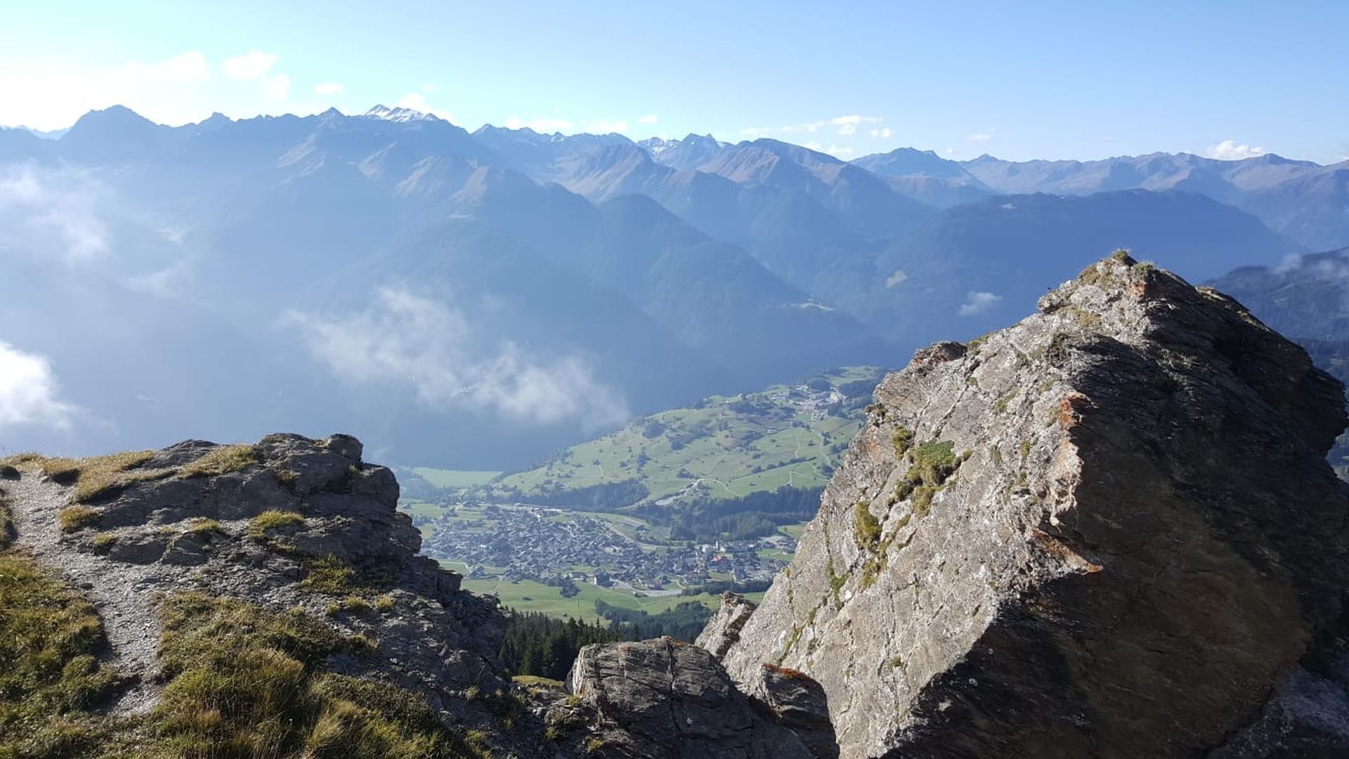
An easy roundabout trail over the flat alpine pastures of the Schönjöchl, 2,493 m, walking is possible in both directions.
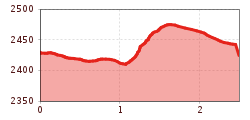
Tour information

  • Requirement: medium
  • Length: 2.5 km
  • Duration: 1:00 h
  • Elevation uphill:121 hm
  • Elevation downhill:127 hm
Highest point2,483 m

Starting point

Schönjochbahn top station

Finishing point

Schönjochbahn top station
  • Fitness level 2 / 6

Features

  • Circular route

Best time of year

  • January
  • February
  • March
  • April
  • May
  • June
  • July
  • August
  • September
  • October
  • November
  • December
Source: Serfaus-Fiss-Ladis

Description

From the Schönjochbahn mountain terminal (F087) go in a northeasterly direction (F088) on the left trail no. 25 to a small hut beside the lift and then on a flat path on over pastures to the broad ridge of the Naggalun (F044), then go right over these pastures up to the Schönjöchl (F079) with its summit cross. From here, either go on the vehicle track or on the wide ridge back on the trail to the cablecar (F087).

Nearby huts and mountain restaurants

Getting here

  • Arrival by public transport

    Travel by train to Landeck-Zams railway station. From there, change to bus line 220 towards Serfaus-Fiss-Ladis.

  • Parking

    By car via the A12 motorway to the Landeck exit, then follow the B171 and L19 towards Fiss. In Fiss, follow the signs to the respective starting point of the tour.


    Parking is available in Fiss. Depending on the starting point of the tour, different car parks are available. The car parks are subject to a fee.

Weather

Today

light rain showers
16°C/7°C
55%4.3l5 km/h

Wed

mainly clear
18°C/6°C
50%2.2l5 km/h

Thu

light rain showers
12°C/4°C
85%15.8l5 km/h
Go to weather forecast

More tours in the surrounding area

  • Fiss to the Oberen Sattelkopf

    Opening hours:open
    Difficulty:medium
    Length:5.6 kmDuration:3:00 hElevation uphill:1,057 m
  • Forscherpfad

    Opening hours:open
    Difficulty:easy
    Length:3.4 kmDuration:1:30 hElevation uphill:219 m
  • Oberer Spinnsee

    Opening hours:open
    Difficulty:medium
    Length:11.2 kmDuration:5:00 hElevation uphill:427 m
  • Murmeltiersteig (Marmot alpine trail)

    Opening hours:open
    Difficulty:medium
    Length:6.9 kmDuration:3:00 hElevation uphill:302 m
  • Six Senses trail

    Opening hours:open
    Difficulty:easy
    Length:6.5 kmDuration:4:00 hElevation uphill:99 m
  • Marmot Trail

    Opening hours:open
    Difficulty:easy
    Length:573 mDuration:0:20 hElevation uphill:12 m
  • Wild Animals Trail

    Opening hours:open
    Difficulty:easy
    Length:1.5 kmDuration:0:31 hElevation uphill:1 m
  • Panorama - Genussweg

    Opening hours:open
    Difficulty:easy
    Length:5.1 kmDuration:1:15 hElevation uphill:42 m
Newsletter

The mountain is calling? So does our newsletter!

In our monthly newsletter we reveal the best holiday tips for Tyrol.
