Mountain hikes Sonntagsköpfl - circular walk

Fügenberg / Hochfügen im Zillertal / Tux Alps
Difficulty ratings: medium
Route length: 12.4 km
Duration: 5:00 h

Sonntagsköpfl - circular walk

Tour information

  • Requirement: medium
  • Length: 12.4 km
  • Duration: 5:00 h
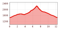
  • Elevation uphill:813 hm
  • Elevation downhill:813 hm
Highest point1,740 m

Starting point

Parkplatz Skigebiet Hochfügen

Finishing point

Parkplatz Skigebiet Hochfügen
  • Fitness level 4 / 6
  • Technique 4 / 6

Features

  • Circular route

Best time of year

  • January
  • February
  • March
  • April
  • May
  • June
  • July
  • August
  • September
  • October
  • November
  • December
Source: Zillertal Tourismus GmbH

Description

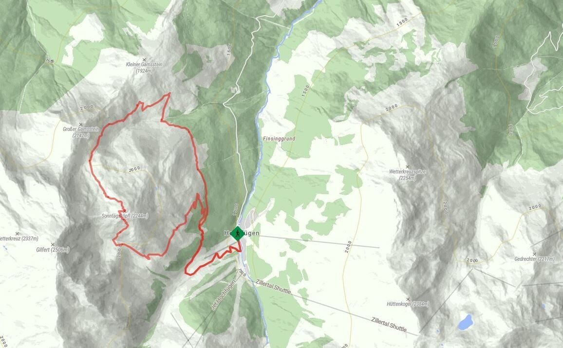
From the Hochfügen bus stop/car park, the path leads past the playground, over a wooden bridge and onto a gravelly forest track. Passing St Michael’s Chapel, it winds its way uphill through the forest along a series of more or less steep hairpin bends. After the cattle gate, the path branches off to the right towards the Machentalalm (unmanned). From there, the hiking trail climbs steadily through beautiful alpine pastureland to the Sonntagsköpfl. The return route first follows a hiking trail to the Lamark Mittelleger and then back through alpine pastureland towards the Lamarkalm. Once you reach the cattle gate, follow the forest path back to Hochfügen.

Nearby huts and mountain restaurants

Weather

Today

light rain showers
20°C/12°C
90%15.2l5 km/h

Sat

light rain showers
19°C/11°C
50%1.2l5 km/h

Sun

clear sky
21°C/10°C
40%0l5 km/h
Go to weather forecast

More tours in the surrounding area

Newsletter

The mountain is calling? So does our newsletter!

In our monthly newsletter we reveal the best holiday tips for Tyrol.