Mountain hikes Tschadinhorn

Kals am Großglockner / Schobergruppe
Difficulty ratings: difficult
Duration: 10:00 h

Tschadinhorn

Tour information

  • Requirement: difficult
  • Duration: 10:00 h

Starting point

Kals/Oberlesach

Finishing point

Kals/Oberlesach
  • Fitness level 5 / 6
  • Technique 4 / 6

Best time of year

  • January
  • February
  • March
  • April
  • May
  • June
  • July
  • August
  • September
  • October
  • November
  • December

Trail condition

Easy hike until Lesachalm than steep and closer to the top quite challenging to hike.

Equipment

good trekkingshoes, hiking sticks, snack, sun- and rain protection
Source: Nationalparkregion Hohe Tauern Osttirol

Description

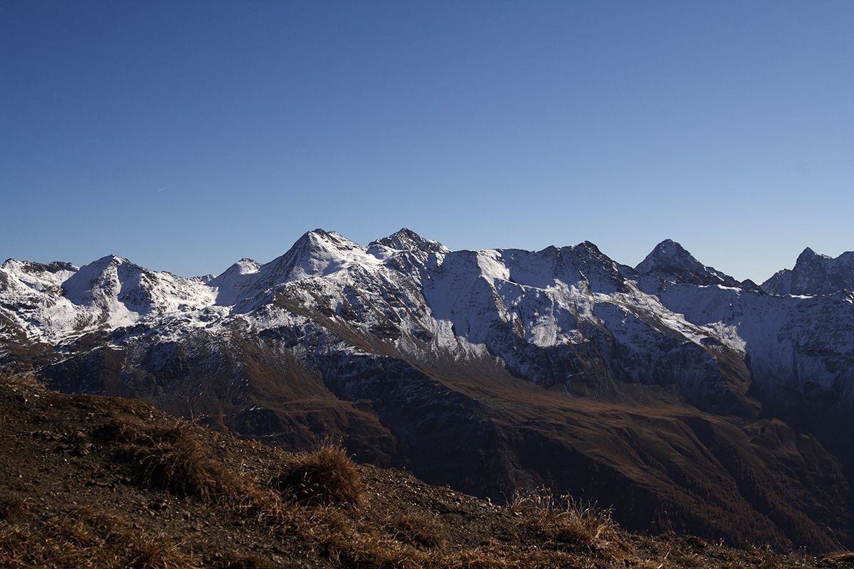
This 3.000m top situated in the Schobergroup is less frequented. Taking the hiking path nr. 60b and AV 912 or the track nr. 60 into the Kalser Lesachtal to the Lesachalm. Than leads the hiking path nr. 65 and 65a to the top. There is a overwhelming view over the whole valley of Kals, to the Großglockner and far into the Schobergroup. Well known neighbours are the Schönleitenspitze and Böses Weibl.
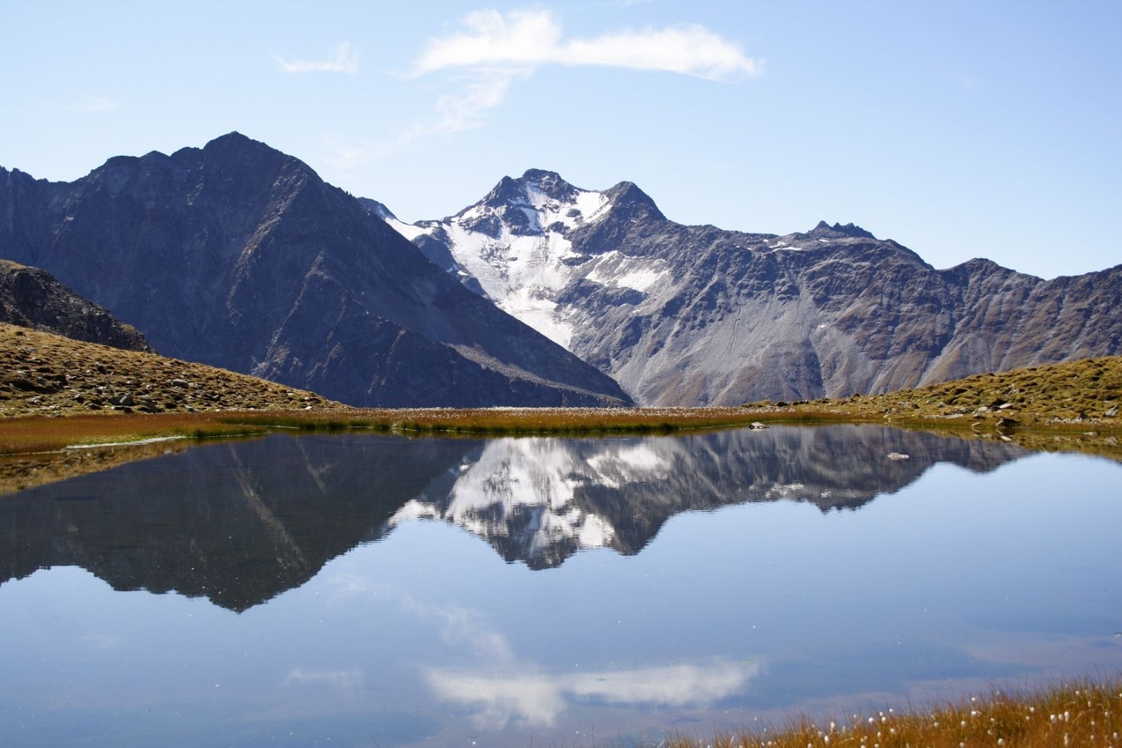
On the way to the top there are small lakes called Zelockssee at a level of 2.600 m.

Nearby huts and mountain restaurants

Getting here

  • Arrival by public transport

    At the busstop Lesacherhof than taking hiking path nr. AV 912 within about 2,5 hours directly to Lesachalm.

  • Parking

    Private parking in Oberlesach at Amraserhof. € 3,00/day or in Unterlesach without fee.

More tours in the surrounding area

  • Lasörling 3.098m

    Difficulty: difficult
    Length: 21.9 km Duration: 12:00 h Elevation uphill: 1,940 m
  • Umbal waterfalls nature force trail

    Difficulty: easy
    Length: 5.8 km Duration: 2:30 h Elevation uphill: 250 m
  • Muhs panorama trail

    Difficulty: medium
    Length: 15.2 km Duration: 6:00 h Elevation uphill: 1,090 m
  • Venediger altitude trail

    Difficulty: difficult
    Length: 55.5 km Duration: 27:00 h Elevation uphill: 3,915 m
  • Lasörling altitude trail

    Difficulty: medium
    Length: 57.0 km Duration: 25:00 h Elevation uphill: 3,740 m
  • Figerhorn

    Difficulty: difficult
    Length: 6.5 km Duration: 6:00 h Elevation uphill: 807 m
  • Hike to Neuen Reichenberger Hütte

    Difficulty: medium
    Length: 9.1 km Duration: 9:00 h Elevation uphill: 1,210 m
  • Badener Hütte

    Difficulty: difficult
    Length: 23.2 km Duration: 11:30 h Elevation uphill: 1,750 m
  • Lucknerhaus - Stüdlhütte

    Difficulty: medium
    Length: 9.3 km Duration: 5:30 h Elevation uphill: 862 m
  • Hike to Kalser Tauernhaus

    Difficulty: medium
    Length: 12.2 km Duration: 4:00 h Elevation uphill: 244 m
  • Hiking tour to Lasörlinghütte 2.350m

    Difficulty: medium
    Length: 14.6 km Duration: 7:10 h Elevation uphill: 1,080 m
  • Hiking tour to Neue Sajathütte 2.600m

    Difficulty: medium
    Length: 10.3 km Duration: 6:50 h Elevation uphill: 1,080 m
  • Hike to the Venedigerhaus Innergschlöß

    Difficulty: easy
    Length: 8.5 km Duration: 2:30 h Elevation uphill: 180 m
  • Rotenkogel

    Difficulty: difficult
    Length: 3.9 km Duration: 3:00 h Elevation uphill: 383 m
  • Böses Weibl

    Difficulty: difficult
    Length: 14.1 km Duration: 8:00 h Elevation uphill: 1,193 m
Newsletter

The mountain is calling? So does our newsletter!

In our monthly newsletter we reveal the best holiday tips for Tyrol.