Mountain hikes Wanderung zur Lesachalmhütte

Kals am Großglockner / Schobergruppe
Difficulty ratings: medium
Route length: 8.2 km
Duration: 4:00 h

Wanderung zur Lesachalmhütte

Tour information

  • Requirement: medium
  • Length: 8.2 km
  • Duration: 4:00 h
  • Elevation uphill:515 hm
  • Elevation downhill:515 hm
Highest point1,819 m

Starting point

Parkplatz Oberlesach

Finishing point

Parkplatz Oberlesach
  • Fitness level 2 / 6
  • Technique 2 / 6

Best time of year

  • January
  • February
  • March
  • April
  • May
  • June
  • July
  • August
  • September
  • October
  • November
  • December

Trail condition

hiking trail AV 912 or forest trail no. 60
Source: TVB Osttirol

Description

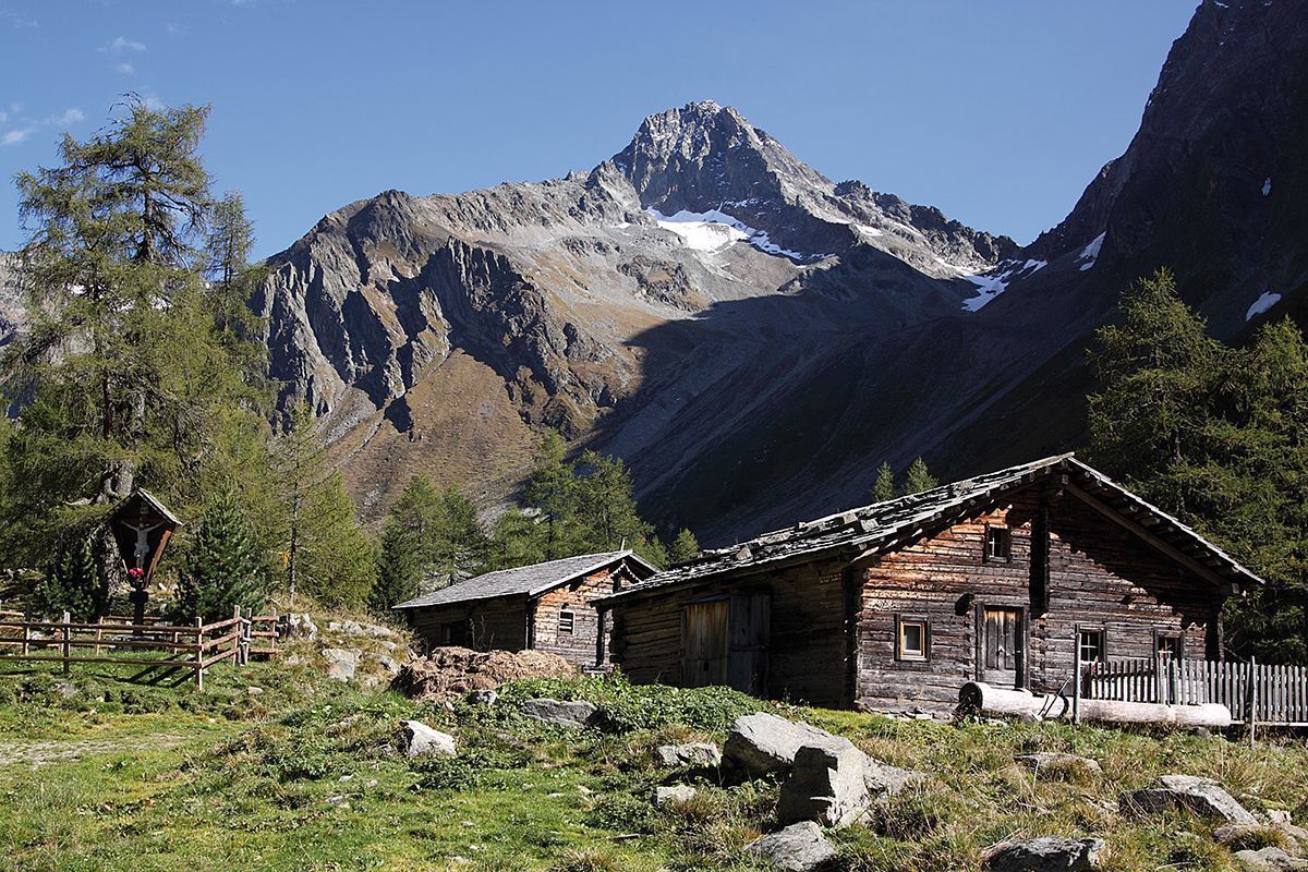
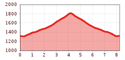
From the Lesach district of Kals (Lesachbrücke parking lot), a well-maintained footpath, hiking trail AV912, leads along the Lesachbach stream to the Lesachalm and the Alpengasthaus Glödis Refugium. 

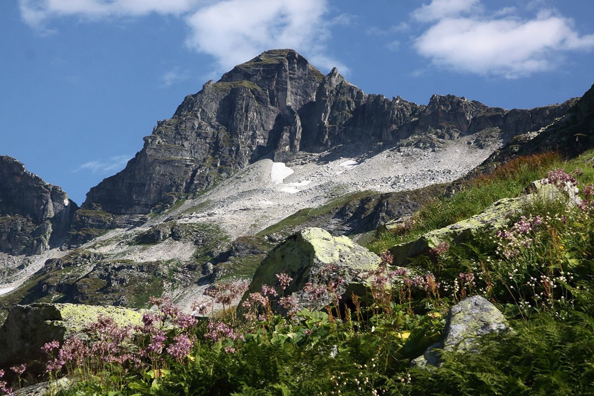
An interesting, varied day tour, especially recommended as a round trip from Oberlesach via forest trail no. 60, where there is a private parking lot at the Amraserhof in Oberlesach with a one-off fee of € 3.00.

Nearby huts and mountain restaurants

Getting here

  • Arrival by public transport

    by bus line 952, bus stop Kals/Lesacherhof

  • Parking

    car park at Kals/Lesach - Unterlesach: hiking trail AV 912
    or up to Oberlesach, car park at Amraserhof, fee € 3,00: forest trail no. 60

More tours in the surrounding area

  • Rotenkogel

    Difficulty:difficult
    Length:3.9 kmDuration:3:00 hElevation uphill:383 m
  • Lasörling 3.098m

    Difficulty:difficult
    Length:21.9 kmDuration:12:00 hElevation uphill:1,940 m
  • Circular walk church St. Nikolaus

    Difficulty:easy
    Length:5.4 kmDuration:1:39 hElevation uphill:150 m
  • Umbal waterfalls nature force trail

    Difficulty:easy
    Length:6.0 kmDuration:2:30 hElevation uphill:257 m
  • Hike to the Venedigerhaus Innergschlöß

    Difficulty:easy
    Length:8.6 kmDuration:2:30 hElevation uphill:184 m
  • Lucknerhaus - Stüdlhütte

    Difficulty:medium
    Length:9.3 kmDuration:5:30 hElevation uphill:862 m
  • Badener Hütte

    Difficulty:difficult
    Length:23.2 kmDuration:11:30 hElevation uphill:1,754 m
  • Hike to Kalser Tauernhaus

    Difficulty:medium
    Length:12.2 kmDuration:4:00 hElevation uphill:244 m
  • Hiking tour to Neue Sajathütte 2.600m

    Difficulty:medium
    Length:10.3 kmDuration:6:50 hElevation uphill:1,086 m
  • Hike to Neuen Reichenberger Hütte

    Difficulty:medium
    Length:18.2 kmDuration:9:00 hElevation uphill:1,252 m
  • Hiking tour to Lasörlinghütte 2.350m

    Difficulty:medium
    Length:14.6 kmDuration:7:10 hElevation uphill:1,080 m
  • Theme path "Virgen crossroads"

    Difficulty:easy
    Length:3.2 kmDuration:1:00 hElevation uphill:104 m
  • Lasörling altitude trail

    Difficulty:medium
    Length:57.0 kmDuration:25:00 hElevation uphill:3,740 m
  • Venediger altitude trail

    Difficulty:difficult
    Length:55.5 kmDuration:27:00 hElevation uphill:3,915 m
  • Figerhorn

    Difficulty:difficult
    Length:6.5 kmDuration:6:00 hElevation uphill:807 m
  • Muhs panorama trail

    Difficulty:medium
    Length:15.2 kmDuration:6:00 hElevation uphill:1,090 m
  • Böses Weibl

    Difficulty:difficult
    Length:14.1 kmDuration:8:00 hElevation uphill:1,193 m
  • Rollitour with Swiss Trac

    Difficulty:easy
    Length:3.2 kmDuration:1:30 hElevation uphill:135 m
Newsletter

The mountain is calling? So does our newsletter!

In our monthly newsletter we reveal the best holiday tips for Tyrol.