
Opening hours:Open today
Place:Kirchdorf in Tirol
:Restaurant, Alpine pasture / hut / mountain restaurant
Impressive tour with strong pictures!
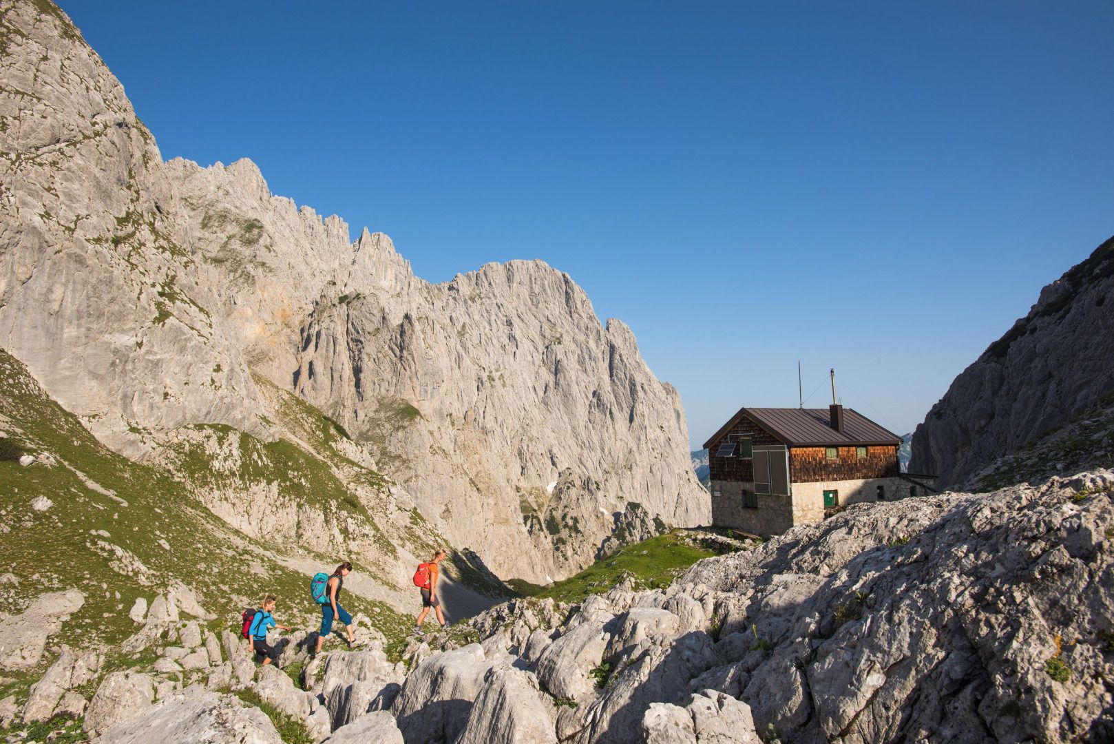
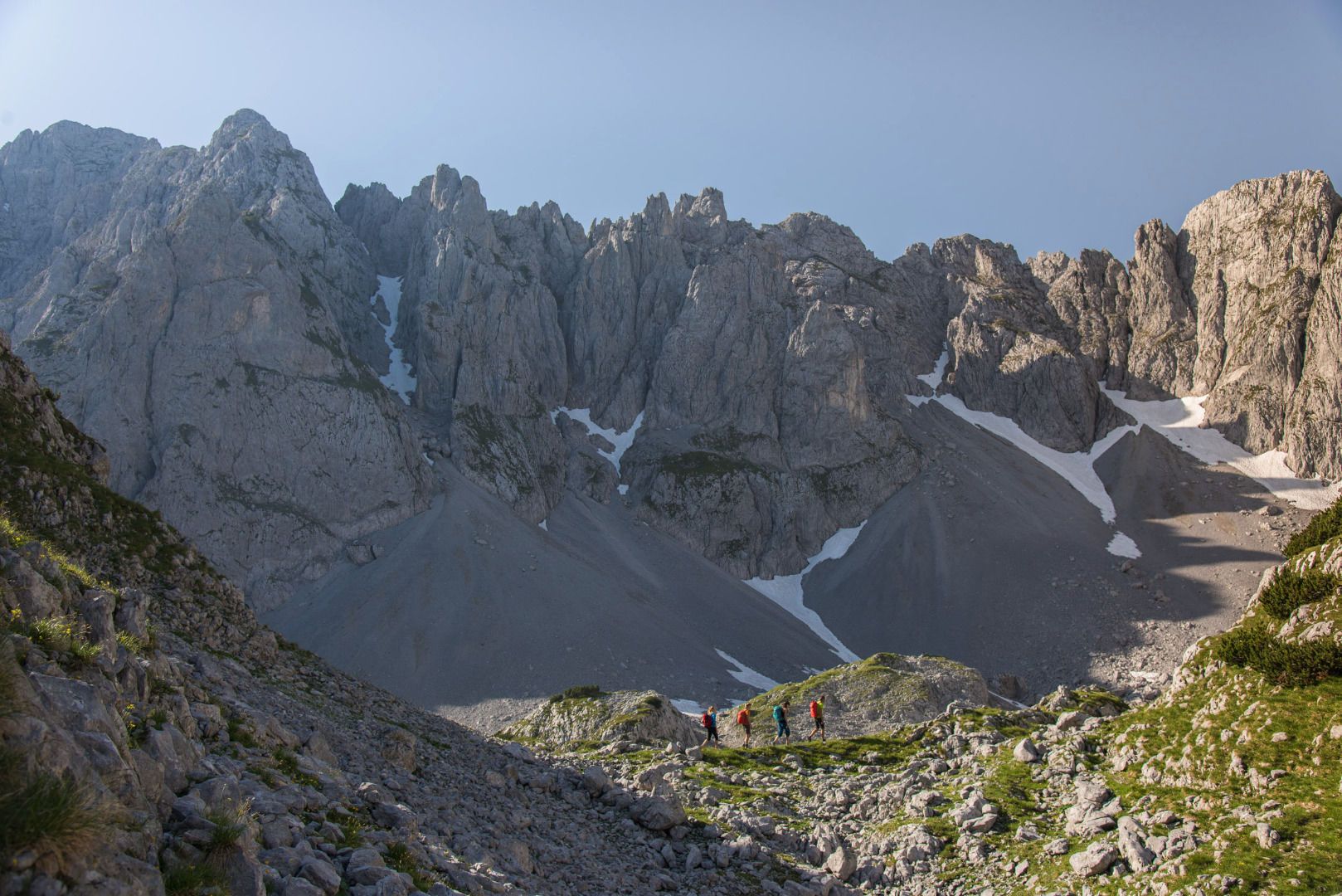
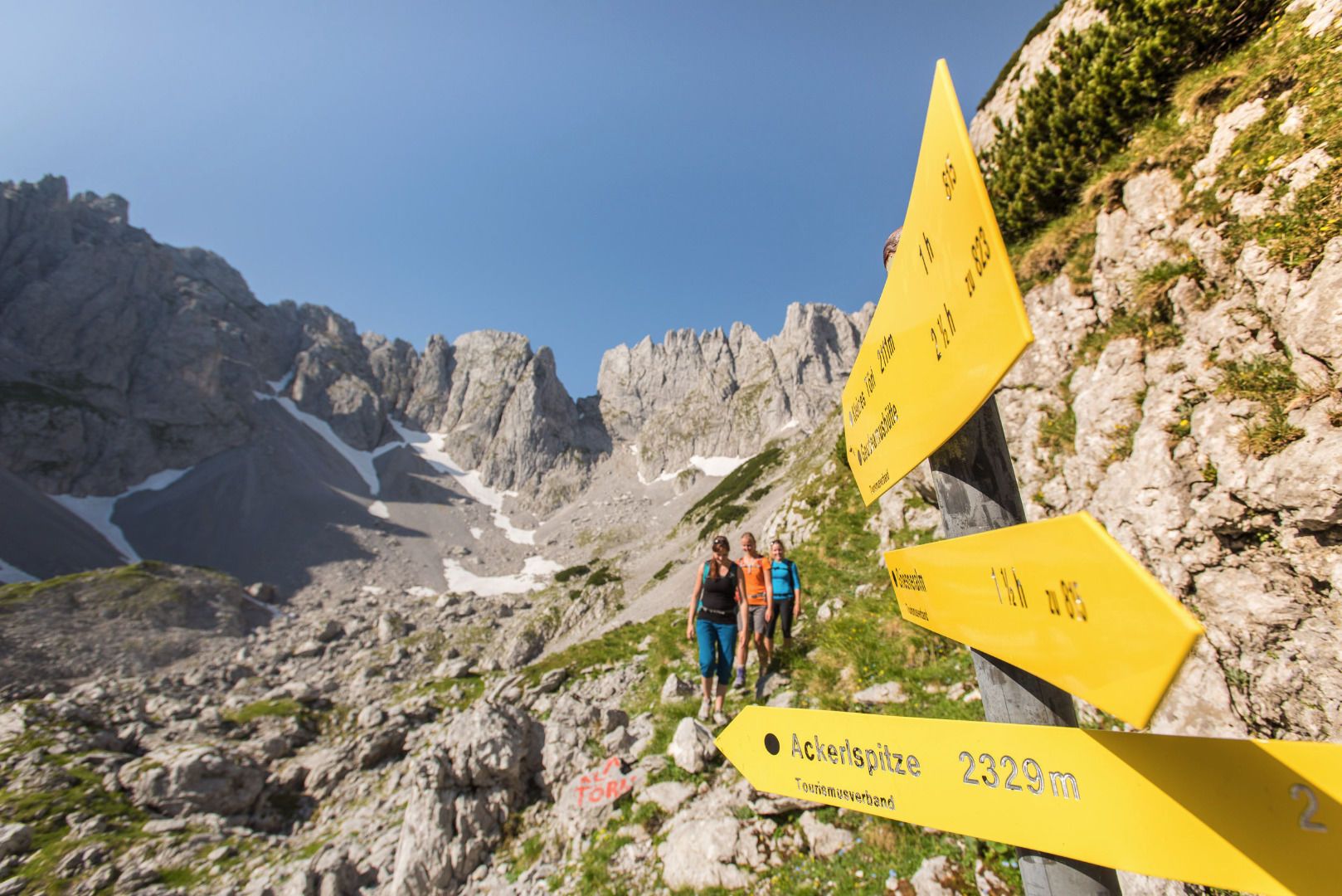
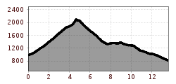
The hike starts at the Griesner Alm. Initially, it leads along a well-maintained hiking trail. At the first fork, choose the path in the direction of Fritz-Pflaum-Hütte. Flanked by the Mitterkaiser, Predigtstuhl and Hinterer Goinger Halt, the mountain trail leads through the Grosses Griesner Kar up to the Fritz-Pflaum Hut in the Griesner Kar. Here you have a breathtaking view of the surrounding peaks of the Wilder Kaiser. Along the walls of the Kleinkaiser, the mountain trail leads over to the Kleines Törl. Attention: In this area there are numerous chamois on the move, so you should definitely wear a helmet because of possible falling rocks. Accompanied by impressive images, you hike up to the Kleines Törl, located 2100 meters above sea level. Via the beautiful Gildensteig you walk past the Wilderer Kanzel down to the Bergsteigergrab (mountaineer's grave) at the Brennender Palven. At this place the teacher Much Wieser, a great lover of the Wilder Kaiser, was buried on October 17, 1952. Continue hiking down to the Obere Regalm and from here you will reach the Graspoint Hochalm and the Schleier Waterfall - the climbing paradise. A little below the Schleier waterfall is the Graspoint Niederalm, a small snack station. The tour ends at the parking lot Hüttling in Going.
Note: The starting and finishing points are not served by public transport.
Bus: Line 4000 stop Kirchdorf in Tirol Griesenau, Okto hiking bus 5 stop Kaiserbachtal parking lot
In the summer months, take the Okto hiking bus to the Kaiserbachtal car park stop in comfort and free of charge.
All journey times for public transport in the St. Johann in Tirol region can be found here: kitzalps.cc/mobile
Kirchdorf i.T. Griesner Alm (Kaiserbachtal 6)


 Mirja Geh (26).jpg")
 Sportalpen (21).jpg")


