Trail running Trailrunning Sattelwaldweg in St. Anton am Arlberg

closed
St. Christoph am Arlberg / Verwall
Route length: 7.5 km
Duration: 1:30 h

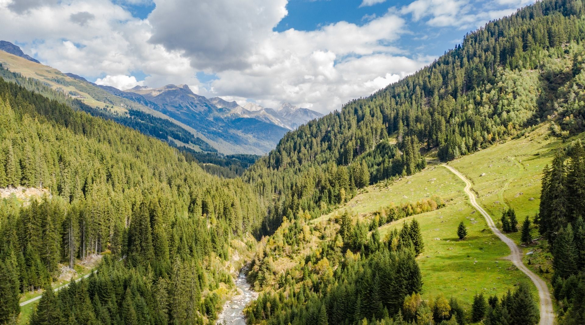
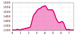
The Sattelwaldweg trail in St. Anton am Arlberg is a moderate 7.5 km loop with approximately 280 meters of elevation gain, suitable for experienced trail runners. The route starts toward the Rosannaschlucht, crosses the Rosanna River at the Fritz Bridge and then climbs steadily up to the Sattelwaldweg. The return descends gently through the Moos Valley and follows a grassy path with several switchbacks back to St. Anton.

Tour information

  • Length: 7.5 km
  • Duration: 1:30 h
  • Elevation uphill:280 hm
  • Elevation downhill:0 hm
Highest point1,560 m

Best time of year

  • January
  • February
  • March
  • April
  • May
  • June
  • July
  • August
  • September
  • October
  • November
  • December
Source: TVB St Anton am Arlberg
Newsletter

The mountain is calling? So does our newsletter!

In our monthly newsletter we reveal the best holiday tips for Tyrol.