Arrival by public transport
You can find information about the current bus schedules here
Route: Karrösten - Mountain Rescue Hut - Tschirgant - Crazy Eddy
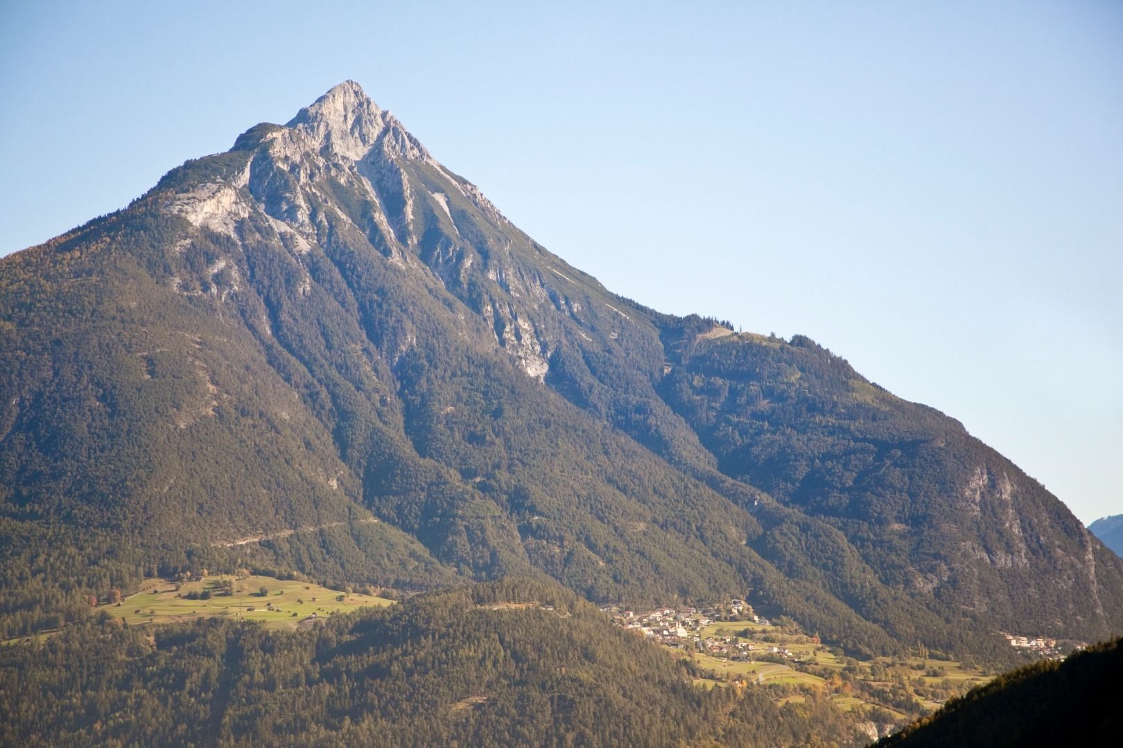
Our route today leads us from Karrösten over the Tschirgant to Silz to Crazy Eddy.
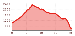
We start at the well signposted parking lot in Karrösten. Initially on the forest road, it soon goes on a trail that winds through the forest towards Karröster Alm. You cross the beautiful alpine pasture and can walk along the well-maintained forest road for another stretch until you reach the mountain pine border. Now it becomes steep! On a steep path with roots and large steps you quickly gain altitude. At the forest border you have the first view of the beautiful mountain massif of the Tschirgant. Arrived at the mountain guard hut there are two possibilities to the summit. Once through the so-called "chimney", which, however, is not recommended with running shoes and good alpine experience. Or the "normal path" which leads to the left of the hut to the summit. Arrived at the summit you can enjoy an incredible panoramic view. Characterized by the Ötztal Alps to the Lechtalern to the Mieminger chain yes even the Zugspitze is best seen from here. From here the real fun begins. The unique ridge divides the Inntal from the Gurgltal. This runnable ridge will definitely be an unforgettable experience before you come back to a wonderful alpine plateau after about 4 kilometers. Passing the Haimingeralm, you continue on another trail, which now slowly slopes towards the Inntal. Through forests and stone massifs it now goes along the "Harrersteig" to Zwischensimmering. Arrived at the junction, the route continues on a forest path for about one kilometer, before it goes on the technically demanding downhill through the Simmering. A good 700 meters of altitude are mastered here in 3 kilometers. Once you arrive in Silz, you'll be in the mood for a wheat beer at Crazy Eddy. With your feet in the cold Inn River, you can reflect on the wonderful tour.
A tour by TrailMotion Tirol
You can find information about the current bus schedules here
free parking place for hikers in Karrösten


.JPG")


 Andi Frank_TVB PillerseeTal (133).jpg")
")

.png")

