Winter hike Panorama trail Hinterhornbach

Hinterhornbach / Allgäuer Alpen
Difficulty ratings: easy
Route length: 1.8 km
Duration: 0:40 h

Winter hike through Hinterhornbach.

Tour information

  • Requirement: easy
  • Length: 1.8 km
  • Duration: 0:40 h
  • Elevation uphill:98 hm
Highest point1,236 m

Starting point

Gufelbridge

Finishing point

Gufelbridge

Features

  • Suitable for families

Best time of year

  • January
  • February
  • March
  • April
  • May
  • June
  • July
  • August
  • September
  • October
  • November
  • December

Trail condition

Groomed hiking trail

Equipment

Good equipment is essential for your hike. The following items should definitely be in your rucksack: - Food and drink - Functional clothing for rain, wind and cold - A change of clothes - Sun protection - First aid kit - Mobile phone with a full battery (Euro emergency number 112) - Hiking map or GPS - Hiking poles Nevertheless, the following applies: light luggage is also easier to carry, so you should not weigh down your rucksack with unnecessary ballast. In addition, your hiking equipment should of course also be adapted to your particular hiking tour.
Source: Lechtal-Reutte

Description

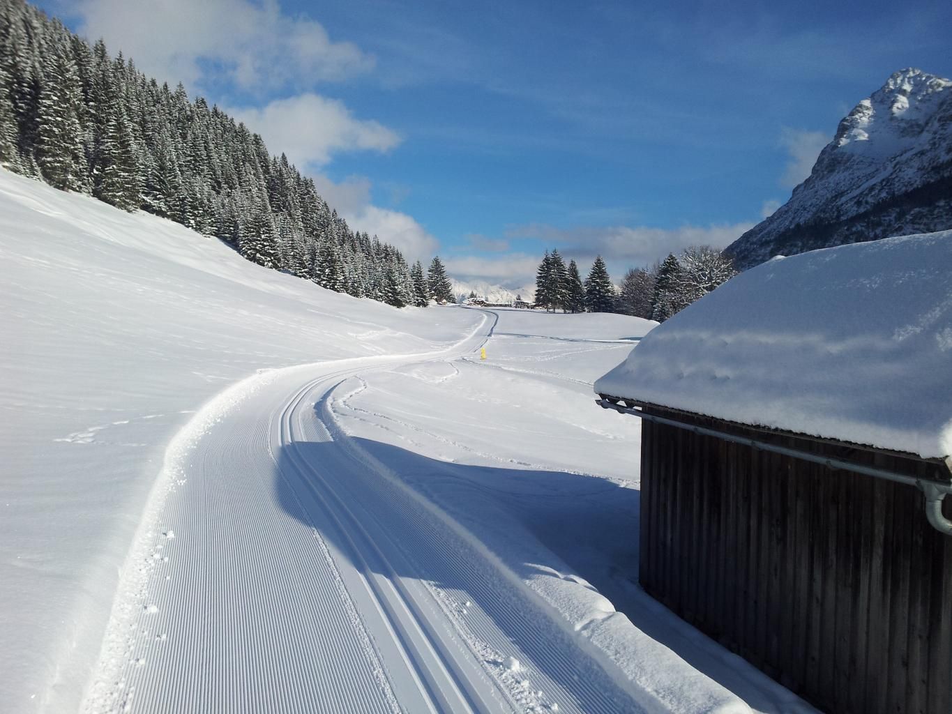
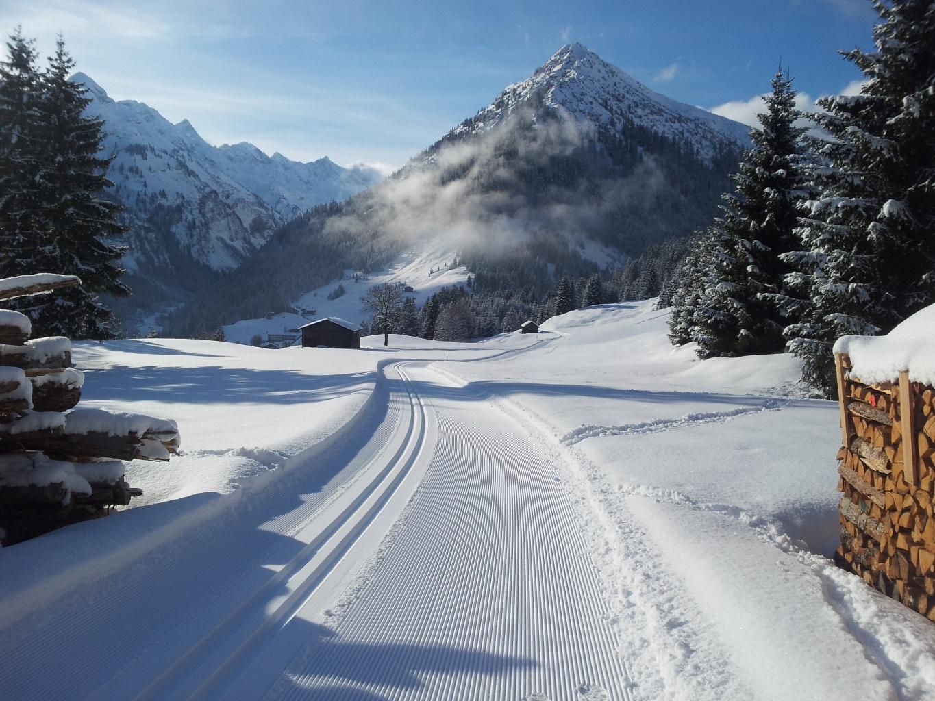
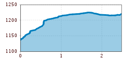
The starting point for your beautiful winter hike is the small village of Hinterhornbach.
To start, walk eastwards along the Jochbach stream and then turn northwards towards a fairly steep passage. After a few metres, join the panoramic trail and you will reach a forest in the direction of "Brunnen". 
A unique view of the municipality and the Hornbach valley awaits you on the panoramic trail.

Getting here

  • Arrival by public transport

    Regiobus Hinterhornbach

  • Parking

    Hinterhornbach village

Newsletter

The mountain is calling? So does our newsletter!

In our monthly newsletter we reveal the best holiday tips for Tyrol.