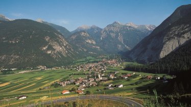
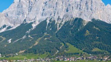
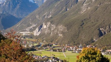
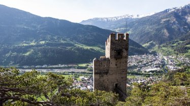
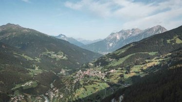
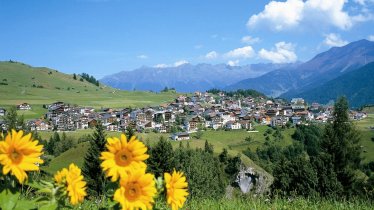
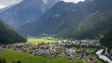
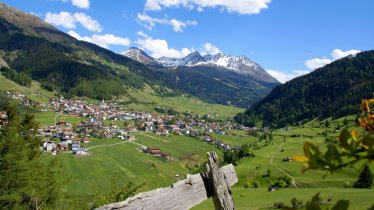
This seven-day mountain bike adventure brings the world's highest mountain to the heart of the Alps – or at least the 8,848 vertical metres of climbing from sea level to the peak of Mount Everest. The route measures 285 kilometres in length and takes riders from Garmisch-Partenkirchen in Germany to Plamort on the Austrian-Italian border. Bikers relying 100% on pedal power will have to be pretty fit to complete the Bike Everest Tirol, while those taking on the challenge with an e-bike can afford to take things a little easier. The route leads through several nature parks and offers fine views of some of the most famous mountains in the Alps, including the Zugspitze and the Ortler. Lakes, waterfalls, canyons, lush meadows, huts, castles and medieval fortresses provide lots to see and explore along the way. The Bike Everest Tirol is best completed between May and October. It can be ridden all in one or split up into several shorter stages. A special package is on offer for riders wishing to ride the route from start to finish in one holiday.

Multi-Day Mountain Bike Ride
Starting point
Garmisch-Partenkirchen
Finishing point
Plamort, Nauders
Mountain chain
Wetterstein Mountains
Lechtal Alps
Mieming Mountains
Ötztal Alps
Samnaun Mountains
Length
285 km
Duration
7 day(s)
Features
- Circular route
- Handicap-accessible
- Route with e-bike charging station
Stage 1:
- Restaurant Mini am Tennsee
- Goasalm
- Gasthaus Ferchensee
Stage 2:
None
Stage 3:
- Zugspitz Resort, Ehrwald
- Leitner Sport, Ehrwald
- Gemeindeamt Lermoos
- Mid-way station of Grubigsteinbahn cable car
- Sport Schönherr Sports & Fun, Biberwier
- green4rent, Infobüro Nassereith
- green4rent, Imst Tourismus
- E-Tankstelle Stadtgemeinde Imst
Stage 4:
- green4rent, Appartment Schatz, Hoch-Imst
- Peto Bike Zams
- Intersport Landeck
Stage 5:
- Schöngampalm
- Sport 2000 Schmid, bottom station of cable car in Fiss
- Bottom station of cable cars in Serfaus
Stage 6:
- Hotel Tyrol, Pfunds
- Gasthof Traube, Pfunds
Stage 7:
- Bottom station of Bergkastel-Seilbahn cable car
- Hotel Post, Nauders
- Sport Spöttl, Nauders
Difficulty rating
difficult
Altitude
Elevation uphill 8,848m
Vertical metres downhill 8,227m
Fitness level
Technique
Best time of year
* These are approximate values and recommendations. Please take your personal fitness level, technical ability and the current weather conditions into account. Tirol Werbung cannot guarantee that the information provided is correct and accepts no liability.
Parking
Garmisch Partenkirchen railway station
Public transport
- Train to Garmisch Partenkirchen (international and regional trains)
Downloads
Trail description
Stage 1: Garmisch-Partenkirchen – Mittenwald – Garmisch-Partenkirchen
Distance: 51.6 kilometres, ascent/descent 1,121/1,126 vertical metres, difficulty: intermediate
Stage one provides the perfect warm-up for the challenge ahead. The ride begins at the Kurpark (or at the nearby railway station) in Garmisch-Partenkirchen. North of the park, cross the Partnach river, turn right, follow the railway line north and then cross over the Amselstraße road and the B2 before starting the climb up the steep road towards Esterbergalm. After around 600 vertical metres you will reach the Esterbergalm hut. Continue through the Finzbachtal Valley in an easterly direction, past the huts of the Farchanter Alm and the Finzalm, down to the Barmsee lake all the way to Krün. From there, riders head south to the village of Mittenwald, past the Lautersee and Ferchensee lakes, then back towards Garmisch-Partenkirchen. Before you get back to the starting point you will pass the impressive Elmau Castle and head through the Partnachklamm gorge.
Selected places serving food and drink along the route:
- Esterbergalm
- Farchanter Alm
- Finzalm
- Alpengasthof Gröblalm
- Postkeller Mittenwald
- Gasthaus Ferchensee
- Luce d'Oro, Krün
- Berggasthof Hintergraseck
- Almwirtschaft Hanneslabauer
Stage 2: Garmisch-Partenkirchen – Eibsee – Ehrwald
Distance: 28.7 kilometres, ascent/descent: 897/610 vertical metres, difficulty: intermediate
Day two begins once again from the Kurpark in Garmisch-Partenkirchen. This time, riders head along the Loisach Cycle Path upstream towards the Zugspitze mountain. They then switch onto the B23 road before turning left and riding through Grainau and continuing to the Eibsee lake. It is here that the climb up to the Hochthörle-Hütte hut begins. After crossing from Germany into Austria, it is downhill all the way via Obermoos to the village of Ehrwald.
Selected places serving food and drink along the route:
- Spatzenhäusl Untergrainau
- Eibsee-Alm
- Hochthörle-Hütte
- Various locations in Ehrwald
Stage 3: Ehrwald – Gipfelhaus Grubigstein – Fernpass – Nassereith – Imst
Distance: 62.5 kilometres, ascent/descent: 1,639/1,810 vertical metres, difficulty: intermediate
The first few flat kilometres on day three lead along the Via Claudia R8 via Lermooser Moos to Lermoos, where riders head south. After passing the bottom station of the Grubigsteinbahn cable car, switch onto mountain bike route 804 and ride up to the mid-way station of the cable car. There, take mountain bike route 861 and continue to the Gipfelhaus Grubigstein. Take the same trail back down and then turn right onto the Wachterweg trail to Biberwier. At the southern end of the village, turn right onto route 838, ride to the Loisachquellen springs and then past the Mittersee lake and the Weißensee lake before climbing up onto the Fernpass mountain pass (R8). The route leads past the small Schanzlsee lake and then along the shore of the Fernsteinsee lake. Riders continue along trail R8 downhill through the Gurgltal Vally, via Nassereith and Tarrenz all the way to Imst.
Selected places serving food and drink along the route:
- Bergrestaurant Grubigalm
- Gipfelhaus Grubigstein
- Rasthaus Zugspitzblick (small detour)
- Raststation Fernsteinsee
- Rastland Nassereith am Fernpass
- Gasthof Gurgltalblick, Nassereith
- Gasthof Seewald
- Various locations in Tarrenz and Imst
Stage 4: Imst – Mils – Kronburg – Landeck
Distance: 40.9 kilometres, ascent/descent: 1,306/1,331 vertical metres, difficulty: intermediate
This stage begins at the parish church in Imst. Take the Gafialgasse road north out of the village towards "Teilwiesen". Turn left onto mountain bike route 619 and continue uphill through the forest to the Obermarkter Alm hut and the alpine zoo. The route continues via the Latschenhütte hut along trail 615 to the Untermarkter Alm hut, then to Gunglgrün and Imster Au (617 and 618). Ride down into the valley, cross under the motorway and continue along trail R8 through Mils and Schönwies, up to the Kronburg fortress, back down to Rifenal, through the village of Zams and along the banks of the Inn river to Landeck.
Selected places serving food and drink along the route:
- Latschenhütte
- Untermarkter Alm
- Restaurant Barbaros, Schönwies
- Gasthof Kronburg
- Various locations in Zams and Landeck
Stage 5: Landeck – Fließ – Fiss – Serfaus
Distance: 37.9 kilometres, ascent/descent: 1,496/883 vertical metres, difficulty: intermediate
Stage five begins by passing Landeck Castle towering on a rocky outcrop above the Inn river. There, take mountain bike route 790 and follow it steeply uphill through the Schlosswald forest. Riders pass Eichholz and eventually reach Fließ, where they should take the road back down inot the valley and cross over the Inn river at Neuer Zoll. On the other side of the valley, take trail 7100 and climb the 1,000 vertical metres all the way up to Schöngampalm. From there, ride back around two kilometres and then turn right onto the mountain bike route 730 ("Fisser Almweg") before riding around the Matekopf mountain and ending up in Fiss. The final three-kilometre section leads along route 765 and then route 7100 to Serfaus.
Selected places serving food and drink along the route:
- Hotel Traube, Fließ
- Gasthof Neuer Zoll, Fließ
- Schöngampalm
- Various locations in Fiss and Serfaus
Stage 6: Serfaus – Pfundser Tschey – Pfunds
Distance: 25.3 kilometres, ascent/descent: 822/1,267 vertical metres, difficulty: intermediate
Leaving from Serfaus, take mountain bike route 7100. The first section of this stage is an easy downhill ride to the banks of the Inn river. Once down on the valley floor, turn left and cross over the Inn river at Tösens. Follow mountain bike route 754, which heads to the other side of the valley before climbing steeply into the Kesselwald forest. After a few kilometres you will reach the beautiful high valley of Pfundser Tschey with its many pretty wooden hay huts. Ride across the valley, gently downhill all the way. At the end of the valley take the narrow road (755) through the settlement of Greit heading out of the valley to Pfunds, which marks the end of this relatively short stage.
Selected places serving food and drink along the route:
- Gasthof Tschupbach, Tösens
- Gasthof Wilder Mann, Tösens
- Berghof, Greit
- Various locations in Pfunds
Stage 7: Pfunds – Martina – Nauders – Plamort
Distance: 39.4 kilometres, ascent/descent: 1,567/511 vertical metres, difficulty: difficult
The final stage is challenging and, with almost 1,600 vertical metres of climbing, one last fitness test on the Bike Everest Tirol. Leaving Pfunds, take route R8 uphill through the Inn Valley. After passing the point where the Samnauntal Valley meets the Inn Valley, you will see the fortress of Altfinstermünz on the eastern side of the river. Switch to the western side and continue over the border to Switzerland. Take the road south, pass through the border village of Martina and then, shortly afterwards, cross over the Inn again to the eastern side at Sclamischot. Take mountain bike route 7042 uphill via Norbertshöhe to Nauders. This is where the final section begins, leading along routes 7032 and 7034 via the Goldseehütte and the top station of the Bergkastelbahn cable car to Plamort (Italy), a famous vantage point overlooking the spectacular Reschensee lake. All that then remains is to head along route 7036 through the Kompatschwald forest to Nauders.
Selected places serving food and drink along the route:
- Restaurant Vinadi Weinberg
- Various locations in Nauders
- Bergresort "Das Jochelius"
- Panoramarestaurant Bergkaste
Return to Garmisch-Partenkirchen: From Nauders take bus 4210 to Landeck, then take the train via Innsbruck to Garmisch-Partenkirchen (4-5 hours).

