Day 1: Innsbruck - Mayrhofen
Uphill/downhill: 2,069/2,016 vertical metres, distance: 69.3 kilometres, highest point: 2,291 metres, difficulty: difficult
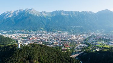
The first day’s ride is more a test of stamina than of mountain bike handling skills. From Innsbruck, the route leads along the Inntal Cycle Path toward Wattens. At Weer, the route begins to climb via the Nafingalm hut to the Weidener Hütte hut (1,799 metres). From the hut, it’s another nasty 500 vertical metres and 4.6 kilometres to reach the top of the Geiseljoch ridge – once up there you have mastered the hardest climb on this loop. The route continues along route 424 to a gravel road that winds down to Vorderlandersbach. There, the route resumes a short climb before cruising down past Dornau to Mayrhofen on quiet back roads.
Day 2: Mayrhofen - Weerberg
Uphill/downhill: 1,303/1,038 vertical metres, distance: 52.2 kilometres, highest point: 1,690 metres, difficulty: intermediate
From Mayrhofen, ride down to Uderns. There, a broad gravel road begins to climb to Hochfügen across Kupfnerberg. After another 200 vertical metres you have reached the highest point of this day’s ride: the 1,680-metre-high Loassattel saddle. From there, a 10-kilometre-long downhill brings you to the destination for this day, Weerberg.
Day 3: Weerberg - Matrei
Uphill/downhill: 810/711 vertical metres, distance: 43.7 kilometres, highest point: 1,078 metres, difficulty: intermediate
From Mitterweerberg, a westward descent takes you back to the floor of the Inn Valley. Passing Wattens and Volders, an easy climb takes you up to Rinn and Sistrans. The ride continues past Patsch and Mühltal to Innerellbögen and Matrei am Brenner.
Please note: As Matrei and Innsbruck are well serviced by public transport, you can easily divide the Innsbruck Loop into two parts in Matrei.
Day 4: Matrei - Axams
Uphill/downhill: 1,056/1,171 vertical metres, distance: 33.2 kilometres, highest point: 1,690 metres, difficulty: intermediate
From Matrei am Brenner, the route follows a tarmac road and gravel to Maria Waldrast, an abbey and place of pilgrimage high above the valley floor. Gather new strength at the friendly tavern run by the monks of Maria Waldrast. From there, the route descends all the way down to Telfes in the Stubai Valley on a broad gravel road. Passing by the beautiful Telfer Wiesen meadows, the ride continues to Mutters and eventually to Axams, the destination of the day.
Day 5: Axams - Kühtai
Uphill/downhill: 1,358/228 vertical metres, distance: 26.3 kilometres, highest point: 2,018 metres, difficulty: intermediate
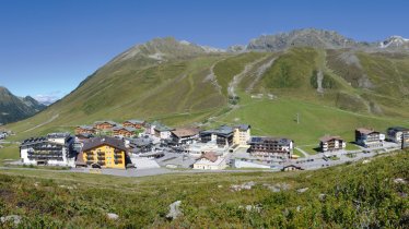
The shortest stage on the Innsbruck Loop takes you along quiet back roads from Axams to Gries im Sellrain. From there, the route winds into the Sellrain Valley, gaining 850 vertical metres on its way past St. Sigmund im Sellrain and Haggen to the destination end of the day: Kühtai at an elevation of more than 2,000 metres above sea level.
Day 6: Kühtai - Innsbruck
Uphill/downhill: 463/1,891 vertical metres, distance: 75.9 kilometres, highest point: 2,002 metres, difficulty: intermediate
A descent takes you from Kühtai to Wald, where a short climb across “Sattele” brings you out high above the Inn Valley. A long downhill delivers you to the village of Haiming. There, the route continues along the flat Innt Valley floor to Mötz. Back roads, gravel trails and a short ascent wind up to Barwies and across the Mieming Plateau and Wildermieming to Telfs. The final section of the ride follows the Inn Cycle Path into the heart of Innsbruck.


