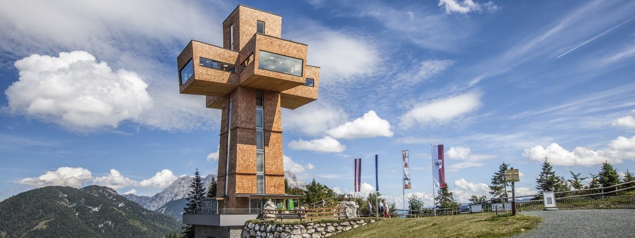
From Flecken, this ride of intermediate difficulty weaves past historic farmsteads and climbs the gentle ridge of the Buchensteinwand mountain. Standing 30 metres tall atop the summit is the Jakobskreuz, a multi-level building in the shape of a cross. It can be climbed using steps and offers glorious 360-degree views of the Pillerseetal Valley, the Loferer Mountains, the Leogang Rocky Mountains and the Kitzbühel Alps. At the top of the mountain at 1,440 metres above sea level there is also a cosy guesthouse, the Alpengasthof Buchensteinwand, serving good local food on its sunny terrace.

Mountain Bike Ride
Starting point
Bottom of Pillersee gondola
Hike to
Jakobskreuz cross, Buchsteinwand mountain
Finishing point
Bottom of Pillersee gondola
Mountain chain
Loferer Rocky Mountains
Length
12.2 km
Riding time
1 h 30 min
Features
- Circular route
- Handicap-accessible
- Route with e-bike charging station
Difficulty rating
medium
Altitude
Elevation uphill 590m
Vertical metres downhill 590m
Fitness level
Technique
Best time of year
* These are approximate values and recommendations. Please take your personal fitness level, technical ability and the current weather conditions into account. Tirol Werbung cannot guarantee that the information provided is correct and accepts no liability.
Parking
Parking at the bottom of the gondola
Places serving food & drink
- Alpengasthof Buchensteinwand
- Various locations in St. Jakob in Haus
Downloads
Trail description
The ride begins at the bottom of the gondola in St. Jakob in Haus. Head along a gravel trail towards St. Ulrich am Pillersee and Flecken. There, turn right onto route number 220 (at building number 31) and cross open fields between the Lehmtalbach and Aubach streams heading in a southerly direction. Follow the signs for "Alpengasthof Buchensteinwand" as you ride uphill along a dirt road in the forest. After 1.1 kilometres, at an altitude of around 960 metres, turn right (just before you reach the open pasturelands of the "Fleckenmähder") and continue for another 2.8 kilometres via many switchback corners up to the Kammbergalm at around 1,320 metres above sea level. The final 1.3 kilometres are steep, with the gradient reaching 16% in places. This last push takes you past the reservoir before flattening off and reaching the mighty Jakobskreuz cross and the Gasthof Buchensteinwand.
Return along the way you came back to the starting point.


