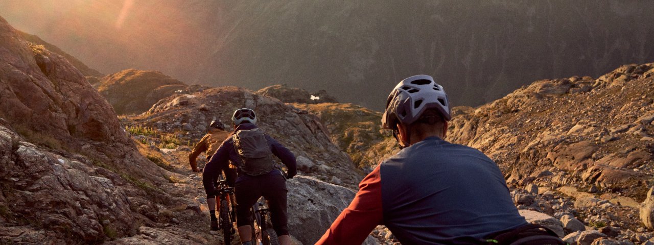
One of the toughest trails in Tirol! The Fernar Trail is the ultimate challenge in the Bike Republic Sölden and aimed at expert freeriders only. It begins on the edge of the Tiefenbach glacier at 2,800 metres above sea level and winds its way down through steep high alpine terrain, including plenty of natural obstacles. The trail is rated S5 (very difficult) from top to bottom and can be accessed only on specific days using a special shuttle service.

Singletrail

"When I first rode this trail, I was surprised how technical it was. What an adventure! Spectacular high-alpine landscape and steep, exposed sections on an official downhill trail for bikers only – unique in Tirol and something we definitely need more of."
Lars Lotze, mountainbike expert
Starting point
Tiefenbach glacier
Finishing point
Gaislach
Mountain chain
Ötztal Alps
Length
6 km
Features
- Circular route
- Handicap-accessible
- Route with e-bike charging station
Difficulty rating
difficult
Altitude
Elevation uphill 18m
Vertical metres downhill 823m
Fitness level
Technique
Best time of year
* These are approximate values and recommendations. Please take your personal fitness level, technical ability and the current weather conditions into account. Tirol Werbung cannot guarantee that the information provided is correct and accepts no liability.
Trail description
The starting point of this trail near the Tiefenbach glacier can only be accessed using a special shuttle service leaving from the bottom of the Gaislachkoglbahn cable car. The Fernar Trail can be ridden in the morning and afternoon but is closed from 10:00 until 15:00, when it is used by walkers and hikers. Trailriders must be fit, experienced and equipped with all the necessary safety gear in order to negotiate this extremely challenging route. There are no huts or restaurants en route serving food, and in some sections there is no mobile phone reception.
Things start with a bang right out of the gate: the first section is super steep and comprises a number of switchback corners on rocky terrain leading past the Petznersee lake and the Petznerkar ridge. The trail is very narrow and in some places it becomes even narrower due to large rocks on both sides. Total concentration and good bike-handling skills are very much the name of the game here. If things get too hairy then we recommend getting off and pushing. Along the way riders cross two streams. Don't forget to take a break every now and then to enjoy the landscape.
After around 2.5 kilometes of riding the hardest section is over and the trail becomes a little more direct. Riders can pick up a little more speed here. In the lower section, near the Gaislach Alm hut, you can even get a bit of flow going as you make your way along the mountain sloped dotted with rocks and stones. However, make sure those concentration levels stay high at all times. A fine reward for all that hard work can be found in the form of a hearty meal at the Gaislach Alm or the Gasthof Sonneck.
Tip! At the end of the Fernar Trail there is another, much easier trail called the Löple Trail (S2) leading to the Löple Alm hut. From there, take the Gaislach Trail and Nene Trail (both rated S3) back down to the bottom of the Gaislachkoglbahn cable car.

